1990s Maps of Shasta County, California
Explore 103 historic maps of Shasta County from the 1990s. These maps offer a rare glimpse into what life looked like during the 1990s — showing old roads, neighborhoods, homes, and landmarks that have changed or disappeared over time.
Whether you're researching your family's past, planning a metal detecting trip, or studying how Shasta County's landscape evolved across the 1990s, these high-resolution maps are a powerful tool for exploring the history of this region.
- Focus on a specific era: All maps on this page are from the 1990s, giving you a focused view of this time period.
- See what’s changed: Compare century-old streets, trails, and buildings to today's modern landscape using overlays and satellite layers.
- Research with precision: Use these maps for genealogy, historical research, land use analysis, or educational projects.
- View, download, or print: Maps are fully viewable online in high resolution, and can be downloaded or printed for your own records.
Start exploring Shasta County's history through authentic maps from the 1990s. This is your window into the past.
Shasta County, CA maps
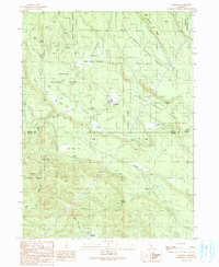
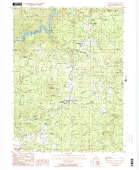
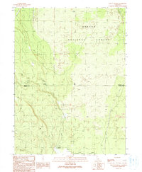
(103)- 1990 Map of Minnesota Mountain
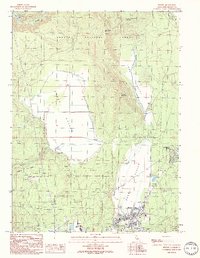
 1990 Minnesota Mountain1990 Print · USGSShasta County in the 1990s is defined by the expansive waters of the National Recreation Area and its surrounding peaks. Researchers can locate the Bully Hill (Site), trace the McClure Gulch drainage, or find the Museum near Squaw Creek.
 - 1990 Map of Burney Mountain East
 1990 Burney Mountain East1990 Print · USGSThe volcanic highlands of Shasta County are captured here in the 1990s, revealing a landscape of cinder cones and lava flows within the Lassen National Forest. Local history researchers can trace the roads into Hat Creek Valley or locate features like Cornaz Lake and the Hat Creek FS Station.
 - 1990 Map of Burney
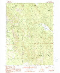
 1990 Burney1990 Print · USGSShasta County life in the early nineties is centered on the growing community of Burney and its neighboring Johnson Park. Researchers can trace local landmarks like the Cem, the Goose Valley Ranch, and the Pit 3 Powerhouse along the river.
 - 1990 Map of Hanland Peak
 1990 Hanland Peak1990 Print · USGSShasta County in the early nineties is shown here as a dense network of forest service lands and lakefront recreation. Researchers can trace the drainages of Indian Creek and Salt Creek or locate landmarks like Hanland Peak and Antlers Campground.
 - 1990 Map of Pondosa
 1990 Pondosa1990 Print · USGSThe timberlands of Siskiyou and Shasta counties are captured in the 1990s as a landscape of managed forests and old logging routes. Researchers can trace the Old Railroad Grade or locate family-named sites like Harlow Place and Bosworth Meadow.
 - 1990 Map of Montgomery Creek
 1990 Montgomery Creek1990 Print · USGSUpper Shasta County comes into focus in the 1990s as a hub of hydroelectric power and forest management. Researchers can trace tribal lands at the Montgomery Creek Rancheria, locate the Halcumb Cemetery, and study the Cedar Powerhouse along the creek.2 unique versions available
 - 1990 Map of Skunk Ridge
 1990 Skunk Ridge1990 Print · USGSShasta National Forest is documented here in the early 1990s, showcasing a landscape of high ridges and critical water sources. You can trace the path of the Pacific Crest National Scenic Trail past Summit Lake and the Nelson Creek Slides.
 - 1990 Map of Fall River Mills
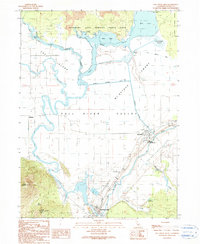 1990 Fall River Mills1990 Print · USGSFall River Valley was a thriving agricultural and hydraulic hub in the 1990s, where the Pit and Fall Rivers meet. Researchers can trace local landmarks like McArthur, the Pine Grove Cem, and the historic Rat Farm (Site) near the edge of the lava beds.
 - 1990 Map of Bohemotash Mountain
 1990 Bohemotash Mountain1990 Print · USGSShasta County’s industrial and recreational transitions are clear in this 1990s record of the rugged terrain surrounding the reservoir. Researchers can locate historical extraction sites like Mammoth Mine and Golinsky Mine alongside the established waters of Shasta Lake.2 unique versions available
 - 1990 Map of Coble Mountain
 1990 Coble Mountain1990 Print · USGSThe volcanic highlands of the Shasta and Lassen county line are captured here in the late twentieth century. You can trace the rugged geography of the Lassen National Forest and locate specific sites like Burton Ranch, Big Cave, and the Pit River.
 - 1990 Map of Goose Gap
 1990 Goose Gap1990 Print · USGSShasta County’s northern wilderness is detailed in the 1990s just as modern mapping methods began to standardize the backcountry. Researchers can trace the steep drainages of Squaw Creek and locate landmarks like Goose Gap, Bagley Flat, and Brock Butte.
 - 1990 Map of O'Brien
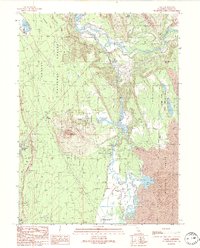
 1990 O'Brien1990 Print · USGSShasta Lake was a well-established recreational and industrial landscape by the late eighties. Researchers can locate the Shasta Iron Mine, trace the Pit River Bridge crossing, and explore sites like Lake Shasta Caverns and the O'Brien settlement.
 - 1990 Map of Chalk Mountain
 1990 Chalk Mountain1990 Print · USGSShasta County’s hydroelectric and forest lands are captured in the late twentieth century as the river network powered regional growth. Researchers can trace the industrial footprint of the Pit 5 Dam and Pit 4 Dam or locate remote landmarks like Hagen Flat and Lake Margaret.
 - 1990 Map of East of Pondosa
 1990 East of Pondosa1990 Print · USGSThe timberlands of Northern California appear in the 1990s as a landscape defined by volcanic geology and forest management. Researchers can trace remote junctions like Hammond Crossing and Spalding Corner near the banks of Bear Creek.
 - 1990 Map of Burney Mountain West
 1990 Burney Mountain West1990 Print · USGSShasta County is captured here in the 1990s as the northern volcanic foothills meet the timbered high country. Researchers can locate the Old Green Burney Camp, trace the course of Burney Creek, and identify landmarks like Indian Spring.
 - 1990 Map of Hogback Ridge
 1990 Hogback Ridge1990 Print · USGSShasta County’s volcanic landscape is captured here in the late twentieth century, showing the rugged transition between timbered forest and lava fields. Researchers can locate the St John Ranch, trace the Pacific Crest National Scenic Trail, or examine the Pit River canyon at Pit River Falls.
 - 1990 Map of Jellico
 1990 Jellico1990 Print · USGSLassen County timber and ranch lands are mapped here during the late twentieth century as they appeared within the national forest. Researchers can trace remote locales like the Cone and Ward Ranch, the Butte Camp (Site), and the high grounds of Negro Camp Mountain.
 - 1990 Map of Day
 1990 Day1990 Print · USGSUpper Modoc and Shasta counties appear as a rugged landscape of volcanic peaks and forest basins during the 1990s. Researchers can trace the Old Railroad Grade, locate the isolated settlement of Day with its cemetery, and identify the Widow Mountain Radio Facility.
 - 1990 Map of Pittville
 1990 Pittville1990 Print · USGSThe northern California ranching and river country comes into focus in the 1990s, centered on the settlement of Pittville. Researchers can trace irrigation history and valley landmarks from Young Falls and Hot Springs to the Lee Drainage Canal.
 - 1990 Map of Burney Falls
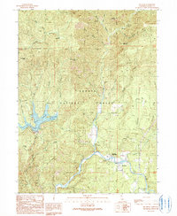
 1990 Burney Falls1990 Print · USGSShasta County in the early nineties reveals a landscape defined by hydroelectric power and forest recreation. Trace the original footprints of Mcarthur Burney Falls Memorial State Park and locate the Britton Cem near the Pit No 3 Dam.
 - 1990 Map of Devils Rock
 1990 Devils Rock1990 Print · USGSThe Pit River Arm of Shasta Lake and the surrounding national forest are captured here in the late twentieth century. Researchers can locate remote outposts like Squaw Creek FS Station, trace the shoreline at Arbuckle Flat, and find Potem Falls.
 - 1990 Map of Bollibokka Mountain
 1990 Bollibokka Mountain1990 Print · USGSShasta Lake and the McCloud River canyon appear here in the early nineties, showing a landscape managed for recreation and timber. Trace forest landmarks like Bollibokka Mountain, the historic Point McCloud (Site), and remote riverside spots like Forks Flat.
 - 1990 Map of Cassel
 1990 Cassel1990 Print · USGSThe spring-fed waters of Shasta County define this late twentieth-century landscape near Cassel. Researchers can trace early hydroelectric infrastructure like Hat 1 Powerhouse or the historic Rising River Ranch.
 - 1990 Map of Big Bend
 1990 Big Bend1990 Print · USGSShasta County during the early 1990s reveals a landscape of tribal lands, forest camps, and thermal springs. Explore the vicinity of Big Bend to find the Big Bend Rancheria, the Indian Springs Sch, and the riverside Hunt Hot Spring.
 - 1990 Map of Dana
 1990 Dana1990 Print · USGSNorthern Shasta County is captured here in the 1990s as a landscape of timber and volcanic peaks. Genealogists can locate the Dana Cem and Horns Four Corners, while outdoorsmen can trace the Pacific Crest National Scenic Trail and Dusty Campground.
Showing maps 1-25 of 103
Top cities of Shasta County
- Redding historical maps
- Anderson historical maps
- Shasta Lake historical maps
- Burney historical maps
- Cottonwood historical maps
- Cottonwood historical maps
See more
Frequently asked questions
- What are the different types of historical maps available for Shasta County?
- What is the oldest map of Shasta County?
- Where can I purchase historical maps of Shasta County for my home or office?
- Where can I download high-res historical maps of Shasta County?
- Are there historical topographic maps available for Shasta County?
- Is there historical aerial imagery available for Shasta County?
- Where are historical maps of Shasta County sourced from?