1900s (20th Century) Maps of Shasta County, California
Explore 237 historic maps of Shasta County from the 1900s (20th Century). These maps offer a rare glimpse into what life looked like during the 1900s — showing old roads, neighborhoods, homes, and landmarks that have changed or disappeared over time.
Whether you're researching your family's past, planning a metal detecting trip, or studying how Shasta County's landscape evolved across the 1900s, these high-resolution maps are a powerful tool for exploring the history of this region.
- Focus on a specific era: All maps on this page are from the 1900s, giving you a focused view of this time period.
- See what’s changed: Compare century-old streets, trails, and buildings to today's modern landscape using overlays and satellite layers.
- Research with precision: Use these maps for genealogy, historical research, land use analysis, or educational projects.
- View, download, or print: Maps are fully viewable online in high resolution, and can be downloaded or printed for your own records.
Start exploring Shasta County's history through authentic maps from the 1900s. This is your window into the past.
Shasta County, CA maps
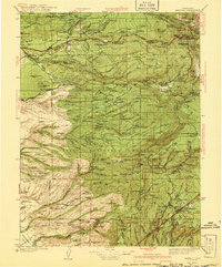
(237)- 1901 Map of Redding
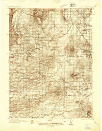
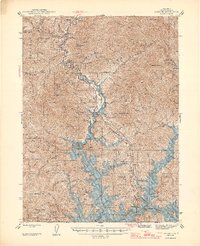
 1901 Redding1901 Print · USGSShasta County's northern canyon and mining districts come into focus at the dawn of the twentieth century. Researchers can trace the original rail stops at Kennett and Keswick or locate early industrial sites like the Bully Hill Mine and Baird Fish Hatchery.7 unique versions available
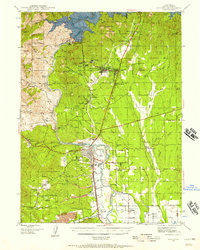
 - 1913 Map of Weaverville
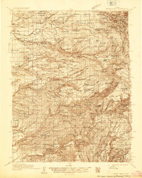
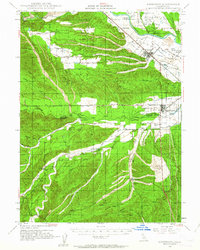
 1913 Weaverville1913 Print · USGSTrinity and Shasta counties appear here during a peak era of mountain mining and ranching before the mid-century reservoirs were built. Genealogists can trace early homesteads and industrial sites like Whiskytown, Minersville, and the Gladstone Mine.6 unique versions available
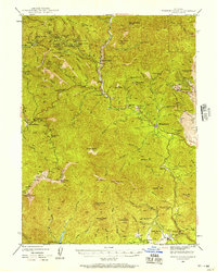
 - 1923 Map of Sawyers Bar
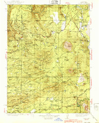
 1923 Sawyers Bar1923 Print · USGSThe Salmon River canyon in the early 1900s reveals a high-country mining landscape during the height of its activity. Genealogists and historians can trace families at Edie Ranch, locate remote classrooms like Russianville School, and find numerous prospects including the Black Bear Mine.4 unique versions available
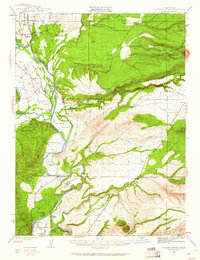
 - 1931 Map of Hoaglin
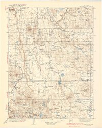
 1931 Hoaglin1931 Print · USGSThe Trinity and Van Duzen river systems define this high country during the early 1930s, when remote ranches and forest stations provided the primary human footprint. Researchers can trace family-named sites like Haine Ranch and Blossom Cabin, or locate the isolated Lake Mtn Sch.
 - 1931 Map of Etna
 1931 Etna1931 Print · USGSThe mining camps and river valleys of the Siskiyou-Trinity border are caught in detail during the early 1930s. Researchers can trace historic claims and remote family holdings like the Bonanza King Mine, Etna Ranch, and the East Fork District Sch.
 - 1932 Map of Olinda
 1932 Olinda1932 Print · USGSNorthern Orange County comes to life in the early thirties as citrus groves and rail lines shaped the local economy. Trace the early development of Yorba Linda and Placentia or follow the historic tracks of the Pacific Electric.
 - 1932 Map of Bartle
 1932 Bartle1932 Print · USGSThe timberlands of Siskiyou and Shasta counties are shown here in the early 1930s as logging and forestry infrastructure expanded. Researchers can locate remote outposts like Star City, rural schoolhouses including Island Dist Sch, and the Burney Fish Hatchery.
 - 1934 Map of Etna
 1934 Etna1934 Print · USGSThe Scott Valley and high California peaks are seen here in the 1930s as centers of mining and remote mountain ranching. Researchers can trace historic family-named locations such as Parker Ranch, Stoddard Cabin, and the Zarina Mine.4 unique versions available
 - 1935 Map of Hoaglin
 1935 Hoaglin1935 Print · USGSTrinity and Mendocino counties are captured here in the mid-1930s, documenting a landscape of isolated valleys and mountain ranches. Researchers can trace family homesteads like Russ Place and Shannon Place or locate early schools including Cover Sch and Lake Mtn Sch.3 unique versions available
 - 1935 Map of Burney
 1935 Burney1935 Print · USGSShasta County's high country is captured in the mid-1930s, showing a transition from ranching to early hydroelectric power. Trace family ranch sites like Armstrong Ranch and long-lost rural schools including Mill Creek Sch and Mountain Grove Sch.2 unique versions available
 - 1935 Map of Paynes Creek
 1935 Paynes Creek1935 Print · USGSUpper Tehama County in the mid-thirties was a hub of mountain industry and early hydroelectric power. Researchers can trace historic family holdings like the Facht Ranch and Wilson Ranch or locate vanished sites like the Forward Mill Camp Forward and Sierra Sch.
 - 1935 Map of Olinda
 1935 Olinda1935 Print · USGSNorthern Orange County appears here in the mid-thirties as a landscape of citrus groves and competing rail lines. Trace early property boundaries and transit routes like the Union Pacific through Yorba Linda, Carlton, and Olinda.
 - 1935 Map of Dunsmuir
 1935 Dunsmuir1935 Print · USGSUpper Siskiyou and Shasta counties are shown here in the mid-1930s as the rail and timber industries shaped the mountain landscape. Genealogists and historians can trace the Southern Pacific line through Dunsmuir, locate the Cedar Park Sch, or find vanished stops like Sims Sta.4 unique versions available
 - 1939 Map of Burney
 1939 Burney1939 Print · USGSShasta County mountain life is captured here in the late 1930s, from the volcanic peaks of the Cascades to the timbered ridges above the Pit River. Genealogists can locate family-named landmarks and remote outposts like Montgomery Creek, Doyles Corner, and the Old Mill Site.3 unique versions available
 - 1939 Map of Halls Flat
 1939 Halls Flat1939 Print · USGSThe high plateau of eastern Shasta and Lassen counties is shown here in the late 1930s, defined by timber management and remote ranching. Researchers can trace early forest outposts like Halls Flat Ranger Sta, family holdings at DeLashmutt Ranch, and the Western Pacific rail line.3 unique versions available
 - 1939 Map of Bartle
 1939 Bartle1939 Print · USGSUpper California's timber and rail landscape is captured here in the late 1930s, showing the intersection of the McCloud River and Fall River drainages. Researchers can trace the M C Cloud River R R through Bartle and Pondosa, or locate remote sites like Kosk Sch and the Pilgrim Creek Nursery Guard Sta.3 unique versions available
 - 1941 Map of Mineral
 1941 Mineral1941 Print · USGSThe volcanic highlands of Tehama and Shasta counties come alive in this pre-war survey of the Lassen region. Genealogists and researchers can locate remote family sites like Childs Ranch, the Ishii Caves, and early timber operations at Forward Mill.3 unique versions available
 - 1944 Map of Redding, 1957 Print
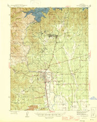
 1944 Redding1957 Print · USGSShasta County during the mid-1940s was a landscape in transition, anchored by the recently completed Shasta Dam and the bustling rail hub of Redding. Family historians and researchers can pinpoint long-standing schools like Grant School and trace industrial sites from the Walker Mine to Benton Airport.2 unique versions available
 - 1944 Map of French Gulch, 1957 Print
 1944 French Gulch1957 Print · USGSThe mining districts of Shasta and Trinity counties are captured here in the mid-1940s, showcasing a landscape defined by gold extraction and rugged mountain summits. Researchers can trace historic claims and camps like French Gulch, the Brown Bear Mine, and the original site of Whiskeytown.2 unique versions available
 - 1944 Map of Tuscan Buttes, 1960 Print
 1944 Tuscan Buttes1960 Print · USGSTehama and Shasta Counties are captured here in the mid-1940s, a landscape defined by the winding Sacramento River and the legacy of frontier outposts. Genealogists can trace family-named properties like Armstrong Ranch and locate vanished rural schoolhouses such as Jelly Sch and Parkville Sch.3 unique versions available
 - 1946 Map of Lamoine
 1946 Lamoine1946 Print · USGSShasta County mountain communities and early mining sites are captured here as the new reservoir begins to fill the canyons. Genealogists and researchers can locate the Smithson Sch, the Shasta Iron Mine, and post offices at Bayles P O and Loftus P O.2 unique versions available
 - 1946 Map of Redding
 1946 Redding1946 Print · USGSShasta County underwent a massive transformation in the mid-forties following the completion of Shasta Dam. Researchers can trace the rise of boomtowns like Project City alongside legacy mining operations such as the Balaklala Mine and Yankee John Mine.2 unique versions available
 - 1947 Map of Tuscan Buttes
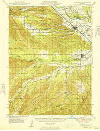
 1947 Tuscan Buttes1947 Print · USGSThe Sacramento River valley in the late 1940s reveals a landscape rich in early pioneer history and river-driven industry. Researchers can locate the Site of Ft Reading, trace the Coleman Canal to its power house, and find family names at Dersch Ranch or Ekelund Ranch.2 unique versions available
 - 1947 Map of Anderson, 1963 Print
 1947 Anderson1963 Print · USGSShasta and Tehama counties appear here in the late 1940s as a thriving corridor of riverside ranching and rail transport. Researchers can trace family sites like Gaines Ranch, early rural schools including Farquhar Sch, and the historical path of the Southern Pacific Railroad.2 unique versions available
 - 1948 Map of Anderson
 1948 Anderson1948 Print · USGSThe northern Sacramento Valley is captured here in the late 1940s, anchored by the rail corridor and the winding Sacramento River. Genealogists can trace family landmarks like Baker Ranch, Cloverdale Cem, and the rural Evergreen Sch.2 unique versions available
Showing maps 1-25 of 237
Top cities of Shasta County
- Redding historical maps
- Anderson historical maps
- Shasta Lake historical maps
- Burney historical maps
- Cottonwood historical maps
- Cottonwood historical maps
See more
Frequently asked questions
- What are the different types of historical maps available for Shasta County?
- What is the oldest map of Shasta County?
- Where can I purchase historical maps of Shasta County for my home or office?
- Where can I download high-res historical maps of Shasta County?
- Are there historical topographic maps available for Shasta County?
- Is there historical aerial imagery available for Shasta County?
- Where are historical maps of Shasta County sourced from?