1980s Maps of Shasta County, California
Explore 44 historic maps of Shasta County from the 1980s. These maps offer a rare glimpse into what life looked like during the 1980s — showing old roads, neighborhoods, homes, and landmarks that have changed or disappeared over time.
Whether you're researching your family's past, planning a metal detecting trip, or studying how Shasta County's landscape evolved across the 1980s, these high-resolution maps are a powerful tool for exploring the history of this region.
- Focus on a specific era: All maps on this page are from the 1980s, giving you a focused view of this time period.
- See what’s changed: Compare century-old streets, trails, and buildings to today's modern landscape using overlays and satellite layers.
- Research with precision: Use these maps for genealogy, historical research, land use analysis, or educational projects.
- View, download, or print: Maps are fully viewable online in high resolution, and can be downloaded or printed for your own records.
Start exploring Shasta County's history through authentic maps from the 1980s. This is your window into the past.
Shasta County, CA maps
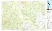
(44)- 1981 Map of Ono
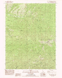
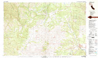 1981 Ono1981 Print · USGSWestern Shasta County is captured here in the early eighties, centered on the community of Ono and the Bald Hills. Researchers can trace old mining sites like the Blue Gravel Mine and find local landmarks including the Cem and Gas Point.2 unique versions available
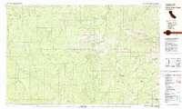
 - 1981 Map of Beegum
 1981 Beegum1981 Print · USGSThe remote borderlands of Tehama, Shasta, and Trinity counties are captured in the early eighties as a landscape of isolated ranching and federal forestry. Researchers can trace family-named sites like Williams Ranch, find the local Cem, or locate the Chrome Mine (Site).
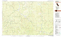
 - 1981 Map of Pony Buck Peak
 1981 Pony Buck Peak1981 Print · USGSThe high country of the Trinity Mountains is captured here in the early 1980s, documenting a remote landscape of national forest lands and isolated family homesteads. Researchers can trace historic mountain sites like Murphy Place, explore mining legacy at Spider Mine, and locate features like Hell to Find Lake.
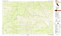
 - 1981 Map of Chickabally Mtn
 1981 Chickabally Mtn1981 Print · USGSTehama and Shasta counties are shown in the early eighties as a network of cattle flats and remote creek drainages. Researchers can locate the Rosewood settlement, a small Cem, and isolated landmarks like Wilson Flat and Wiley Flat.2 unique versions available
 - 1981 Map of Dubakella Mtn
 1981 Dubakella Mtn1981 Print · USGSThe Trinity and Shasta County borderlands are mapped here in the early 1980s, showcasing a network of forest roads and remote settlements. Researchers can locate the Wildwood Sch, trace the Blue Point Ditch, and find the Shiell Ranch (Site).2 unique versions available
 - 1981 Map of Chanchelulla Peak
 1981 Chanchelulla Peak1981 Print · USGSThe Trinity and Shasta county line area in the early eighties was a landscape of high-altitude lookouts and deep-canyon ranching. Researchers can trace historic mining operations at Midas Mine or locate family sites like Williams Ranch and the Deer Lick Springs resort.2 unique versions available
 - 1982 Map of Bully Choop Mtn
 1982 Bully Choop Mtn1982 Print · USGSThe Trinity Mountains gold and copper country is captured here in the early eighties. Researchers can trace historical mining operations at Bully Choop Mine and Cleveland Mine, or follow the old Jerusalem Trail.
 - 1982 Map of Papoose Creek
 1982 Papoose Creek1982 Print · USGSThe Trinity Mountains and the shores of Clair Engle Lake are captured here in the early eighties as a hub of forest management and mountain recreation. Researchers can trace the winding Jeep Trails and locate old mountain outposts like the Five Pines Mine and the Trinity Mountain Forest Service Station.
 - 1982 Map of Lewiston
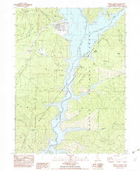
 1982 Lewiston1982 Print · USGSTrinity County in the early eighties shows a landscape of river-valley ranching and state forestry. Researchers can trace historic riverside locations like Lowden Ranch, the operations at French Mine, and the old crossroads at Buckhorn Station.2 unique versions available
 - 1982 Map of Damnation Peak
 1982 Damnation Peak1982 Print · USGSIn the early eighties, this pocket of the Trinity Mountains preserved traces of its industrial and ranching past. You can trace old transit routes past the Tollhouse or locate the historic Lamoine Mill (Site) and Caves Mine.
 - 1982 Map of Schell Mtn
 1982 Schell Mtn1982 Print · USGSNorthern California's high-country terrain in the early eighties is meticulously charted here at the junction of two national forests. Researchers can trace the drainage patterns of North Fork Squaw Creek and locate historic upland sites like Schultz Sheep Camp and Hall Cabin.
 - 1982 Map of Trinity Center
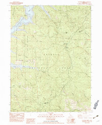
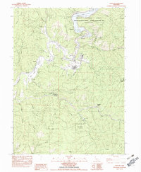
 1982 Trinity Center1982 Print · USGSNorthern California’s mountain landscape is captured here in the early eighties as the recreation area around the reservoir matured. Researchers can locate the Norwegian Ranch, trace the drainage of Swift Creek, and survey landmarks like Billys Peak.2 unique versions available
 - 1984 Map of Redding
 1984 Redding1984 Print · USGSThe Shasta County region in the mid-1980s reveals a landscape of massive reservoirs and active mining districts. Researchers can trace the development of Redding and Enterprise or locate historic mineral sites like Iron Mountain Mine and Keystone Mine.2 unique versions available
 - 1984 Map of McArthur
 1984 McArthur1984 Print · USGSThe northern California high country near McArthur is captured in the mid-1980s, showcasing a landscape of volcanic peaks and river valleys. Genealogists and historians can trace the rail connections at Nubieber and Bieber, or locate family sites near Pittville and Glenburn.
 - 1985 Map of Miller Mountain
 1985 Miller Mountain1985 Print · USGSShasta County in the mid-1980s shows a landscape of volcanic buttes and hydroelectric infrastructure. You can trace the path of Old Cow Creek to the Kilarc Powerhouse or locate high-altitude waters like Silver Lake and Blue Lake.
 - 1985 Map of Hagaman Gulch
 1985 Hagaman Gulch1985 Print · USGSShasta County during the mid-1980s reveals a transition from timber-producing gulches to high-elevation flats and meadows. Researchers can locate the site of Ritts Mill, trace the springs feeding Hagaman Gulch, and explore family-named landmarks like Dersch Meadows.
 - 1985 Map of Prospect Peak
 1985 Prospect Peak1985 Print · USGSThe volcanic wilderness of northeastern California is captured here in the mid-1980s, centered on the dramatic geological features of the Lassen region. Researchers can trace the massive flows of the Fantastic Lava Beds and locate landmarks like Cinder Cone, Butte Lake, and Snag Lake.
 - 1985 Map of Manzanita Lake
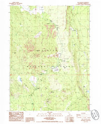
 1985 Manzanita Lake1985 Print · USGSShasta County's volcanic highlands are captured here in the mid-1980s, centered on the entrance to the national park. Researchers can trace landforms like Chaos Crater and Chaos Crags or locate recreational sites at Eskimo Hill and Reflection Lake.2 unique versions available
 - 1985 Map of West Prospect Peak
 1985 West Prospect Peak1985 Print · USGSShasta County’s volcanic highlands are captured here in the mid-1980s, centered on the northern reaches of the Cascade Range. Hikers and historians can trace the Pacific Crest National Scenic Trail past West Prospect Peak and find the historic route of Emigrant Pass.
 - 1985 Map of Old Station
 1985 Old Station1985 Print · USGSLassen National Forest in the mid-eighties shows a rugged intersection of volcanic geology and outdoor recreation near the Hat Creek Rim. Researchers can trace the path of the Pacific Crest National Scenic Trail or locate landmarks like Subway Cave and Old Station.2 unique versions available
 - 1985 Map of Grays Peak
 1985 Grays Peak1985 Print · USGSLassen National Forest and the Shasta-Tehama county line are documented in the mid-1980s, showcasing a landscape of high ridges and deep gulches. Researchers can identify historic recreation sites and remote landmarks like Camp Forward, Grays Peak, and Sugarpine Flat.
 - 1985 Map of Mt. Harkness
 1985 Mt. Harkness1985 Print · USGSThe high volcanic peaks of Plumas and Lassen counties are captured here in the mid-1980s. Researchers can locate seasonal outposts like Kelly Camp, trace the Pacific Crest National Scenic Trail, and find the Fleischmann Boy Scout Camp.
 - 1985 Map of Reading Peak
 1985 Reading Peak1985 Print · USGSLassen Volcanic National Park in the mid-1980s reveals a landscape of hydrothermal wonders and high-country wilderness. Trace the path of the Pacific Crest National Scenic Trail past Bumpass Hell, the Devils Kitchen, and the isolated outpost at Drakesbad.
 - 1985 Map of Thousand Lakes Valley
 1985 Thousand Lakes Valley1985 Print · USGSShasta County’s high wilderness is captured here in the mid-1980s, showcasing a landscape of volcanic buttes and alpine lakes. Researchers can trace the rugged topography around Magee Peak, locate the Magee Lookout, and identify remote water sources like Lake Eiler and Cornaz Spring.
 - 1985 Map of Lassen Peak
 1985 Lassen Peak1985 Print · USGSGeothermal activity and high-altitude lakes characterize this mid-1980s look at the Tehama County backcountry. Trace the trails leading to active thermal areas like Sulphur Works and Bumpass Hell Mud Pots, or locate recreation spots at Dry Lake Campground.
Showing maps 1-25 of 44
Top cities of Shasta County
- Redding historical maps
- Anderson historical maps
- Shasta Lake historical maps
- Burney historical maps
- Cottonwood historical maps
- Cottonwood historical maps
See more
Frequently asked questions
- What are the different types of historical maps available for Shasta County?
- What is the oldest map of Shasta County?
- Where can I purchase historical maps of Shasta County for my home or office?
- Where can I download high-res historical maps of Shasta County?
- Are there historical topographic maps available for Shasta County?
- Is there historical aerial imagery available for Shasta County?
- Where are historical maps of Shasta County sourced from?