Old Maps of Allendale, California for Metal Detecting
Plan your next treasure hunt with 14 historic maps of Allendale. Find old homesites, ghost towns, trails, and gathering spots that may be lost to time — perfect for identifying promising metal detecting locations.
- Locate forgotten sites: Uncover places like long-lost settlements, abandoned rail lines, or gathering spots.
- Plan better hunts: Use map overlays combined with LiDAR or satellite views to narrow in on historically rich areas.
- Made for detectorists: Thousands of hobbyists use these maps to discover relics, coins, and hidden history.
Use these historic maps to boost your research and find new opportunities beneath the surface of Allendale.
Allendale, CA maps
(14)- 1908 Map of Vacaville
 1908 Vacaville1908 Print · USGSNorthern California's agricultural heartland is captured here at the start of the century, centered on the rail corridors of the Southern Pacific. Genealogists can trace early homesteads and rail stops like Elmira, Maine Prairie, and the Cement Mill.3 unique versions available
 - 1917 Map of Wolfskill
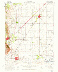
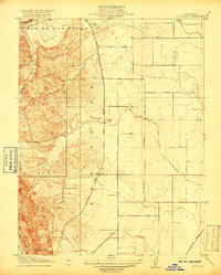 1917 Wolfskill1917 Print · USGSRail-line settlements in Solano County define this early twentieth-century landscape during the peak of the steam era. Researchers can trace the development of rural hubs along the Southern Pacific tracks, including Allendale, Hartley, and the station at Wolfskill.2 unique versions available
 - 1941 Map of Vacaville
 1941 Vacaville1941 Print · USGSSolano County’s fertile ranching and orchard lands are documented in the early 1940s, just before significant regional growth. Local historians can trace family-named school districts like Tremont District School and rural rail stops including Batavia and Cannon.
 - 1947 Map of Sacramento, 1948 Print
 1947 Sacramento1948 Print · USGSThe Sacramento Valley meets the high Sierra during a period of post-war expansion. Trace the historic river delta islands like Grand Island or locate early airfield footprints at McClellan Air Force Base and Mather Air Force Base.2 unique versions available
 - 1948 Map of Sacramento, 1951 Print
 1948 Sacramento1951 Print · USGSPost-war Northern California comes alive in this regional survey, capturing the era of expansion between the Central Valley and the High Sierra. Researchers can trace the rail networks of the Central California Traction and Sacramento Northern RR or locate landmarks like the State Capitol and University of California Davis.
 - 1953 Map of Allendale, 1954 Print
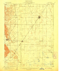
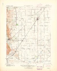
 1953 Allendale1954 Print · USGSSolano County agriculture and rail infrastructure are on full display in the early fifties, centered on the Allendale community. Genealogists can locate family-named landmarks and rural institutions like Browns Valley School, Union Chapel, and the village of Hartley.6 unique versions available
 - 1953 Map of Vacaville, 1959 Print
 1953 Vacaville1959 Print · USGSSolano County's agricultural heartland is documented here during the mid-fifties as the local rail and military presence expanded. Genealogists and historians can trace numerous rural school sites like Grant Sch and lost rail stops such as Batavia or Dozier.
 - 1956 Map of Sacramento
 1956 Sacramento1956 Print · USGSMid-century California unfolds from the delta to the high Sierra, capturing a landscape of growing valley cities and burgeoning military airbases. Genealogists and historians can trace the rail lines and river towns from Woodland to Lodi, or explore the foothill settlements of Placerville and Jackson.2 unique versions available
 - 1957 Map of Sacramento, 1966 Print
 1957 Sacramento1966 Print · USGSIn the mid-twentieth century, the California heartland was a hub of river transport, rail lines, and military airbases. Genealogists and historians can trace the development of Gold Country towns like Angels Camp and Sonora or follow the path of the Southern Pacific RR through the growing suburbs of Sacramento.4 unique versions available
 - 1993 Map of Lodi, 1994 Print
 1993 Lodi1994 Print · USGSNorthern California's delta country and the growing Central Valley corridors are captured here in the early nineties. Genealogists and historians can trace the intricate island tracts, old railroad lines like the Sacramento Northern RR, and established local landmarks including the Lodi Memorial Cemetery and University of the Pacific.2 unique versions available
 - 2012 Map of Allendale, 2012 Print
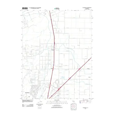 2012 Allendale2012 Print · USGSCovers Allendale, including Vacaville, Hartley, and other nearby areas
 - 2015 Map of Allendale, 2015 Print
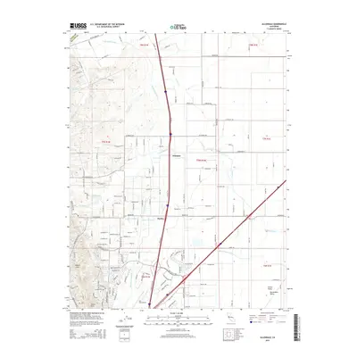 2015 Allendale2015 Print · USGSCovers Allendale, including Vacaville, Hartley, and other nearby areas
 - 2018 Map of Allendale, 2018 Print
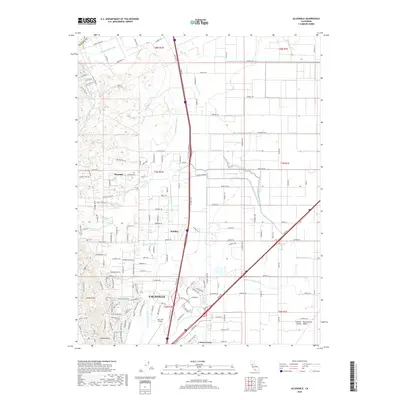 2018 Allendale2018 Print · USGSCovers Allendale, including Vacaville, Hartley, and other nearby areas
 - 2022 Map of Allendale, 2022 Print
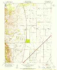
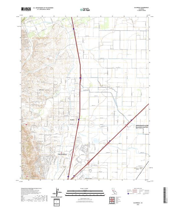 2022 Allendale2022 Print · USGSThe western edge of the Sacramento Valley meets the rising English Hills in the early 2020s. Researchers can trace irrigation networks like the Putah South Canal and locate family landmarks near Allendale, Hartley, or the Nut Tree Airport.
End of results
Showing maps 1-14 of 14
Top cities near Allendale
- Fairfield historical maps
- Vacaville historical maps
- Davis historical maps
- Woodland historical maps
- Suisun City historical maps
- Dixon historical maps
See more
Frequently asked questions
- What are the different types of historical maps available for Allendale?
- What is the oldest map of Allendale?
- Where can I purchase historical maps of Allendale for my home or office?
- Where can I download high-res historical maps of Allendale?
- Are there historical topographic maps available for Allendale?
- Is there historical aerial imagery available for Allendale?
- Where are historical maps of Allendale sourced from?