Old Maps of Tehama, California for Metal Detecting
Plan your next treasure hunt with 17 historic maps of Tehama. Find old homesites, ghost towns, trails, and gathering spots that may be lost to time — perfect for identifying promising metal detecting locations.
- Locate forgotten sites: Uncover places like long-lost settlements, abandoned rail lines, or gathering spots.
- Plan better hunts: Use map overlays combined with LiDAR or satellite views to narrow in on historically rich areas.
- Made for detectorists: Thousands of hobbyists use these maps to discover relics, coins, and hidden history.
Use these historic maps to boost your research and find new opportunities beneath the surface of Tehama.
Tehama, CA maps
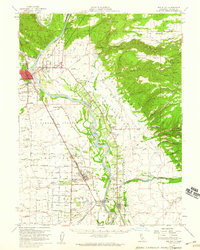
(17)- 1890 Map of Red Bluff
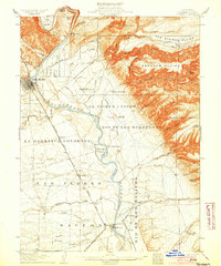
 1890 Red Bluff1890 Print · USGSNorthern California in the late nineteenth century was a hub of river-and-rail activity where the Central Pacific Railroad met the rugged Klamath Mountains. Researchers can trace old ferry crossings like Ball's Ferry, locate the U.S. Fishery, or find early mining camps and stations such as Minersville and Buck Horn Station.
 - 1894 Map of Red Bluff, 1896 Print
 1894 Red Bluff1896 Print · USGSNorthern California's mining and river-trading frontier comes alive in this survey of the late nineteenth century. Genealogists and historians can trace the growth of rail hubs like Redding or locate early river crossings and industrial sites such as Jelley's Ferry and the Copper Mine.6 unique versions available
 - 1905 Map of Tehama
 1905 Tehama1905 Print · USGSThe Sacramento Valley in the early nineteen-hundreds is shown here at a peak of early rail and river development. Local researchers can trace the Shasta Route through Red Bluff and Tehama, or locate landmarks like the U. S. Fishery and Tuscan Springs.4 unique versions available
 - 1950 Map of Gerber, 1962 Print
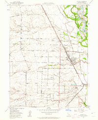 1950 Gerber1962 Print · USGSMid-century Tehama County is defined by the heavy rail influence of the Southern Pacific and the winding course of the Sacramento River. Genealogists and local historians can trace family-named roads and rural landmarks like the Tehama Cem, El Camino Grange, and the settlement of Gerber.3 unique versions available
 - 1951 Map of Gerber
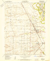 1951 Gerber1951 Print · USGSTehama County's agricultural heartland is documented here in the early 1950s, showing the vital rail and river networks of the Sacramento Valley. Genealogists and local historians can trace family properties near Gerber, Tehama, and Proberta, or locate the Tehama Cem and the El Camino Grange.
 - 1952 Map of Los Molinos, 1953 Print
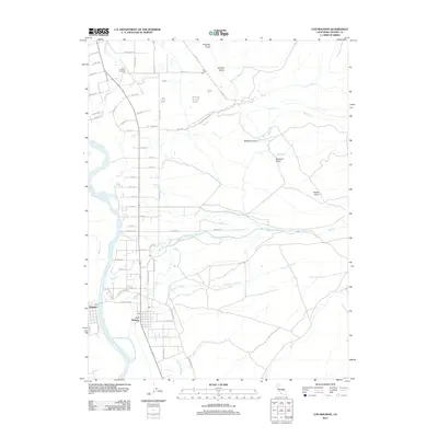
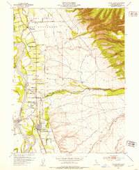 1952 Los Molinos1953 Print · USGSTehama County agriculture and transit flourish during the early fifties as the railroad and river shape local growth. Trace the development of Los Molinos and Tehama near the Southern Pacific line and family landmarks like the Lassen View Union School.4 unique versions available
 - 1952 Map of Red Bluff, 1959 Print
 1952 Red Bluff1959 Print · USGSTehama County in the early fifties shows a bustling valley landscape of river-side grants and railroad towns. Genealogists and local historians can trace family-named sites such as Oak Hill Cem, the Los Molinos Grange, and the Antelope Sch.3 unique versions available
 - 1958 Map of Redding
 1958 Redding1958 Print · USGSNorthern California's valley and mountain landscapes are captured in the late fifties, showing the region as new reservoirs reshaped the river systems. Genealogists and historians can trace rail-side towns like Cottonwood, the military presence at Red Bluff Air Force Station, and mountain outposts like Weaverville.5 unique versions available
 - 1979 Map of Red Bluff
 1979 Red Bluff1979 Print · USGSTehama and Shasta counties come alive in the late seventies as the agricultural heart of the northern valley meets the high wilderness. Genealogists and local historians can trace the rail-and-river corridor from Red Bluff to Los Molinos, finding sites like Balls Ferry and the Southern Pacific line.3 unique versions available
 - 2012 Map of Los Molinos, 2012 Print
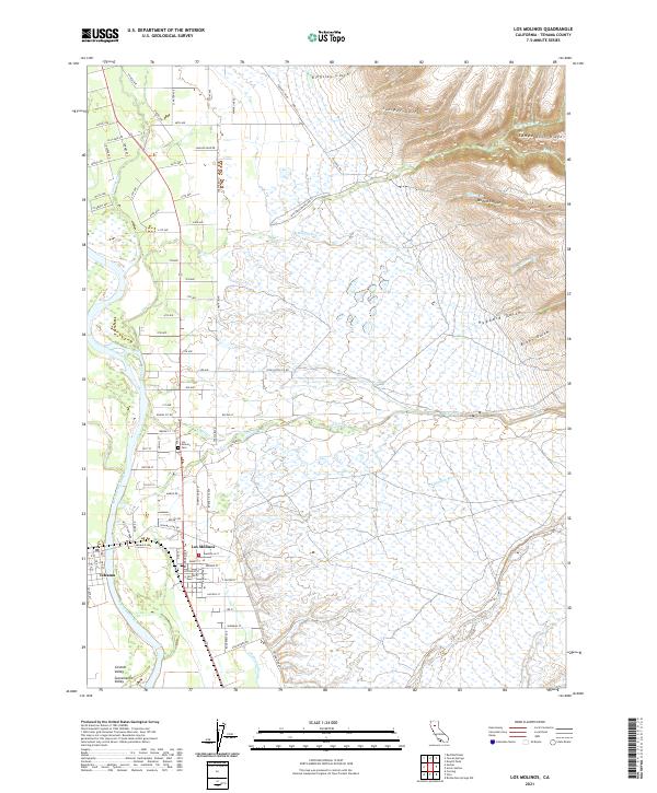
 2012 Los Molinos2012 Print · USGSCovers Tehama, including Los Molinos, Tehama County, and other nearby areas
 - 2012 Map of Gerber, 2012 Print
 2012 Gerber2012 Print · USGSCovers Tehama, including El Camino, Rawson, and other nearby areas
 - 2015 Map of Los Molinos, 2015 Print
 2015 Los Molinos2015 Print · USGSCovers Tehama, including Los Molinos, Tehama County, and other nearby areas
 - 2015 Map of Gerber, 2015 Print
 2015 Gerber2015 Print · USGSCovers Tehama, including El Camino, Rawson, and other nearby areas
 - 2018 Map of Los Molinos, 2018 Print
 2018 Los Molinos2018 Print · USGSCovers Tehama, including Los Molinos, Tehama County, and other nearby areas
 - 2018 Map of Gerber, 2018 Print
 2018 Gerber2018 Print · USGSCovers Tehama, including El Camino, Rawson, and other nearby areas
 - 2021 Map of Los Molinos, 2021 Print
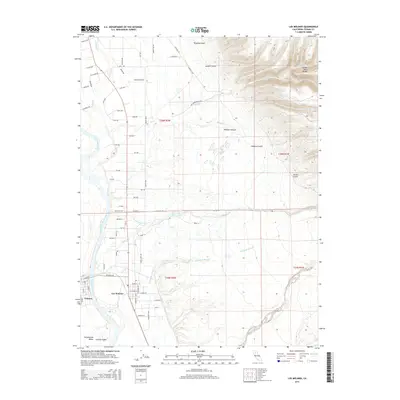
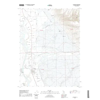
 2021 Los Molinos2021 Print · USGSThe Sacramento River corridor and the foothills of Tehama County are shown here at the start of the 2020s. Researchers can trace family sites near Los Molinos Cemetery or follow the seasonal drainages of Mill Creek and Champlin Slough.
 - 2022 Map of Gerber, 2022 Print
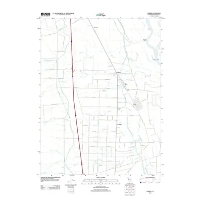
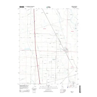
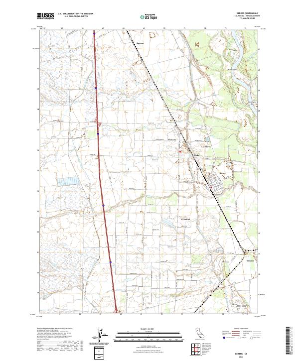 2022 Gerber2022 Print · USGSThe agricultural heart of the Sacramento Valley comes into focus here, showing the region's dependence on the Tehama-Colusa Canal and Corning Canal. Genealogists and local historians can locate family plots at Tehama Cem or trace old property lines near Gerber, Proberta, and Rawson.
End of results
Showing maps 1-17 of 17
Top cities near Tehama
- Chico historical maps
- Red Bluff historical maps
- Corning historical maps
- Los Molinos historical maps
- Vina historical maps
Frequently asked questions
- What are the different types of historical maps available for Tehama?
- What is the oldest map of Tehama?
- Where can I purchase historical maps of Tehama for my home or office?
- Where can I download high-res historical maps of Tehama?
- Are there historical topographic maps available for Tehama?
- Is there historical aerial imagery available for Tehama?
- Where are historical maps of Tehama sourced from?