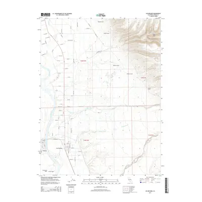
2015 Map of Los Molinos
USGS Topo · Published 2015About this map
Los Molinos and the nearby town of Tehama occupy the fertile plains of the Sacramento Valley, where numerous drainages converge on the Sacramento River. This landscape is defined by the transition from the flat agricultural lands in the west to the rising volcanic foothills in the east. The complex hydrology of the region is evident in the meandering path of Champlin Slough and the many seasonal creeks, such as Mill Creek, Dye Cr, and Antelope Cr, that cut through the terrain. To the northeast, the land climbs sharply toward Campo Seco Ridge, a prominent landform overlooking deeply carved features like Wildcat Canyon and Kingsley Gulch. The map records a dense grid of rural roads and residential streets, particularly around Los Molinos, illustrating the established settlement patterns and land divisions within the northern Central Valley.
Find a feature on this map
83 named features on this map. Tap any name to fly to it.
Don’t see what you’re looking for? This feature index may not catch every label — zoom into the map to look around manually.
Map Details
Editions of this 2015 Los Molinos Map
This is the sole edition of this map. No revisions or reprints were ever made.
Other maps of this area

1886 · Lassen Peak
USGS Topo · 1:250,000

1890 · Red Bluff
USGS Topo · 1:250,000

1891 · Chico
USGS Topo · 1:125,000

1892 · Lassen Peak
USGS Topo · 1:250,000

1893 · Chico
USGS Topo · 1:125,000

1894 · Lassen Peak
USGS Topo · 1:250,000

1894 · Red Bluff
USGS Topo · 1:250,000

1895 · Chico
USGS Topo · 1:125,000

1904 · Vina
USGS Topo · 1:62,500

1905 · Tehama
USGS Topo · 1:62,500