Old Maps of Dedrick, California for Academic Research
Study the evolution of Dedrick with 12 high-resolution historic maps. Whether you're teaching, researching, or modeling changes in land use, these maps provide essential visual documentation of urban, environmental, and geographic change.
- Analyze long-term change: Track patterns in development, transportation, and natural features.
- Ideal for environmental or urban studies: Support academic projects with primary historical map data.
- Use in the classroom or lab: Educators and researchers rely on these maps to bring historical context to life.
These maps are a powerful tool for teaching, research, and visualizing how Dedrick has changed over the decades.
Dedrick, CA maps
(12)- 1909 Map of Big Bar
 1909 Big Bar1909 Print · USGSTrinity County at the turn of the century shows a land defined by deep river canyons and remote mountain settlements. Genealogists and local historians can trace early footprints at Hyampom and Hayfork, or locate the high ridges of Barker Mtn and Thompson Peak.2 unique versions available
 - 1915 Map of Big Bar and Vicinity
 1915 Big Bar and Vicinity1915 Print · USGSThe Trinity River wilderness in the early twentieth century was a landscape of isolated mining outposts and river settlements. Genealogists and historians can trace the early footprints of Junction City, Helena, and Hyampom alongside remote landmarks like Keystone Cabin.5 unique versions available
 - 1951 Map of Helena, 1953 Print
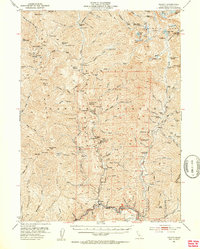 1951 Helena1953 Print · USGSTrinity County’s rugged mining country is captured here in the early fifties, detailing the transition from active extraction to national forest management. Researchers can locate remote camps and historic gold operations like the Enterprise Mine, Dedrick, and Canyon City.5 unique versions available
 - 1958 Map of Redding
 1958 Redding1958 Print · USGSNorthern California's valley and mountain landscapes are captured in the late fifties, showing the region as new reservoirs reshaped the river systems. Genealogists and historians can trace rail-side towns like Cottonwood, the military presence at Red Bluff Air Force Station, and mountain outposts like Weaverville.5 unique versions available
 - 1982 Map of Dedrick
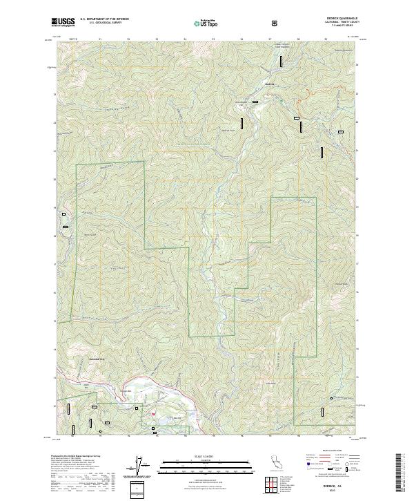
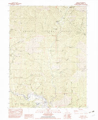 1982 Dedrick1982 Print · USGSTrinity County's gold-mining legacy is preserved in this early 1980s survey of the rugged Canyon Creek drainage. Researchers can trace the location of historical workings like Enterprise Mine and lost camps such as Canyon City or Dedrick.
 - 1982 Map of Hayfork, 1983 Print
 1982 Hayfork1983 Print · USGSTrinity and Humboldt counties appear here in the early eighties as a landscape of timber and mining. Researchers can trace remote river settlements like Hyampom and Burnt Ranch or locate old operations such as the Yellowstone Mine and Index Mine.
 - 1998 Map of Dedrick, 2003 Print
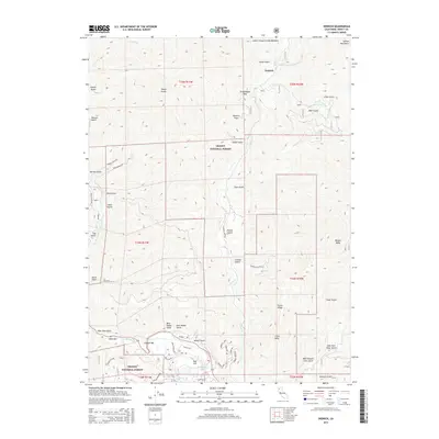
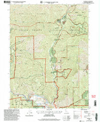 1998 Dedrick2003 Print · USGSThe Trinity Alps region at the end of the millennium reveals a landscape deeply carved by its mining heritage. Researchers can trace the legacies of the Enterprise Mine and Noonan Mine or locate the riverside operations at Idaho Bar and Canyon City.
 - 2012 Map of Dedrick, 2012 Print
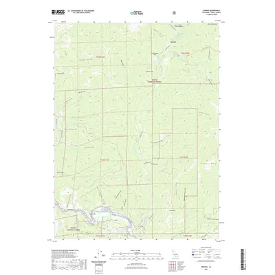
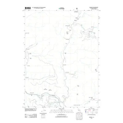 2012 Dedrick2012 Print · USGSCovers Dedrick, including Trinity County, United States, and other nearby areas
 - 2015 Map of Dedrick, 2015 Print
 2015 Dedrick2015 Print · USGSCovers Dedrick, including Trinity County, United States, and other nearby areas
 - 2018 Map of Dedrick, 2018 Print
 2018 Dedrick2018 Print · USGSCovers Dedrick, including Trinity County, United States, and other nearby areas
 - 2022 Map of Dedrick, 2022 Print
 2022 Dedrick2022 Print · USGSCovers Dedrick, including Trinity County, United States, and other nearby areas
 - 2023 Map of Dedrick, 2023 Print
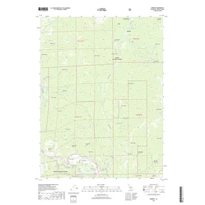
 2023 Dedrick2023 Print · USGSThe Trinity River corridor in the twenty-first century continues to reveal its deep history of riverbank settlement and mountain exploration. Genealogists and historians can trace family-named sites like Mccartneys and Idaho Bar, or follow Canyon Creek Rd to the remote outpost of Dedrick.
End of results
Showing maps 1-12 of 12
Top cities near Dedrick
Frequently asked questions
- What are the different types of historical maps available for Dedrick?
- What is the oldest map of Dedrick?
- Where can I purchase historical maps of Dedrick for my home or office?
- Where can I download high-res historical maps of Dedrick?
- Are there historical topographic maps available for Dedrick?
- Is there historical aerial imagery available for Dedrick?
- Where are historical maps of Dedrick sourced from?