
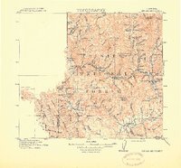
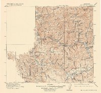
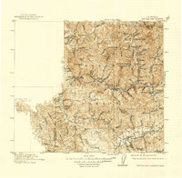
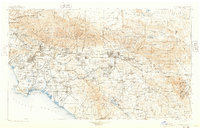
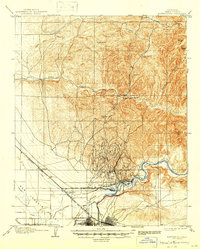
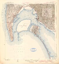
1915 Map of Big Bar and Vicinity
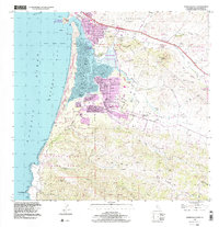
USGS Topo · Published 1915This historical map portrays the area of Big Bar and Vicinity in 1915, primarily covering California. Featuring a scale of 1:250000, this map provides a highly detailed snapshot of the terrain, roads, buildings, counties, and historical landmarks in the Big Bar and Vicinity region at the time. Published in 1915, it is one of 5 known editions of this map due to revisions or reprints.
Find a feature on this map
91 named features on this map. Tap any name to fly to it.
Don’t see what you’re looking for? This feature index may not catch every label — zoom into the map to look around manually.
Map Details
Editions of this 1915 Big Bar and Vicinity Map
5 editions found
Historical Maps of Dedrick Through Time
28 maps found

1894 Los Angeles
California
1900 Los Angeles
California
1901 Southern California Sheet No. 1
California
1904 Indio
California
1904 Southern California Sheet No. 1
California
1904 Southern California Sheet No. 2
California
1906 Bakersfield
California
1915 Big Bar and Vicinity
California

1915 Spenceville
California

1924 Hollywood
California
1925 Long Beach
California
1926 Hollywood
California

1928 Altadena
California

1929 Crescent City
California

1931 Tejon Hills
California

1933 Ontario
California

1942 Ontario and Vicinity
California
1942 Point Loma
California
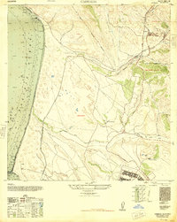
1947 Casmalia
California
1950 Parker Dam Area
California
1953 Del Mar
California

1953 Point Loma
California

1967 Del Mar
California

1967 Point Loma
California

1976 Morro Bay South
California

1994 Del Mar
California

1996 Point Loma
California
1998 Morro Bay South
California