1920s Maps of Tulare, California
Explore 5 historic maps of Tulare from the 1920s. These maps offer a rare glimpse into what life looked like during the 1920s — showing old roads, neighborhoods, homes, and landmarks that have changed or disappeared over time.
Whether you're researching your family's past, planning a metal detecting trip, or studying how Tulare's landscape evolved across the 1920s, these high-resolution maps are a powerful tool for exploring the history of this region.
- Focus on a specific era: All maps on this page are from the 1920s, giving you a focused view of this time period.
- See what’s changed: Compare century-old streets, trails, and buildings to today's modern landscape using overlays and satellite layers.
- Research with precision: Use these maps for genealogy, historical research, land use analysis, or educational projects.
- View, download, or print: Maps are fully viewable online in high resolution, and can be downloaded or printed for your own records.
Start exploring Tulare's history through authentic maps from the 1920s. This is your window into the past.
Tulare, CA maps
(5)- 1925 Map of Tulare
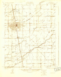 1925 Tulare1925 Print · USGSTulare and its surrounding agricultural colonies are captured here in the mid-twenties as the valley's irrigation and rail networks expanded. Researchers can trace the development of small settlements like Burling and Elba alongside early landmarks such as the Oakland Colony School.
 - 1925 Map of Tipton
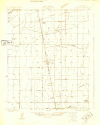 1925 Tipton1925 Print · USGSThe agricultural landscape surrounding Tipton was still taking shape in the mid-twenties as the Southern Pacific railroad spurred growth. Family historians can locate rural landmarks like Hanby School, Edendale School, and the early route of Vineyard Road.
 - 1927 Map of Paige
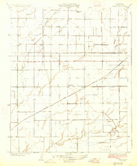 1927 Paige1927 Print · USGSTulare County's agricultural heartland is captured in the mid-twenties as the valley's irrigation and rail networks expanded. Researchers can locate several rural schoolhouses like Linder School and trace the path of the Atchison Topeka and Santa Fe through Paige.2 unique versions available
 - 1927 Map of Tulare
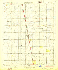
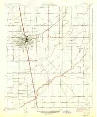 1927 Tulare1927 Print · USGSThe San Joaquin Valley town of Tulare and its surrounding agricultural colonies are captured here during the mid-1920s. Genealogists can trace early rural life at Oakland Colony School and railroad stops at Burling and Elba.3 unique versions available
 - 1928 Map of Tipton
 1928 Tipton1928 Print · USGSTulare County's agricultural heartland is captured here in the mid-1920s as the rail-side town of Tipton grows along the Southern Pacific. Researchers can locate early schools like Hanby School and Edendale School, or trace old roads and sidings at Octol and Alfac.2 unique versions available
End of results
Showing maps 1-5 of 5
Top cities near Tulare
- Visalia historical maps
- Corcoran historical maps
- Exeter historical maps
- Farmersville historical maps
- Woodlake historical maps
- Ivanhoe historical maps
See more
Frequently asked questions
- What are the different types of historical maps available for Tulare?
- What is the oldest map of Tulare?
- Where can I purchase historical maps of Tulare for my home or office?
- Where can I download high-res historical maps of Tulare?
- Are there historical topographic maps available for Tulare?
- Is there historical aerial imagery available for Tulare?
- Where are historical maps of Tulare sourced from?