Old Maps of Black Jack Bluffs, California for Academic Research
Study the evolution of Black Jack Bluffs with 14 high-resolution historic maps. Whether you're teaching, researching, or modeling changes in land use, these maps provide essential visual documentation of urban, environmental, and geographic change.
- Analyze long-term change: Track patterns in development, transportation, and natural features.
- Ideal for environmental or urban studies: Support academic projects with primary historical map data.
- Use in the classroom or lab: Educators and researchers rely on these maps to bring historical context to life.
These maps are a powerful tool for teaching, research, and visualizing how Black Jack Bluffs has changed over the decades.
Black Jack Bluffs, CA maps
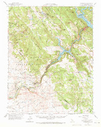
(14)- 1916 Map of Copperopolis
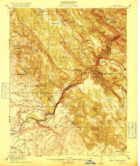 1916 Copperopolis1916 Print · USGSCalaveras and Stanislaus counties at the height of the early copper and ranching era reveal a landscape of deep canyons and mining outposts. Trace the Sierra Ry of California or locate historic crossings like Reynolds Ferry and the Wilbur-Womble Mine.3 unique versions available
 - 1942 Map of Copperopolis
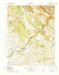 1942 Copperopolis1942 Print · USGSThe Mother Lode's mining and water heritage is preserved here in the early 1940s, centered on the copper-rich hills and the Stanislaus River. Genealogists and historians can trace family-named sites like Curtin Ranch, old schools such as O'Byrnes School, and active mines including the Wilbur Womble Mine.
 - 1947 Map of San Jose, 1948 Print
 1947 San Jose1948 Print · USGSNorthern California's heartland is captured here just after the war, showing the rapid growth of the Santa Clara and Central Valleys. Researchers can trace the legacy of rail and water at Castle Air Force Base, Stockton, and the Hetch Hetchy Aqueduct.
 - 1954 Map of Copperopolis, 1956 Print
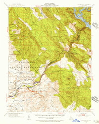 1954 Copperopolis1956 Print · USGSThe California foothills in the mid-fifties reveal a transition from gold and copper mining to water management along the Stanislaus River. Locate historic sites like Central Ferry and the Napoleon Mine while tracing the Sierra Railroad.
 - 1956 Map of San Jose
 1956 San Jose1956 Print · USGSCentral California in the mid-fifties reveals the transition from sprawling orchards to growing urban hubs like San Jose and Stockton. Genealogists and historians can trace the rail-era landscape of the Mother Lode through Chinese Camp and Tuttletown, or follow the water through the Joaquin River and Calaveras Reservoir.
 - 1962 Map of San Jose
 1962 San Jose1962 Print · USGSCentral California in the early sixties showcases the expansion of the San Joaquin and Santa Clara valleys. Researchers can trace the rail-to-road transition along the Southern Pacific RR or locate landmarks like Castle USAF Base and Loma Prieta.4 unique versions available
 - 1962 Map of Melones Dam, 1963 Print
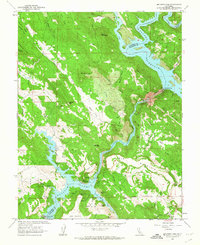 1962 Melones Dam1963 Print · USGSThe Stanislaus River corridor in the early sixties reveals a landscape shaped by both gold-era mining and modern reservoirs. Researchers can locate legacy sites like the Lightner Mine, the Central Ferry (Site), and the Byrne Ferry Historical Monument along the water's edge.4 unique versions available
 - 1962 Map of Copperopolis, 1964 Print
 1962 Copperopolis1964 Print · USGSThe foothills of the Mother Lode come alive in the early sixties as mining towns and water projects reshape the landscape. Genealogists and historians can trace family-named sites like Wagner Ranch and Kistler Ranch alongside the historic Sierra Railroad and Knights Ferry crossing.2 unique versions available
 - 1966 Map of San Jose
 1966 San Jose1966 Print · USGSCentral California in the mid-1960s reveals a landscape of massive irrigation projects and expanding Cold War military footprints. Researchers can trace the rail-and-river network of the San Joaquin Valley or locate specialized sites like Castle Air Force Base and the Sharp General Depot (Military).
 - 1994 Map of Oakdale, 1995 Print
 1994 Oakdale1995 Print · USGSThe San Joaquin Valley meets the Sierra foothills in the mid-1990s, where massive reservoirs and canal networks fueled California's agricultural heartland. Researchers can trace the Hetch Hetchy Aqueduct, find the Sierra RR, and locate the Riverbank Army Ammunition Plant.2 unique versions available
 - 2012 Map of New Melones Dam, 2012 Print
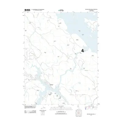 2012 New Melones Dam2012 Print · USGSCovers Black Jack Bluffs, including The Shores of Poker Flat, Tuolumne County, and other nearby areas
 - 2015 Map of New Melones Dam, 2015 Print
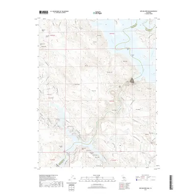
 2015 New Melones Dam2015 Print · USGSCovers Black Jack Bluffs, including The Shores of Poker Flat, Tuolumne County, and other nearby areas
 - 2018 Map of New Melones Dam, 2018 Print
 2018 New Melones Dam2018 Print · USGSCovers Black Jack Bluffs, including The Shores of Poker Flat, Tuolumne County, and other nearby areas
 - 2021 Map of New Melones Dam, 2021 Print
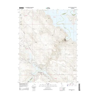
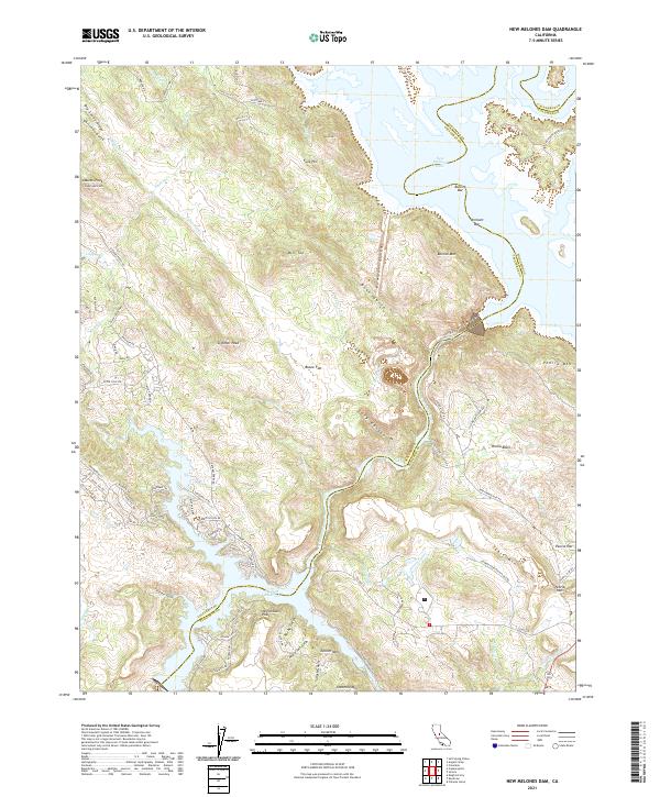 2021 New Melones Dam2021 Print · USGSThe foothills of the Sierra Nevada meet the waters of the Stanislaus River in this recent survey. Researchers can trace the shoreline of New Melones Lake and Tulloch Reservoir while locating historic mining-era sites like Bostick Bar and Vermont Bar.
End of results
Showing maps 1-14 of 14
Top cities near Black Jack Bluffs
- Oakdale historical maps
- Sonora historical maps
- Jamestown historical maps
- Telegraph City historical maps
Frequently asked questions
- What are the different types of historical maps available for Black Jack Bluffs?
- What is the oldest map of Black Jack Bluffs?
- Where can I purchase historical maps of Black Jack Bluffs for my home or office?
- Where can I download high-res historical maps of Black Jack Bluffs?
- Are there historical topographic maps available for Black Jack Bluffs?
- Is there historical aerial imagery available for Black Jack Bluffs?
- Where are historical maps of Black Jack Bluffs sourced from?