2020s Maps of Thousand Oaks, California
Explore 5 historic maps of Thousand Oaks from the 2020s. These maps offer a rare glimpse into what life looked like during the 2020s — showing old roads, neighborhoods, homes, and landmarks that have changed or disappeared over time.
Whether you're researching your family's past, planning a metal detecting trip, or studying how Thousand Oaks's landscape evolved across the 2020s, these high-resolution maps are a powerful tool for exploring the history of this region.
- Focus on a specific era: All maps on this page are from the 2020s, giving you a focused view of this time period.
- See what’s changed: Compare century-old streets, trails, and buildings to today's modern landscape using overlays and satellite layers.
- Research with precision: Use these maps for genealogy, historical research, land use analysis, or educational projects.
- View, download, or print: Maps are fully viewable online in high resolution, and can be downloaded or printed for your own records.
Start exploring Thousand Oaks's history through authentic maps from the 2020s. This is your window into the past.
Thousand Oaks, CA maps
(5)- 2021 Map of Point Dume, 2021 Print
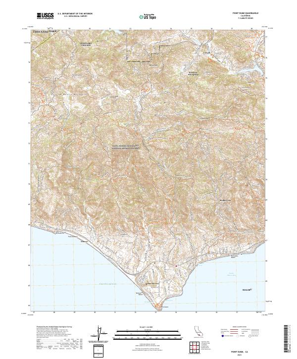 2021 Point Dume2021 Print · USGSThe Santa Monica Mountains meet the Pacific Ocean in the early twenty-first century, showing the development of coastal enclaves. Trace historic trails and modern topography through Seminole Hot Springs, Malibu Vista, and the prominent Point Dume.
 - 2021 Map of Newbury Park, 2021 Print
 2021 Newbury Park2021 Print · USGSVentura County at the start of the 2020s shows a landscape of suburban centers and vast protected parklands. Researchers can trace the modern development of Thousand Oaks or explore the hiking corridors of the Santa Monica Mountains and Boney Mtn.
 - 2022 Map of Camarillo, 2022 Print
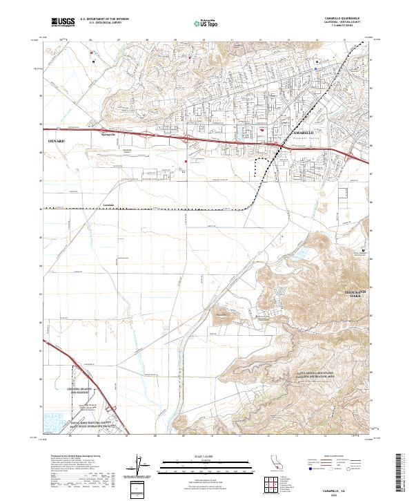 2022 Camarillo2022 Print · USGSVentura County's coastal valley comes into focus in this contemporary survey of the corridor between Oxnard and Thousand Oaks. Researchers can trace the layout of Saint John's Seminary, the military grounds of Channel Islands ANG Station, and the slopes of the Santa Monica Mountains.
 - 2022 Map of Simi Valley West, 2022 Print
 2022 Simi Valley West2022 Print · USGSVentura County at the start of the 2020s shows the dense suburban expansion of Simi Valley and Moorpark against a backdrop of steep ridgelines. Researchers can trace local heritage at El Rancho Simi Pioneer Cem or explore the rugged network of the Edison Fire Rd.
 - 2022 Map of Thousand Oaks, 2022 Print
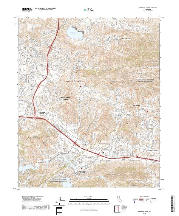 2022 Thousand Oaks2022 Print · USGSThousand Oaks and the southern Simi Hills are shown here as a modern suburban landscape deeply integrated with protected mountain parklands. Genealogists and hikers can trace local landmarks like Valley Oaks Memorial Park Cem, Greenwich Village, and the rugged Mountclef Ridge.
End of results
Showing maps 1-5 of 5
Top cities near Thousand Oaks
- Los Angeles historical maps
- Simi Valley historical maps
- Camarillo historical maps
- Moorpark historical maps
- Santa Paula historical maps
- Calabasas historical maps
See more
Top neighborhoods of Thousand Oaks
- Greenwich Village historical maps
- North Ranch historical maps
- Mountclef Village historical maps
- Triunfo Corner historical maps
- Westlake Village historical maps
- Newbury Park historical maps
See more
Frequently asked questions
- What are the different types of historical maps available for Thousand Oaks?
- What is the oldest map of Thousand Oaks?
- Where can I purchase historical maps of Thousand Oaks for my home or office?
- Where can I download high-res historical maps of Thousand Oaks?
- Are there historical topographic maps available for Thousand Oaks?
- Is there historical aerial imagery available for Thousand Oaks?
- Where are historical maps of Thousand Oaks sourced from?