Old Maps of Valdez, California for Genealogy
Trace your family roots with 14 historic maps of Valdez. These high-res maps reveal old neighborhoods, homesites, landmarks, and streets — helping you uncover where your ancestors lived and how the area evolved over time.
- Explore historic neighborhoods: Identify where your relatives may have lived in the 1800s or 1900s.
- Compare maps over time: Trace the changes in streets, buildings, and landmarks for multi-generational research.
- Perfect for genealogy & ancestry research: Used by family historians and researchers to map out lineage and migration.
These maps are an incredible resource for exploring your personal connection to Valdez's past.
Valdez, CA maps
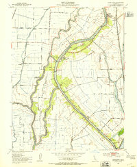
(14)- 1908 Map of Courtland
 1908 Courtland1908 Print · USGSThe Sacramento Delta at the dawn of the twentieth century was a landscape of fertile river islands and vital waterborne transit. Genealogists and historians can trace the early footprints of Courtland, Clarksburg, and Freeport, or locate landmarks like the Free County Ferry and Indian Mound.3 unique versions available
 - 1916 Map of Vorden
 1916 Vorden1916 Print · USGSThe Sacramento River delta was a bustling network of river landings and island farms in the early twentieth century. Genealogists and historians can trace the foundations of Courtland, Vorden, and Paintersville, or locate river infrastructure like Pier 13 and the ferry.
 - 1947 Map of Sacramento, 1948 Print
 1947 Sacramento1948 Print · USGSThe Sacramento Valley meets the high Sierra during a period of post-war expansion. Trace the historic river delta islands like Grand Island or locate early airfield footprints at McClellan Air Force Base and Mather Air Force Base.2 unique versions available
 - 1948 Map of Sacramento, 1951 Print
 1948 Sacramento1951 Print · USGSPost-war Northern California comes alive in this regional survey, capturing the era of expansion between the Central Valley and the High Sierra. Researchers can trace the rail networks of the Central California Traction and Sacramento Northern RR or locate landmarks like the State Capitol and University of California Davis.
 - 1952 Map of Courtland, 1953 Print
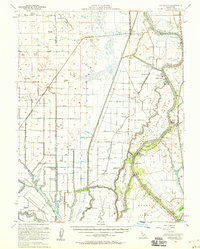
 1952 Courtland1953 Print · USGSThe Sacramento Delta in the early fifties shows a landscape of engineered waterways and island farming communities. Genealogists and historians can trace the development of riverfront towns like Courtland and Locke or follow the Southern Pacific rail line.6 unique versions available
 - 1952 Map of Courtland, 1959 Print
 1952 Courtland1959 Print · USGSThe Sacramento Delta comes alive in the early fifties, showing a landscape defined by river commerce and sprawling ranch holdings. Family researchers can locate Tremont Cem, Liberty Sch, and long-established properties like Glide Ranch and Maxwell Ranch.3 unique versions available
 - 1956 Map of Sacramento
 1956 Sacramento1956 Print · USGSMid-century California unfolds from the delta to the high Sierra, capturing a landscape of growing valley cities and burgeoning military airbases. Genealogists and historians can trace the rail lines and river towns from Woodland to Lodi, or explore the foothill settlements of Placerville and Jackson.2 unique versions available
 - 1957 Map of Sacramento, 1966 Print
 1957 Sacramento1966 Print · USGSIn the mid-twentieth century, the California heartland was a hub of river transport, rail lines, and military airbases. Genealogists and historians can trace the development of Gold Country towns like Angels Camp and Sonora or follow the path of the Southern Pacific RR through the growing suburbs of Sacramento.4 unique versions available
 - 1978 Map of Courtland
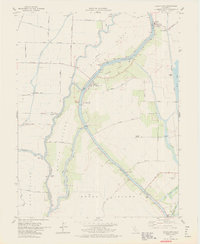 1978 Courtland1978 Print · USGSThe Sacramento River Delta is mapped here in the late seventies, showing a landscape defined by its complex sloughs and island agriculture. Genealogists and local historians can trace the riverside communities of Courtland, Locke, and Hood, along with landings like Steamboat Landing.3 unique versions available
 - 1993 Map of Lodi, 1994 Print
 1993 Lodi1994 Print · USGSNorthern California's delta country and the growing Central Valley corridors are captured here in the early nineties. Genealogists and historians can trace the intricate island tracts, old railroad lines like the Sacramento Northern RR, and established local landmarks including the Lodi Memorial Cemetery and University of the Pacific.2 unique versions available
 - 2012 Map of Courtland, 2012 Print
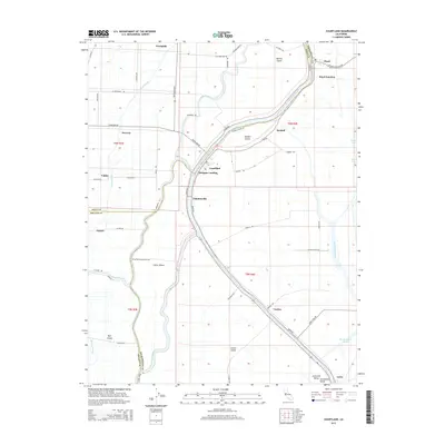
 2012 Courtland2012 Print · USGSCovers Valdez, including Oxford, Vorden, and other nearby areas
 - 2015 Map of Courtland, 2015 Print
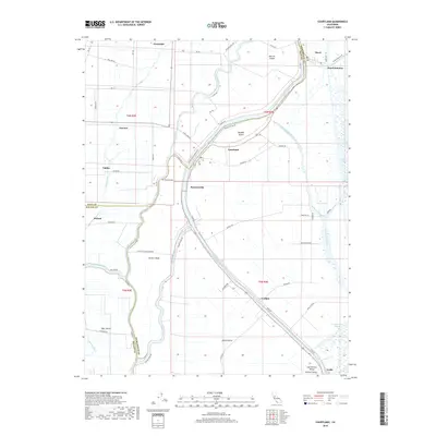
 2015 Courtland2015 Print · USGSCovers Valdez, including Oxford, Vorden, and other nearby areas
 - 2018 Map of Courtland, 2018 Print
 2018 Courtland2018 Print · USGSCovers Valdez, including Oxford, Vorden, and other nearby areas
 - 2022 Map of Courtland, 2022 Print
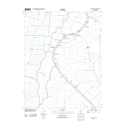
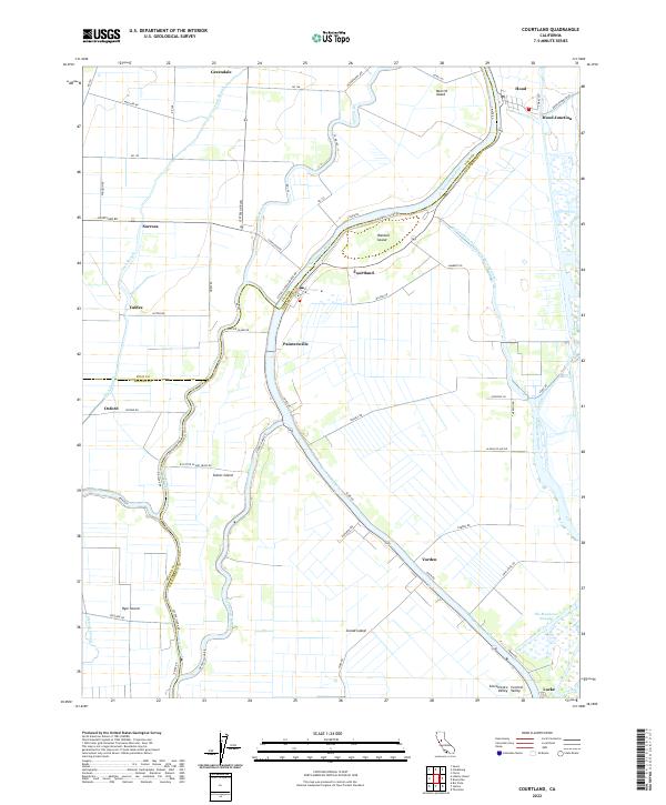 2022 Courtland2022 Print · USGSThe California Delta’s intricate river systems and island settlements are captured in this modern survey. Genealogists and historians can trace the riverside layouts of Courtland, the unique history of Locke, and the water-bound geography of Grand Island.
End of results
Showing maps 1-14 of 14
Top cities near Valdez
- Sacramento historical maps
- Davis historical maps
- Lodi historical maps
- West Sacramento historical maps
- Dixon historical maps
- Rio Vista historical maps
See more
Frequently asked questions
- What are the different types of historical maps available for Valdez?
- What is the oldest map of Valdez?
- Where can I purchase historical maps of Valdez for my home or office?
- Where can I download high-res historical maps of Valdez?
- Are there historical topographic maps available for Valdez?
- Is there historical aerial imagery available for Valdez?
- Where are historical maps of Valdez sourced from?