1950s Maps of Adams County, Colorado
Explore 50 historic maps of Adams County from the 1950s. These maps offer a rare glimpse into what life looked like during the 1950s — showing old roads, neighborhoods, homes, and landmarks that have changed or disappeared over time.
Whether you're researching your family's past, planning a metal detecting trip, or studying how Adams County's landscape evolved across the 1950s, these high-resolution maps are a powerful tool for exploring the history of this region.
- Focus on a specific era: All maps on this page are from the 1950s, giving you a focused view of this time period.
- See what’s changed: Compare century-old streets, trails, and buildings to today's modern landscape using overlays and satellite layers.
- Research with precision: Use these maps for genealogy, historical research, land use analysis, or educational projects.
- View, download, or print: Maps are fully viewable online in high resolution, and can be downloaded or printed for your own records.
Start exploring Adams County's history through authentic maps from the 1950s. This is your window into the past.
Adams County, CO maps
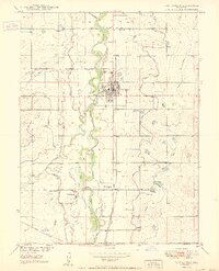
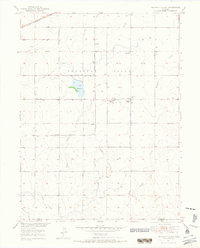
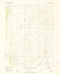
(50)- 1950 Map of Frederick
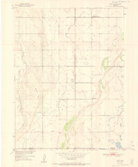
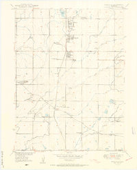 1950 Frederick1950 Print · USGSThe coal-rich corridor of Weld County is caught in a moment of industrial transition during the early 1950s. Genealogists and historians can trace the mining family hubs of Frederick, Firestone, and Dacono, alongside local schools like Mount View School and the Shamrock Mine.7 unique versions available
 - 1950 Map of Derby
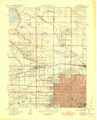
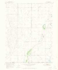
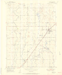
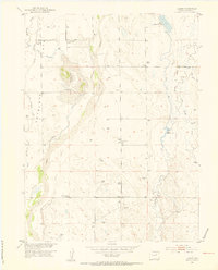
 1950 Derby1950 Print · USGSThe northern reaches of Denver and Adams County are captured here at mid-century as industry and rail lines shaped the river valley. Researchers can trace the early footprints of Adams City, the Stockyards, and family history at Riverside Cemetery or Rose Hill Cem.
 - 1950 Map of Englewood
 1950 Englewood1950 Print · USGSDenver and Englewood are seen during a period of rapid post-war expansion, blending urban civic centers with emerging suburban country clubs. Researchers can trace historic burial sites at Fairmount Cemetery or locate the settlement of Sullivan near the Highline Canal.
 - 1950 Map of Arvada
 1950 Arvada1950 Print · USGSMid-century Jefferson County comes to life as Denver’s western edge begins its suburban transformation from a landscape of irrigation ditches and small farms. Researchers can trace the original footprints of Arvada, Wheatridge, and local landmarks like the Crown Hill Cemetery and Regis College.
 - 1950 Map of Fort Lupton
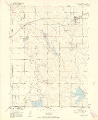
 1950 Fort Lupton1950 Print · USGSFort Lupton and the South Platte River valley are captured in detail during the post-war era, showing a landscape shaped by rail and irrigation. Genealogists can locate family landmarks like Hillside Cemetery, Porter Sch, and the small settlement of Wattenberg.2 unique versions available
 - 1950 Map of South Roggen, 1952 Print
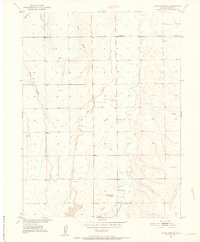
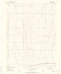
 1950 South Roggen1952 Print · USGSThis mid-century survey of the Colorado plains near the Weld-Adams county line documents a rural landscape transitioning into the modern era. Researchers can trace the path of the Henrylyn Canal and locate the Television Relay Station or the settlement at South Roggen.3 unique versions available
 - 1950 Map of Wiggins SW, 1952 Print
 1950 Wiggins SW1952 Print · USGSThe Colorado high plains of Weld and Morgan counties are captured here in the mid-century, defined by vital water infrastructure and rural school districts. Genealogists and historians can trace the locations of the Kiowa School and the path of the Gaynor Nile Ditch.2 unique versions available
 - 1950 Map of Keenesburg, 1958 Print
 1950 Keenesburg1958 Print · USGSThe high plains of Weld County come alive in this mid-century survey of the irrigation networks and rail lines that sustained the local economy. Researchers can trace family-named landmarks like Lott Reservoir, Banner Lakes, and the railroad siding at Keenesburg.5 unique versions available
 - 1950 Map of Prospect Valley, 1965 Print
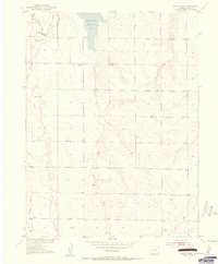
 1950 Prospect Valley1965 Print · USGSThe Colorado high plains of the early 1950s come into focus through this detailed view of the Prospect Valley irrigation and rail corridor. Genealogists and local historians can trace the early township layout through family landmarks like Krauss and Sloan, or locate the site of the Prospect Valley School.4 unique versions available
 - 1950 Map of Roper School, 1972 Print
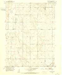
 1950 Roper School1972 Print · USGSAdams County ranching country is captured here during the early fifties, showing a landscape shaped by water rights and rural education. Genealogists and local researchers can locate the Roper School and trace the drainage of Kiowa Creek and Comanche Creek.3 unique versions available
 - 1950 Map of Hoyt, 1972 Print
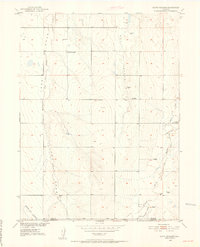
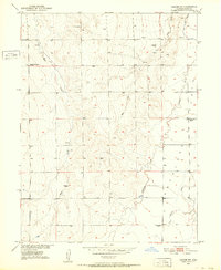
 1950 Hoyt1972 Print · USGSThe Colorado high plains on the Morgan and Adams county line are captured here at mid-century, defined by scattered ranching outposts and new federal infrastructure. Genealogists and researchers can locate the Hoyt Cemetery, the settlement of Hoyt, and the Long Meadow Community Center.4 unique versions available
 - 1951 Map of Keenesburg
 1951 Keenesburg1951 Print · USGSSurrounding Keenesburg in the early fifties, this survey captures the critical irrigation network of the High Plains. Trace the development of local agriculture along the Chicago Burlington and Quincy rail line and Horse Creek Reservoir.2 unique versions available
 - 1951 Map of Prospect Valley
 1951 Prospect Valley1951 Print · USGSWeld County agriculture and irrigation systems are in full view in the early fifties. Genealogists and local researchers can locate family-named sites like Krauss and Johnson or trace water rights via the Henrylyn Canal and Lord Reservoir.2 unique versions available
 - 1951 Map of Hoyt
 1951 Hoyt1951 Print · USGSThe Morgan and Adams County border area is captured here in the early fifties, showing a rural landscape at the intersection of prairie life and federal utility growth. Researchers can locate the Hoyt Cemetery, the Long Meadow Community Center, and the specialized USGS Testing and Recording Station.2 unique versions available
 - 1951 Map of Roper School
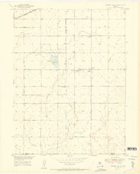
 1951 Roper School1951 Print · USGSThe eastern Colorado plains come into focus in the early fifties, showing a rural landscape defined by water and wind. Researchers can trace the drainage of Kiowa Creek and locate local landmarks like Roper School and various Windmill sites.
 - 1951 Map of Hudson
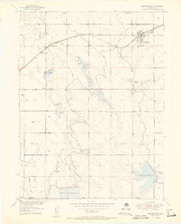
 1951 Hudson1951 Print · USGSAgricultural growth and rail transport define Hudson and Tonville in the early fifties. Genealogists and historians can trace local landmarks like Mountain View Cem, Henry Lake Reservoir, and the Burlington Ditch.2 unique versions available
 - 1951 Map of Living Springs, 1952 Print
 1951 Living Springs1952 Print · USGSEastern Adams County ranching lands are captured in the early fifties before the expansion of suburban Denver. Researchers can trace the Henrylyn Canal (Abandoned) and locate landmarks like Living Springs Ranch and the CAA Beacon.4 unique versions available
 - 1951 Map of Leader NW, 1952 Print
 1951 Leader NW1952 Print · USGSAdams County in the early fifties was a landscape of remote schoolhouses and winding creek beds during the Missouri River Basin development. Genealogists can locate rural landmarks like Valley Center School, the small Cem, and the site of Coal Mines.2 unique versions available
 - 1951 Map of Leader SE, 1953 Print
 1951 Leader SE1953 Print · USGSThe high plains of Adams County are captured here in the early fifties, a time when family ranching relied on scattered water sources. Researchers can locate the Woolsey Cem, trace the drainage of Muddy Creek, and find the Busy Bee School (Aband).5 unique versions available
 - 1951 Map of Manila, 1953 Print
 1951 Manila1953 Print · USGSThe Colorado high plains of the early 1950s are captured here as a landscape of remote ranching and early aviation. Researchers can trace the path of the UNION PACIFIC through Manila or locate the site of the old CAA Beam Transmitter.2 unique versions available
 - 1951 Map of Leader, 1953 Print
 1951 Leader1953 Print · USGSEastern Adams County was a landscape of remote prairie schools and ambitious irrigation projects during the early 1950s. Genealogists can trace family footprints near Leader through landmarks like Plainview Sch, Leader Community Hall, and the Moore School.5 unique versions available
 - 1952 Map of Horse Creek, 1953 Print
 1952 Horse Creek1953 Print · USGSAdams County ranching and water management define this mid-century prairie landscape just as the Missouri River Basin development was taking shape. Researchers can trace rural life through the locations of the Whittier School, Horse Creek Reservoir, and numerous Windmill sites.5 unique versions available
 - 1952 Map of Leader SW, 1953 Print
 1952 Leader SW1953 Print · USGSAdams County ranching and water management are frozen in time during the early fifties as part of the Missouri River Basin development. Researchers can trace family ranch lands such as Munson Ranch and locate the former sites of Hopewell School (Aban'd) and the Opportunity School (Aban'd).4 unique versions available
 - 1953 Map of Denver, 1964 Print
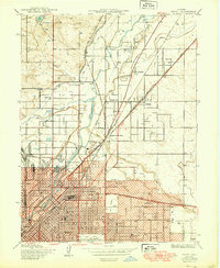
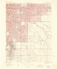
 1953 Denver1964 Print · USGSDenver and the Colorado Front Range are captured here during a decade of post-war growth and military expansion. Researchers can trace the sprawling rail lines of the Union Pacific, locate the State Capitol, and explore historic mountain mining hubs like Central City.6 unique versions available
 - 1954 Map of Limon
 1954 Limon1954 Print · USGSThe Eastern Colorado plains and the Kansas borderlands come alive in the mid-fifties, showing the vital rail-and-road corridor through Limon. Genealogists and historians can trace the Chicago Rock Island & Pacific line through Burlington and find remote outposts like Arickaree and Anton.4 unique versions available
Showing maps 1-25 of 50
Top cities of Adams County
- Thornton historical maps
- Commerce City historical maps
- Northglenn historical maps
- Brighton historical maps
- Sherrelwood historical maps
- Welby historical maps
See more
Frequently asked questions
- What are the different types of historical maps available for Adams County?
- What is the oldest map of Adams County?
- Where can I purchase historical maps of Adams County for my home or office?
- Where can I download high-res historical maps of Adams County?
- Are there historical topographic maps available for Adams County?
- Is there historical aerial imagery available for Adams County?
- Where are historical maps of Adams County sourced from?