
1951 Map of Living Springs
USGS Topo · Published 1952About this map
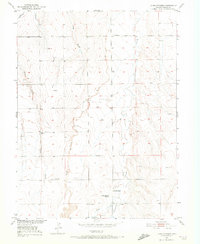
Living Springs Ranch and the nearby Living Springs settlement serve as the primary landmarks in this 1951 study of the Colorado plains. Located within the Missouri River Basin development area, the landscape is defined by its drainage network, where Kiowa Creek and Comanche Creek carve paths through the rolling terrain. The presence of the Henrylyn Canal (Abandoned) in the northwest corner suggests early twentieth-century attempts at large-scale irrigation that had already fallen into disuse by mid-century.
Find a feature on this map
15 named features on this map. Tap any name to fly to it.
Don’t see what you’re looking for? This feature index may not catch every label — zoom into the map to look around manually.
Map Details
Editions of this 1951 Living Springs Map
4 editions found
Other maps of this area

1949 · Sunnydale
USGS Topo · 1:24,000

1949 · Bennett
USGS Topo · 1:24,000

1950 · South Roggen
USGS Topo · 1:24,000

1950 · Wiggins SW
USGS Topo · 1:24,000

1950 · Prospect Valley
USGS Topo · 1:24,000

1950 · Roper School
USGS Topo · 1:24,000

1951 · Prospect Valley
USGS Topo · 1:24,000

1951 · Roper School
USGS Topo · 1:24,000

1951 · Leader NW
USGS Topo · 1:24,000

1952 · Leader SW
USGS Topo · 1:24,000