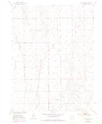
1951 Map of Living Springs
USGS Topo · Published 1986About this map
Kiowa Creek and Comanche Creek define the drainage of this Adams County landscape, where the high plains terrain is marked by the remnants of early twentieth-century water management and ranching. The presence of the Henrylyn Canal (Abandoned) in the northwest corner signifies the complex history of irrigation efforts in this semi-arid region, while the Living Springs Ranch serves as a central point of settlement. Navigation and infrastructure are represented by a CAA Beacon near Wolf Creek and a long Pipeline traversing the central sections. Numerous windmills dot the map, indicating a heavy reliance on groundwater for livestock across the rolling sections. The inclusion of a Silo and various wells near Sand Creek further illustrates the agricultural character of this area during the early 1950s.
Find a feature on this map
16 named features on this map. Tap any name to fly to it.
Don’t see what you’re looking for? This feature index may not catch every label — zoom into the map to look around manually.
Map Details
Editions of this 1951 Living Springs Map
4 editions found
Other maps of this area

1949 · Sunnydale
USGS Topo · 1:24,000

1949 · Bennett
USGS Topo · 1:24,000

1950 · South Roggen
USGS Topo · 1:24,000

1950 · Wiggins SW
USGS Topo · 1:24,000

1950 · Prospect Valley
USGS Topo · 1:24,000

1950 · Roper School
USGS Topo · 1:24,000

1951 · Prospect Valley
USGS Topo · 1:24,000

1951 · Roper School
USGS Topo · 1:24,000

1951 · Living Springs
USGS Topo · 1:24,000

1951 · Leader NW
USGS Topo · 1:24,000