
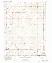
1950 Map of Wiggins SW
USGS Topo · Published 1952About this map
Kiowa School stands as a central community landmark in this high plains landscape at the intersection of Weld, Morgan, and Adams counties. Surveyed in 1950, the area is defined by the intermittent drainage patterns of Kiowa Creek and Jack Rabbit Creek, which cut through the undulating terrain near Alkire. The scarcity of permanent surface water is evident in the dense distribution of groundwater infrastructure, with numerous numbered wells and landmarks like Windmill 4736 and Windmill 4819 serving the local agricultural needs.
Find a feature on this map
25 named features on this map. Tap any name to fly to it.
Don’t see what you’re looking for? This feature index may not catch every label — zoom into the map to look around manually.
Map Details
Editions of this 1950 Wiggins SW Map
2 editions found
Other maps of this area

1950 · Wiggins
USGS Topo · 1:24,000

1950 · South Roggen
USGS Topo · 1:24,000

1950 · Hoyt
USGS Topo · 1:24,000

1951 · Hoyt
USGS Topo · 1:24,000

1951 · Living Springs
USGS Topo · 1:24,000

1951 · Roggen
USGS Topo · 1:24,000

1951 · Leader NW
USGS Topo · 1:24,000

1951 · Omar
USGS Topo · 1:24,000

1951 · Leader
USGS Topo · 1:24,000

1953 · Denver
USGS Topo · 1:250,000