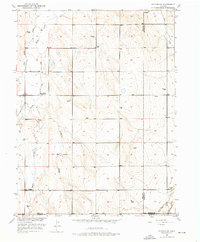
1950 Map of Wiggins SW
USGS Topo · Published 1976About this map
Kiowa School stands as a central point of reference in this high-plains landscape, where the confluence of several seasonal waterways dictates the local geography. The drainage patterns of Kiowa Creek, Goose Creek, and Mule Creek carve subtle paths across the terrain, reflecting the arid environment of eastern Colorado during the mid-century. Significant surveying markers such as the Base Line and the county boundaries for Weld, Adams, and Morgan counties intersect here, defining the administrative grid of the region. A notable vestige of early water management is the Nile Ditch (Aband), appearing as an abandoned irrigation feature that hints at past attempts to divert the erratic flow of Rock Creek for agricultural use.
Find a feature on this map
12 named features on this map. Tap any name to fly to it.
Don’t see what you’re looking for? This feature index may not catch every label — zoom into the map to look around manually.
Map Details
Editions of this 1950 Wiggins SW Map
2 editions found
Other maps of this area

1950 · Wiggins
USGS Topo · 1:24,000

1950 · South Roggen
USGS Topo · 1:24,000

1950 · Wiggins SW
USGS Topo · 1:24,000

1950 · Hoyt
USGS Topo · 1:24,000

1951 · Hoyt
USGS Topo · 1:24,000

1951 · Living Springs
USGS Topo · 1:24,000

1951 · Roggen
USGS Topo · 1:24,000

1951 · Leader NW
USGS Topo · 1:24,000

1951 · Omar
USGS Topo · 1:24,000

1951 · Leader
USGS Topo · 1:24,000