1970s Maps of Adams County, Colorado
Explore 10 historic maps of Adams County from the 1970s. These maps offer a rare glimpse into what life looked like during the 1970s — showing old roads, neighborhoods, homes, and landmarks that have changed or disappeared over time.
Whether you're researching your family's past, planning a metal detecting trip, or studying how Adams County's landscape evolved across the 1970s, these high-resolution maps are a powerful tool for exploring the history of this region.
- Focus on a specific era: All maps on this page are from the 1970s, giving you a focused view of this time period.
- See what’s changed: Compare century-old streets, trails, and buildings to today's modern landscape using overlays and satellite layers.
- Research with precision: Use these maps for genealogy, historical research, land use analysis, or educational projects.
- View, download, or print: Maps are fully viewable online in high resolution, and can be downloaded or printed for your own records.
Start exploring Adams County's history through authentic maps from the 1970s. This is your window into the past.
Adams County, CO maps
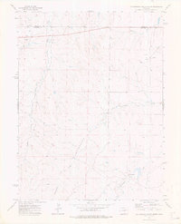
(10)- 1971 Map of Hudson, 1972 Print
 1971 Hudson1972 Print · USGSThe agricultural plains of Weld County come into focus during the early seventies, showing a landscape shaped by irrigation and rail. Researchers can trace the Burlington Northern line through Hudson and Tonville, or locate Mountain View Cem near the area's many reservoirs.
 - 1972 Map of Long Branch
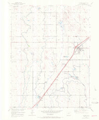
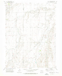
 1972 Long Branch1972 Print · USGSThe High Plains east of Denver show a mix of early suburban growth and sprawling military infrastructure in the years following the war. Researchers can trace the layout of the Fitzsimons General Hospital and find long-standing rural landmarks like Rose Hill Sch and the Irondale settlement.
 - 1973 Map of Potty Brown Creek, 1976 Print
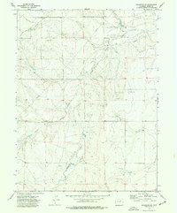
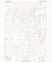 1973 Potty Brown Creek1976 Print · USGSAdams County ranching and early energy development are captured in the early seventies, showing a landscape defined by seasonal watercourses. Genealogists and researchers can trace land features near Potty Brown Creek, Hoffman Creek, and scattered early Oil Wells.
 - 1973 Map of Shamrock, 1976 Print
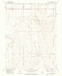
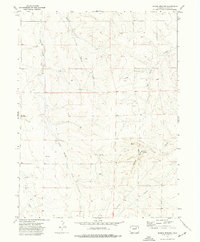
 1973 Shamrock1976 Print · USGSAdams County ranching country meets the mid-century energy boom in this early 1970s study of the eastern plains. Genealogists and historians can locate the Shamrock settlement and trace local water and energy infrastructure through Simpsons Reservoir, the regional Pipeline, and various Oil Wells.
 - 1973 Map of Last Chance NW, 1976 Print
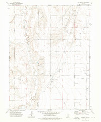
 1973 Last Chance NW1976 Print · USGSThe High Plains of Eastern Colorado are captured here in the early 1970s as agricultural life centered on the tri-county border. Genealogists and researchers can trace local landmarks like Prairie Farms, the Landing Strip, and the winding Beaver Creek.
 - 1973 Map of Woodrow NW, 1976 Print
 1973 Woodrow NW1976 Print · USGSThe rural border of Washington and Adams Counties is shown here in the 1970s as an active center of energy production. Researchers can trace the layout of the local Oil Field, identifying Oil Wells and the Arapahoe Pumping Sta along Badger Creek.
 - 1973 Map of Cottonwood Valley North, 1976 Print
 1973 Cottonwood Valley North1976 Print · USGSThe high plains at the Adams and Arapahoe county line are captured here in the early seventies, showing a landscape of ranching and energy. Genealogists and historians can locate the Arrow K Ranch and trace the paths of Badger Creek and Rattlesnake Creek.
 - 1973 Map of Wetzel Creek, 1976 Print
 1973 Wetzel Creek1976 Print · USGSThe High Plains along the Adams and Washington County line are shown here in the early seventies during a period of active energy development. Researchers can trace the extensive Big Beaver Oil Field, locate Swan Cem, and follow the paths of Wetzel Creek and various pipelines.
 - 1973 Map of Shamrock SE, 1977 Print
 1973 Shamrock SE1977 Print · USGSIn the early 1970s, the plains of eastern Adams County were defined by active resource extraction and a network of dryland creeks. Genealogists and historians can trace the paths of Badger Creek and Poison Springs Creek alongside industrial markers like Oil Wells and a prominent Aqueduct.
 - 1973 Map of Poison Springs, 1977 Print
 1973 Poison Springs1977 Print · USGSAdams County’s high plains terrain is shown here in the early seventies, dominated by drainage networks and energy exploration. Researchers can trace the paths of Poison Springs Creek and Sun Arroyo alongside industrial features like Oil Wells and Gravel Pits.
End of results
Showing maps 1-10 of 10
Top cities of Adams County
- Thornton historical maps
- Commerce City historical maps
- Northglenn historical maps
- Brighton historical maps
- Sherrelwood historical maps
- Welby historical maps
See more
Frequently asked questions
- What are the different types of historical maps available for Adams County?
- What is the oldest map of Adams County?
- Where can I purchase historical maps of Adams County for my home or office?
- Where can I download high-res historical maps of Adams County?
- Are there historical topographic maps available for Adams County?
- Is there historical aerial imagery available for Adams County?
- Where are historical maps of Adams County sourced from?