2020s Maps of Pagosa Springs, Colorado
Explore 3 historic maps of Pagosa Springs from the 2020s. These maps offer a rare glimpse into what life looked like during the 2020s — showing old roads, neighborhoods, homes, and landmarks that have changed or disappeared over time.
Whether you're researching your family's past, planning a metal detecting trip, or studying how Pagosa Springs's landscape evolved across the 2020s, these high-resolution maps are a powerful tool for exploring the history of this region.
- Focus on a specific era: All maps on this page are from the 2020s, giving you a focused view of this time period.
- See what’s changed: Compare century-old streets, trails, and buildings to today's modern landscape using overlays and satellite layers.
- Research with precision: Use these maps for genealogy, historical research, land use analysis, or educational projects.
- View, download, or print: Maps are fully viewable online in high resolution, and can be downloaded or printed for your own records.
Start exploring Pagosa Springs's history through authentic maps from the 2020s. This is your window into the past.
Pagosa Springs, CO maps
(3)- 2022 Map of Jackson Mountain, 2022 Print
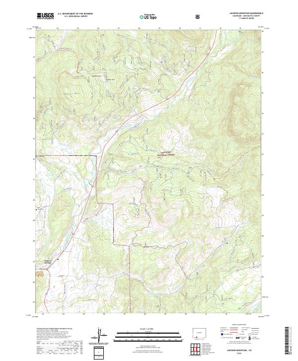 2022 Jackson Mountain2022 Print · USGSModern Archuleta County comes to life in this detailed view of the high-country landscape surrounding Pagosa Springs. Researchers can trace irrigation history through Park Ditch or locate family history at the Eoff Ranch Cem and Rito Blanco Ranch.
 - 2023 Map of Oakbrush Hill, 2023 Print
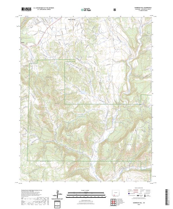 2023 Oakbrush Hill2023 Print · USGSThe foothills of the San Juan Mountains come alive in this recent survey of Archuleta County, where the high desert meets the forest. Genealogists and researchers can trace the roads around Pagosa Springs and Nutria or explore the drainage basins of the San Juan River and Rio Blanco.
 - 2023 Map of Pagosa Springs, 2023 Print
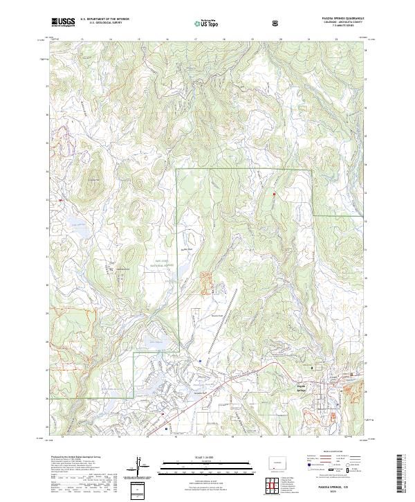 2023 Pagosa Springs2023 Print · USGSPagosa Springs and the San Juan River valley are presented here in the early twenty-first century as a growing mountain community. Genealogists and hikers can trace the Archuleta County Courthouse, Hilltop Cem, and trails through Dutton Park.
End of results
Showing maps 1-3 of 3
Frequently asked questions
- What are the different types of historical maps available for Pagosa Springs?
- What is the oldest map of Pagosa Springs?
- Where can I purchase historical maps of Pagosa Springs for my home or office?
- Where can I download high-res historical maps of Pagosa Springs?
- Are there historical topographic maps available for Pagosa Springs?
- Is there historical aerial imagery available for Pagosa Springs?
- Where are historical maps of Pagosa Springs sourced from?