2020s Maps of Boulder County, Colorado
Explore 24 historic maps of Boulder County from the 2020s. These maps offer a rare glimpse into what life looked like during the 2020s — showing old roads, neighborhoods, homes, and landmarks that have changed or disappeared over time.
Whether you're researching your family's past, planning a metal detecting trip, or studying how Boulder County's landscape evolved across the 2020s, these high-resolution maps are a powerful tool for exploring the history of this region.
- Focus on a specific era: All maps on this page are from the 2020s, giving you a focused view of this time period.
- See what’s changed: Compare century-old streets, trails, and buildings to today's modern landscape using overlays and satellite layers.
- Research with precision: Use these maps for genealogy, historical research, land use analysis, or educational projects.
- View, download, or print: Maps are fully viewable online in high resolution, and can be downloaded or printed for your own records.
Start exploring Boulder County's history through authentic maps from the 2020s. This is your window into the past.
Boulder County, CO maps
(24)- 2022 Map of Carter Lake Reservoir, 2022 Print
 2022 Carter Lake Reservoir2022 Print · USGSThe area between Loveland and Berthoud comes into focus in this recent survey, showcasing a complex water-management landscape. Researchers can trace irrigation networks like the Saint Vrain Supply Canal and locate rural landmarks such as Flatiron Mtn and the Lazy W Airport.
 - 2022 Map of Niwot, 2022 Print
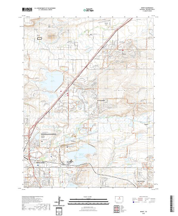 2022 Niwot2022 Print · USGSBoulder County in the early 2020s shows a complex web of modern industry and historic water rights. Researchers can trace the lineage of the plains through sites like Niwot Cem, Valmont Butte, and the massive IBM Plant.
 - 2022 Map of Longmont, 2022 Print
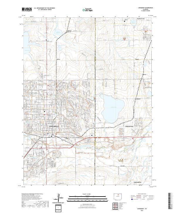 2022 Longmont2022 Print · USGSLongmont and the surrounding plains are shown during a period of significant growth, where traditional irrigation networks meet expanding suburban borders. Trace family history at Mountain View Cem or follow the historic Great Western RR and Oligarchy Ditch.
 - 2022 Map of Isolation Peak, 2022 Print
 2022 Isolation Peak2022 Print · USGSThe high crest of the Rockies in the 2020s remains a wilderness of granite peaks and glacial lakes. Hikers and historians can trace the high-altitude routes of the Buchanan Pass Trl and Timberline Trl near Isolation Peak and Thunder Lake.
 - 2022 Map of Hygiene, 2022 Print
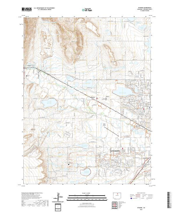 2022 Hygiene2022 Print · USGSThe area surrounding Hygiene and western Longmont is shown here in the 2020s, revealing a landscape defined by historic irrigation and early Swedish settlement. Researchers can trace local heritage through landmarks like Ryssby Church Cem and the complex network of the Oligarchy Ditch.
 - 2022 Map of Louisville, 2022 Print
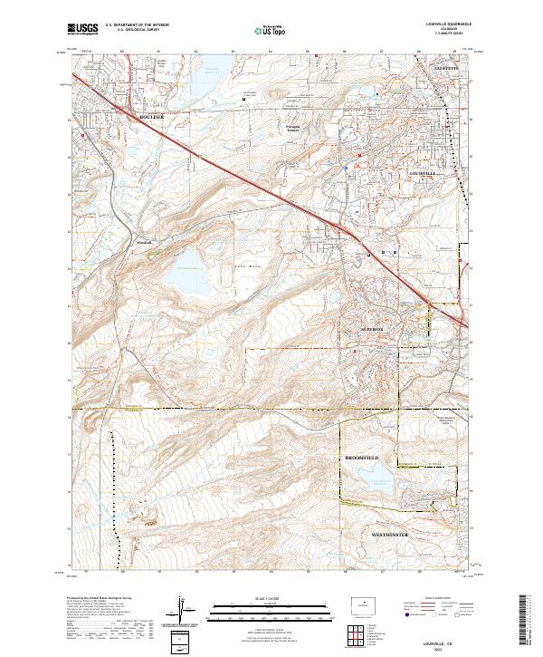 2022 Louisville2022 Print · USGSThe suburbs of Boulder and Louisville meet the industrial Front Range at the start of the 2020s. Researchers can trace the extensive canal networks like the Goodhue Ditch and find local landmarks such as Marshall and the Sacred Heart of Mary Cem.
 - 2022 Map of Eldorado Springs, 2022 Print
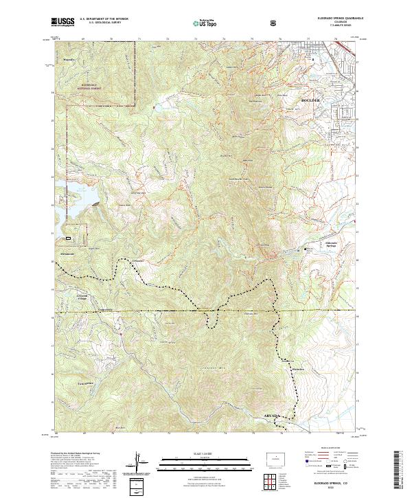 2022 Eldorado Springs2022 Print · USGSThe Front Range foothills in the modern era reveal a landscape where early mountain settlements meet suburban growth. Genealogists and hikers can trace family sites near Eldorado Springs Cemetery or follow the Union Pacific RR past Copperdale and Magnolia.
 - 2022 Map of Nederland, 2022 Print
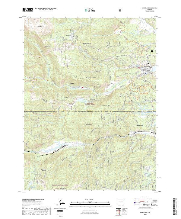 2022 Nederland2022 Print · USGSHigh in the Front Range during the early twenty-first century, this area reveals the enduring legacy of mining and the development of mountain towns. Researchers can trace historic routes like Moffat Road and locate sites from Nederland Cemetery to the Anchor Mine.
 - 2022 Map of East Portal, 2022 Print
 2022 East Portal2022 Print · USGSThe Continental Divide crossing at Rollins Pass is captured here in the early twenty-first century. Rail historians and hikers can trace the original route of the Moffat Road and the Moffat Tunnel near East Portal and Riflesight Notch.
 - 2022 Map of Tungsten, 2022 Print
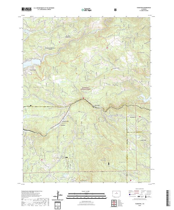 2022 Tungsten2022 Print · USGSThe Front Range high country around Nederland comes alive in this contemporary topographical study. Genealogists and hikers can trace property lines and access routes near Pinecliffe, Wondervu, and the historic recreational area of Lincoln Hills.
 - 2022 Map of Lafayette, 2022 Print
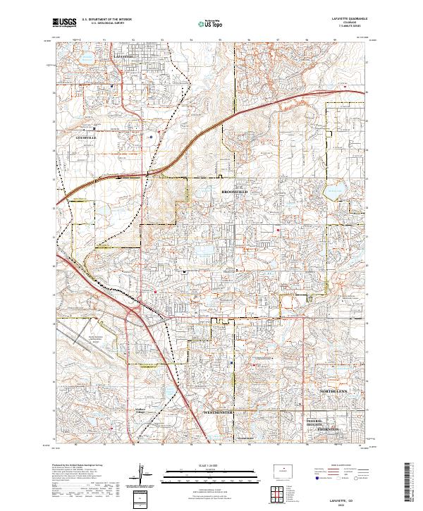 2022 Lafayette2022 Print · USGSModern suburban development meets early water management in the 2020s north of Denver. Researchers can trace the layout of Wallace Village and find local landmarks like Louisville Cem and the Broomfield County Courthouse.
 - 2022 Map of Pinewood Lake, 2022 Print
 2022 Pinewood Lake2022 Print · USGSNorthern Colorado mountain life is captured here in the early twenty-first century, showing the interface between wilderness and settlement. Trace local history through Pinewood Springs, Noland, and the water engineering of the Pole Hill Tunnel.
 - 2022 Map of Ward, 2022 Print
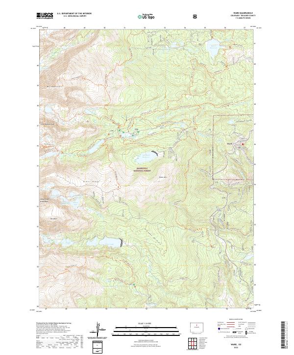 2022 Ward2022 Print · USGSThe high mountain town of Ward and the surrounding peaks are captured here in 2022. Researchers can trace the path of the historic Switzerland Trail and locate remote water bodies like Silver Lake and Brainard Lake.
 - 2022 Map of Boulder, 2022 Print
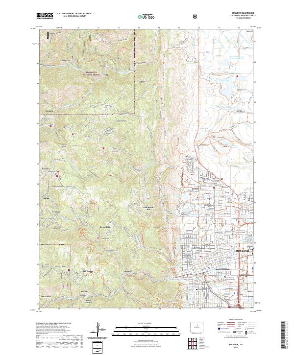 2022 Boulder2022 Print · USGSBoulder and its western foothills are shown here as the city expanded toward the mountain canyons. Researchers can trace historic settlements like Crisman and Salina or locate the Sunshine Cem tucked into the gulches above the city.
 - 2022 Map of Allenspark, 2022 Print
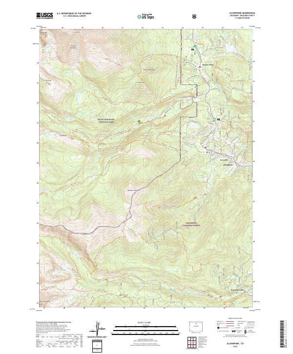 2022 Allenspark2022 Print · USGSThe eastern edge of the Front Range comes alive in this 2022 survey of Boulder County mountain communities and wilderness boundaries. Genealogists and hikers can trace the historical Bunce School or map the trail networks around Allenspark and the high Mt Meeker peaks.
 - 2022 Map of Raymond, 2022 Print
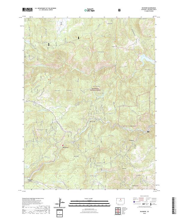 2022 Raymond2022 Print · USGSBoulder County's high-country settlements and forest reaches are detailed here in the 2020s. Genealogists and historians can trace the roads connecting Raymond, Peaceful Valley, and the Emmit Mine, along with landmarks like The Ironclads and Minnie Lake.
 - 2022 Map of Gold Hill, 2022 Print
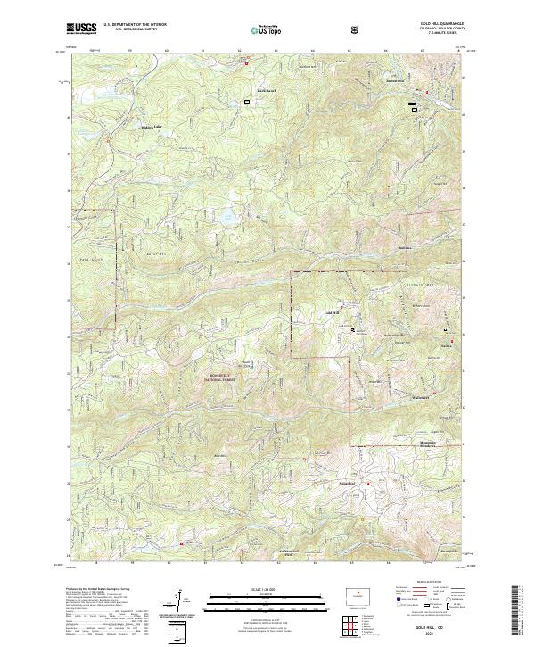 2022 Gold Hill2022 Print · USGSThe Colorado Front Range mountains come alive in this 2022 survey, showcasing the enduring settlement patterns of a famous mining district. Genealogists and historians can trace family ties at Gold Hill Cemetery or explore old foothill communities like Summerville and Wallstreet.
 - 2022 Map of Berthoud, 2022 Print
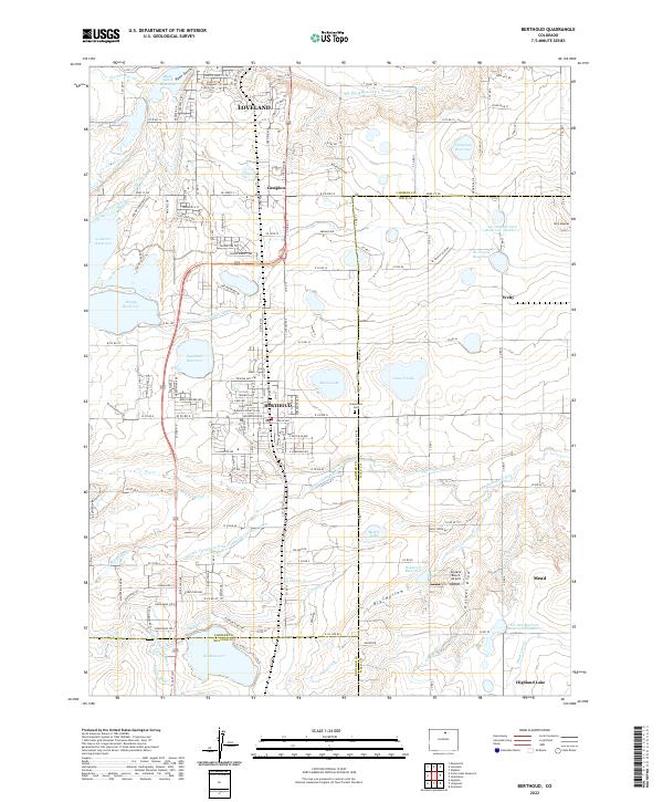 2022 Berthoud2022 Print · USGSBerthoud and the surrounding plains of Larimer and Weld Counties appear here during a period of steady growth and sophisticated water management. Researchers can trace historical property lines and local landmarks like Greenlawn Cem, Skylane Ranch Airport, and the Little Thompson River.
 - 2022 Map of McHenrys Peak, 2022 Print
 2022 McHenrys Peak2022 Print · USGSRocky Mountain National Park is seen here in the early twenty-first century, centered on the high ridges of the Continental Divide. Hikers and historians can trace the paths of the Alva B Adams Tunnel, the Eureka Ditch, and the historic Ute Trail East Trl.
 - 2022 Map of Lyons, 2022 Print
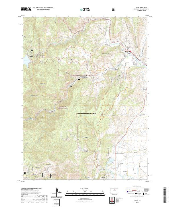 2022 Lyons2022 Print · USGSThe foothills of Boulder County come alive in this survey of the Lyons area and the North and South Saint Vrain Creeks. Local historians can trace the irrigation network of the Table Mountain Ditch, find the Lyons Cem, and locate the Golden Age mine site.
 - 2022 Map of Monarch Lake, 2022 Print
 2022 Monarch Lake2022 Print · USGSThe high crest of the Indian Peaks is captured here in the early twenty-first century, showing the rugged divide between Grand and Boulder counties. Hikers and historians can trace high-altitude routes like the Arapaho Pass Trl and Pawnee Pass Trl past landmarks like Monarch Lake.
 - 2022 Map of Longs Peak, 2022 Print
 2022 Longs Peak2022 Print · USGSThe Front Range town of ESTES PARK serves as the starting point for this survey of the high peaks and moraines of Rocky Mountain National Park. Researchers can trace early family history at the Cleave - Griffith Cem or locate the historic Eugenia Mine Trl.
 - 2022 Map of Panorama Peak, 2022 Print
 2022 Panorama Peak2022 Print · USGSEstes Park and the neighboring mountain peaks were undergoing modern development in 2022 while preserving their frontier ranching roots. Researchers can trace historic sites like the Irvin Homestead Trl, Big Elk Meadows, and Pierson Park.
 - 2022 Map of Erie, 2022 Print
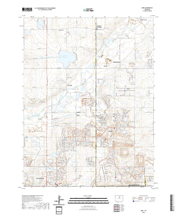 2022 Erie2022 Print · USGSErie and its neighboring towns of Frederick and Lafayette are shown here during the modern era of expansion. Researchers can trace irrigation networks like Lower Boulder Ditch and find local landmarks such as Lafayette Cem and Canfield.
End of results
Showing maps 1-24 of 24
Top cities of Boulder County
- Boulder historical maps
- Longmont historical maps
- Lafayette historical maps
- Louisville historical maps
- Lyons historical maps
- Nederland historical maps
See more
Frequently asked questions
- What are the different types of historical maps available for Boulder County?
- What is the oldest map of Boulder County?
- Where can I purchase historical maps of Boulder County for my home or office?
- Where can I download high-res historical maps of Boulder County?
- Are there historical topographic maps available for Boulder County?
- Is there historical aerial imagery available for Boulder County?
- Where are historical maps of Boulder County sourced from?