1950s Maps of Boulder County, Colorado
Explore 28 historic maps of Boulder County from the 1950s. These maps offer a rare glimpse into what life looked like during the 1950s — showing old roads, neighborhoods, homes, and landmarks that have changed or disappeared over time.
Whether you're researching your family's past, planning a metal detecting trip, or studying how Boulder County's landscape evolved across the 1950s, these high-resolution maps are a powerful tool for exploring the history of this region.
- Focus on a specific era: All maps on this page are from the 1950s, giving you a focused view of this time period.
- See what’s changed: Compare century-old streets, trails, and buildings to today's modern landscape using overlays and satellite layers.
- Research with precision: Use these maps for genealogy, historical research, land use analysis, or educational projects.
- View, download, or print: Maps are fully viewable online in high resolution, and can be downloaded or printed for your own records.
Start exploring Boulder County's history through authentic maps from the 1950s. This is your window into the past.
Boulder County, CO maps
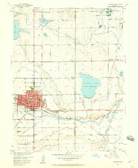
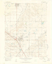
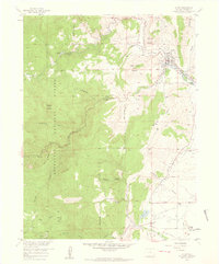
(28)- 1950 Map of Hygiene, 1952 Print
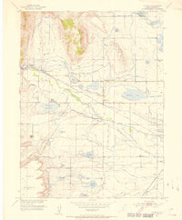 1950 Hygiene1952 Print · USGSThe Boulder County plains meet the foothills in the mid-twentieth century, revealing a landscape shaped by intricate irrigation and early ranching. Genealogists can trace family footprints at the Ryssby Ch, the settlement of Altona, and several rural schoolhouses like Montgomery School.5 unique versions available
 - 1950 Map of Louisville, 1955 Print
 1950 Louisville1955 Print · USGSThe Boulder Valley coal fields and irrigation networks are on full display in the mid-twentieth century. Researchers can trace dozens of mining sites like the Eldorado Mine, find the Superior Cemetery, and locate rural schools including Marshall Sch.
 - 1950 Map of Erie, 1956 Print
 1950 Erie1956 Print · USGSIn the mid-century landscape of the Colorado plains, coal mining and irrigation dictate the growth of towns and transport. Genealogists can trace family roots through markers like the Columbine Mine, Gooding School, and Erie Cem.
 - 1950 Map of Niwot, 1957 Print
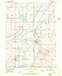
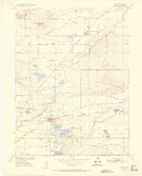
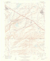
 1950 Niwot1957 Print · USGSThe Boulder Valley in the early fifties is captured here as a landscape of irrigation ditches, rural schoolhouses, and heavy industry. Genealogists can locate family landmarks like the Niwot Cemetery, the Batchelder School, and the industrial Fluorspar Mill near Valmont.4 unique versions available
 - 1950 Map of Longmont, 1960 Print
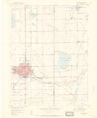
 1950 Longmont1960 Print · USGSLongmont and the surrounding plains of Boulder and Weld Counties appear here at the mid-century, defined by a massive network of irrigation ditches and vital rail lines. Genealogists can trace family roots through several local burial grounds like Mountain View Cemetery or locate rural landmarks such as Dixons Mills and Liberty Hall Grange.2 unique versions available
 - 1951 Map of Niwot
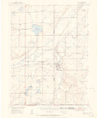
 1951 Niwot1951 Print · USGSBoulder County in the early fifties reveals a landscape shaped by irrigation ditches and the early industrial hub of Valmont. Genealogists and historians can trace family roots through numerous rural school sites like Niwot School and historic burial grounds including Valmont Cemetery.
 - 1951 Map of Erie
 1951 Erie1951 Print · USGSThe mining and agricultural corridor of Weld and Boulder counties is captured here in the early 1950s. Researchers can trace dozens of individual operations like the Morrison Mine and Erie Mine, or locate family sites near the Gooding School and Erie Cemetery.
 - 1951 Map of Longmont
 1951 Longmont1951 Print · USGSThe agricultural plains of Boulder and Weld Counties are captured here in the early fifties as the town of Longmont expanded. Researchers can trace rural landmarks like the Liberty Hall Grange, Dixons Mills, and several family cemeteries and schools.
 - 1953 Map of Denver, 1964 Print
 1953 Denver1964 Print · USGSDenver and the Colorado Front Range are captured here during a decade of post-war growth and military expansion. Researchers can trace the sprawling rail lines of the Union Pacific, locate the State Capitol, and explore historic mountain mining hubs like Central City.6 unique versions available
 - 1954 Map of Greeley, 1966 Print
 1954 Greeley1966 Print · USGSNorthern Colorado transitions from high-alpine peaks to the irrigated South Platte valley during this mid-century period of growth. Genealogists and historians can trace rail-connected hubs like Greeley and Longmont alongside landmarks like Horsetooth Reservoir and Estes Park.3 unique versions available
 - 1956 Map of Lafayette, 1958 Print
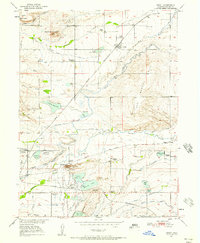
 1956 Lafayette1958 Print · USGSBoulder County experiences a post-war transition in the mid-fifties as the new turnpike and traditional mining industries coexist. Researchers can trace early suburban expansion in Broomfield Heights while locating the Centennial Mine and local landmarks like Ruston Heights Airport.
 - 1957 Map of Denver
 1957 Denver1957 Print · USGSDenver and the Colorado Front Range are seen here during a mid-century period of intense military and urban expansion. Trace the footprints of the Rocky Mountain Arsenal, the early United States Air Force Academy, and the Lowry AF Base.
 - 1957 Map of Greeley
 1957 Greeley1957 Print · USGSNorthern Colorado in the mid-fifties is captured here as the agricultural plains of Weld County meet the high peaks of the Front Range. Genealogists and historians can trace rail-linked towns like Keenesburg and Roggen or locate early water features such as Boyd Lake and Fossil Creek Reservoir.
 - 1957 Map of Louisville, 1958 Print
 1957 Louisville1958 Print · USGSThe northern Colorado coalfields and rural landscapes are captured here during a period of industrial transition. Researchers can trace numerous historic coal operations like the Cracker Jack Mine and Industrial Mine, alongside the early Denver Boulder Turnpike.2 unique versions available
 - 1957 Map of Mc Henrys Peak, 1959 Print
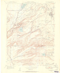
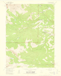
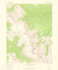 1957 Mc Henrys Peak1959 Print · USGSRocky Mountain National Park in the late 1950s reveals a high-alpine landscape defined by the Continental Divide and its massive glaciers. Trace historic climbing routes and trail networks near Mc Henrys Peak, Andrews Glacier, and Bear Lake.8 unique versions available
 - 1957 Map of Boulder, 1959 Print
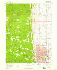 1957 Boulder1959 Print · USGSBoulder and the Front Range foothills are shown during a time of mid-century expansion and active mining heritage. Trace the development of the University of Colorado and find numerous historic mines like the Sun and Moon Mine or Emancipation Mine.3 unique versions available
 - 1957 Map of Allens Park, 1959 Print
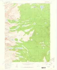
 1957 Allens Park1959 Print · USGSThe Front Range high country comes into focus in the mid-fifties as outdoor recreation and mountain living expand. Researchers can locate early outposts like the Wild Basin Ranger Station and St Catherine Chapel, or trace the waters of Ouzel Creek and Coney Creek.7 unique versions available
 - 1957 Map of Gold Hill, 1959 Print
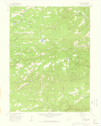 1957 Gold Hill1959 Print · USGSBoulder County's mining heartland is captured in the late fifties, showcasing a landscape defined by gold fever and high-altitude settlement. Researchers can trace the heritage of specific operations like the Ophir Mine or locate early mountain communities such as Jamestown and Wallstreet.7 unique versions available
 - 1957 Map of Raymond, 1959 Print
 1957 Raymond1959 Print · USGSThe mountain canyons of Boulder County in the late fifties show a landscape transitioning from mining to forest recreation. Genealogists and historians can trace the foundations of Balarat, locate the Bunce Sch (Aband), and explore old workings at the Argo Mine.6 unique versions available
 - 1957 Map of Longs Peak, 1959 Print
 1957 Longs Peak1959 Print · USGSThe eastern gateway to the high Rockies was maturing in the late fifties, blending traditional camp life with increasing park infrastructure. Researchers can trace early hiking routes like the Storm Pass Trail and locate recreation sites such as the Cheley Camp and Marys Lake.2 unique versions available
 - 1957 Map of Ward, 1959 Print
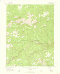
 1957 Ward1959 Print · USGSThe Colorado Front Range comes into focus during the mid-fifties, showing the high-elevation camps and mining legacy near Ward. Researchers and genealogists can trace the Boulder City Aqueduct or locate family sites at Camp Harmony and Stapp Lakes Lodge.7 unique versions available
 - 1957 Map of Lyons, 1959 Print
 1957 Lyons1959 Print · USGSLyons and the surrounding Boulder County foothills are documented here in the late fifties as a center for stone quarrying and irrigation. Researchers can trace historic water routes like the Toll Gate Ditch or locate the Altona Grange and local quarries.2 unique versions available
 - 1957 Map of Boulder, 1960 Print
 1957 Boulder1960 Print · USGSBoulder and the surrounding mountain canyons are captured in the late fifties, showing a landscape defined by mining history and early settlement. Trace the footprints of old camps like Gold Hill and Wallstreet, or locate the historic Bunce School and Gresham (Site).3 unique versions available
 - 1958 Map of Greeley
 1958 Greeley1958 Print · USGSNorthern Colorado and the high peaks of the Front Range appear here in the mid-fifties as the region's agricultural and rail networks were fully established. Genealogists can locate family homes near Virginia Dale, Waverly, or Kuner, and trace the path of the Union Pacific Railroad through Greeley.
 - 1958 Map of Denver
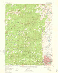
 1958 Denver1958 Print · USGSDenver and the Colorado Front Range are captured here during the mid-century suburban boom. Trace the footprints of military installations like Buckley Air Force Base alongside the established rail networks of the Colorado & Southern Ry.
Showing maps 1-25 of 28
Top cities of Boulder County
- Boulder historical maps
- Longmont historical maps
- Lafayette historical maps
- Louisville historical maps
- Lyons historical maps
- Nederland historical maps
See more
Frequently asked questions
- What are the different types of historical maps available for Boulder County?
- What is the oldest map of Boulder County?
- Where can I purchase historical maps of Boulder County for my home or office?
- Where can I download high-res historical maps of Boulder County?
- Are there historical topographic maps available for Boulder County?
- Is there historical aerial imagery available for Boulder County?
- Where are historical maps of Boulder County sourced from?