1960s Maps of Chaffee County, Colorado
Explore 13 historic maps of Chaffee County from the 1960s. These maps offer a rare glimpse into what life looked like during the 1960s — showing old roads, neighborhoods, homes, and landmarks that have changed or disappeared over time.
Whether you're researching your family's past, planning a metal detecting trip, or studying how Chaffee County's landscape evolved across the 1960s, these high-resolution maps are a powerful tool for exploring the history of this region.
- Focus on a specific era: All maps on this page are from the 1960s, giving you a focused view of this time period.
- See what’s changed: Compare century-old streets, trails, and buildings to today's modern landscape using overlays and satellite layers.
- Research with precision: Use these maps for genealogy, historical research, land use analysis, or educational projects.
- View, download, or print: Maps are fully viewable online in high resolution, and can be downloaded or printed for your own records.
Start exploring Chaffee County's history through authentic maps from the 1960s. This is your window into the past.
Chaffee County, CO maps
(13)- 1960 Map of Leadville
 1960 Leadville1960 Print · USGSThe Colorado high country in the mid-fifties comes alive through its mining camps, river valleys, and rail lines. Trace the industrial legacy of the Climax Molybdenum Mine and explore the alpine reaches of the Camp Hale Military Reservation.2 unique versions available
 - 1960 Map of Montrose
 1960 Montrose1960 Print · USGSThe Colorado high country in the mid-fifties is captured here during a period of steady ranching and persistent mining. Researchers can trace the path of the Denver & Rio Grande Western RR or locate small settlements like Somerset, Maher, and Sargent.2 unique versions available
 - 1960 Map of Independence Pass, 1965 Print
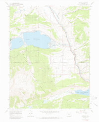
 1960 Independence Pass1965 Print · USGSThe high country around the Continental Divide was still a landscape of active water engineering and remnant mining in the 1960s. Researchers can trace the trans-basin New York Collection Canal and find mining era sites like Independence and Ruby Mine.5 unique versions available
 - 1961 Map of South Peak, 1963 Print
 1961 South Peak1963 Print · USGSThe high mountain divide of the central Rockies is captured in the early sixties as it straddles three counties. Trace the path of the Denver and Rio Grande Western near Columbia or locate the Old Railroad Grade and Buffalo Meadows.3 unique versions available
 - 1962 Map of Leadville
 1962 Leadville1962 Print · USGSThe Colorado high country in the early sixties was a rugged landscape of mining camps, military training grounds, and emerging ski towns. Researchers can trace the legacy of Camp Hale, locate the Molybdenum mine near Leadville, and follow the Denver and Rio Grande Western RR through the canyons.
 - 1962 Map of Pueblo
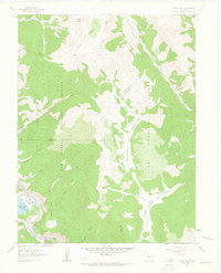
 1962 Pueblo1962 Print · USGSThe Front Range and high plains meet in the early sixties as military installations and industrial mining shape the corridor from Colorado Springs to Pueblo. Genealogists can trace family names through rural landmarks like the Columbine School, Hanover Church, and Fairview Cem.
 - 1964 Map of Leadville
 1964 Leadville1964 Print · USGSColorado's high country is captured here during the mid-1960s, showing the intersection of mining history and mountain transport. Trace the legacy of high-altitude industry at the Climax Molybdenum Mine or follow the rails of the Colorado and Southern Ry past Leadville.
 - 1966 Map of Pueblo
 1966 Pueblo1966 Print · USGSThe Front Range and Arkansas River Valley are captured here in the mid-1960s, showing a landscape shaped by mining, military expansion, and rail. Researchers can locate numerous country schools and mines, such as the Lytle School, Pioneer Cem, and Empire Zinc Mine.
 - 1967 Map of Pahlone Peak, 1969 Print
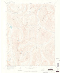
 1967 Pahlone Peak1969 Print · USGSThe high Continental Divide country of Gunnison and Chaffee counties is captured here in the late 1960s. Researchers can trace historic access routes like Old Monarch Pass, mining sites such as Pinnacle Mine, and water features including Larkspur Ditch.4 unique versions available
 - 1967 Map of Pieplant, 1971 Print
 1967 Pieplant1971 Print · USGSThe high Gunnison backcountry appears here in the late sixties, where mining history meets the grazing lands of the Taylor River. Researchers can locate the Pieplant Mill (Site), the Pieplant Cow Camp, and the rugged route of the Timberline Trail.3 unique versions available
 - 1967 Map of Granite, 1972 Print
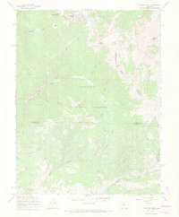
 1967 Granite1972 Print · USGSThe Arkansas River valley during the mid-sixties reveals a landscape of high-altitude mining and early mountain tourism. Researchers can trace the Denver and Rio Grande Western RR as it passes Granite and locate the Columbine Mine.3 unique versions available
 - 1967 Map of Mount Elbert, 1972 Print
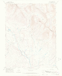
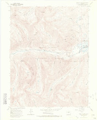 1967 Mount Elbert1972 Print · USGSThe Sawatch Range reaches its zenith in the late sixties, showing the high-altitude mines and trails surrounding Mount Elbert. Trace historic claims like the Golden Fleece Mine or locate the shoreline of the Twin Lakes Reservoir.4 unique versions available
 - 1968 Map of Montrose
 1968 Montrose1968 Print · USGSThe Western Slope and Continental Divide meet in the late sixties, showing the vital river valleys and high-mountain mining districts. Trace the historic route of the Denver and Rio Grande Western RR or locate small settlements like Sargents and Powderhorn.
End of results
Showing maps 1-13 of 13
Top cities of Chaffee County
- Salida historical maps
- Buena Vista historical maps
- Poncha Springs historical maps
- Nathrop historical maps
- Alpine historical maps
- Smeltertown historical maps
Frequently asked questions
- What are the different types of historical maps available for Chaffee County?
- What is the oldest map of Chaffee County?
- Where can I purchase historical maps of Chaffee County for my home or office?
- Where can I download high-res historical maps of Chaffee County?
- Are there historical topographic maps available for Chaffee County?
- Is there historical aerial imagery available for Chaffee County?
- Where are historical maps of Chaffee County sourced from?