1980s Maps of Chaffee County, Colorado
Explore 28 historic maps of Chaffee County from the 1980s. These maps offer a rare glimpse into what life looked like during the 1980s — showing old roads, neighborhoods, homes, and landmarks that have changed or disappeared over time.
Whether you're researching your family's past, planning a metal detecting trip, or studying how Chaffee County's landscape evolved across the 1980s, these high-resolution maps are a powerful tool for exploring the history of this region.
- Focus on a specific era: All maps on this page are from the 1980s, giving you a focused view of this time period.
- See what’s changed: Compare century-old streets, trails, and buildings to today's modern landscape using overlays and satellite layers.
- Research with precision: Use these maps for genealogy, historical research, land use analysis, or educational projects.
- View, download, or print: Maps are fully viewable online in high resolution, and can be downloaded or printed for your own records.
Start exploring Chaffee County's history through authentic maps from the 1980s. This is your window into the past.
Chaffee County, CO maps
(28)- 1980 Map of Wellsville
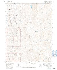
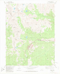
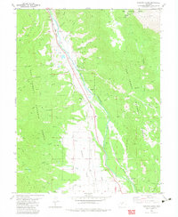
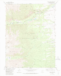
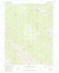 1980 Wellsville1980 Print · USGSNear the turn of the 1980s, this area of Fremont County shows the rugged intersection of the Arkansas River and high alpine forests. Researchers can trace the path of the Denver and Rio Grande Western through Wellsville or locate mountain landmarks like Simmons Peak and Salamander Lake.3 unique versions available
 - 1980 Map of Poncha Pass, 1981 Print
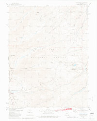
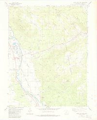
 1980 Poncha Pass1981 Print · USGSThe high mountain pass between Chaffee and Saguache counties is documented here in the early eighties as a corridor of transit and mining. Researchers can trace the path of the Old Railroad Grade and locate long-standing landmarks like Mearx Junction and Camp Rock.4 unique versions available
 - 1980 Map of Mount Ouray, 1981 Print
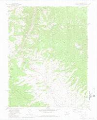
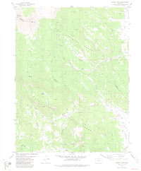
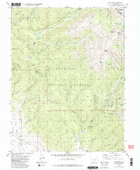
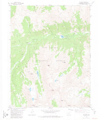
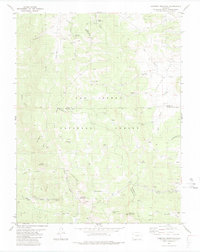
 1980 Mount Ouray1981 Print · USGSThe high Continental Divide country comes alive in this late twentieth-century survey of the Chaffee and Saguache county border. Researchers can trace the legacy of mining and mountain transit through Shirley (Site), the Cinderella Mine, and the historic Marshall Pass.5 unique versions available
 - 1982 Map of Buena Vista West, 1983 Print
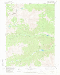
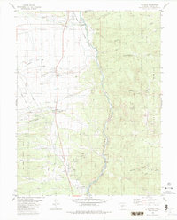
 1982 Buena Vista West1983 Print · USGSBuena Vista is documented here in the early 1980s as a thriving mountain hub between the river and the peaks. Researchers can trace historic family sites at Mt Olivet Cem, locate the Cottonwood Hot Springs, or follow the Old Railroad Grade north along the river.4 unique versions available
 - 1982 Map of Cumberland Pass, 1983 Print
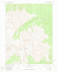
 1982 Cumberland Pass1983 Print · USGSThe high Rockies of the early eighties are captured here along the divide between the Gunnison and San Isabel forests. Trace the historic route of the Alpine Tunnel and its Abandoned rail line, or locate mining-era landmarks like Tincup Cem and the Old Gold Cup Mine.2 unique versions available
 - 1982 Map of Marmot Peak, 1983 Print
 1982 Marmot Peak1983 Print · USGSHigh in the mountains of central Colorado in the early eighties, this area straddles the county line through the national forests. Researchers can trace the path of an Old Railroad Grade near Chubb or locate remote mines and the Natural Arch.2 unique versions available
 - 1982 Map of Winfield, 1983 Print
 1982 Winfield1983 Print · USGSIn the high country of the Sawatch Range in the early 1980s, these valleys held the historic remains of mining-era settlements. Trace the location of Winfield, Vicksburg, and the Banker Mine alongside high-altitude landmarks like The Three Apostles.3 unique versions available
 - 1982 Map of Tincup, 1983 Print
 1982 Tincup1983 Print · USGSThe high-country mining district around Tincup is captured here during the early 1980s, straddling the Continental Divide. Researchers can locate numerous Mines, extensive Dredge Tailings, and high-altitude landmarks like Cottonwood Pass and Ptarmigan Lake.2 unique versions available
 - 1982 Map of Garfield, 1983 Print
 1982 Garfield1983 Print · USGSThe Sawatch Range peaks and high mountain passes of Chaffee County come into focus during the early eighties. Researchers can trace the Denver and Rio Grande Western rail line and locate heritage sites like the Garfield Mine and Tomichi Cem.2 unique versions available
 - 1982 Map of Whitepine, 1983 Print
 1982 Whitepine1983 Print · USGSGunnison County mining history is preserved here during the early 1980s, centered on the high-altitude camps and peaks of the Sawatch Range. Genealogists and industrial historians can trace the foundations of Whitepine, locate the Akron Mine, and find the local Cem near the banks of Tomichi Creek.2 unique versions available
 - 1982 Map of Mount Yale, 1983 Print
 1982 Mount Yale1983 Print · USGSHigh in the Sawatch Range during the early eighties, this area straddles the Continental Divide and the Chaffee-Gunnison county line. Modern hikers and historians can trace the paths to Mount Yale and locate old mining sites like Gladstone Mine and Holywater Mine.2 unique versions available
 - 1982 Map of Mount Harvard, 1983 Print
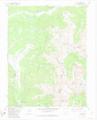
 1982 Mount Harvard1983 Print · USGSChaffee and Gunnison counties are shown at the height of the early eighties, centered on the high peaks of the Sawatch Range. Genealogists and hikers can trace the settlement of Winfield, find the Winfield Cem, and locate high-altitude workings like the Lienhart Mine.2 unique versions available
 - 1982 Map of Harvard Lakes, 1983 Print
 1982 Harvard Lakes1983 Print · USGSChaffee County in the early 1980s reveals a landscape of high-altitude mining and transit along the Arkansas River. Genealogists and historians can trace the Denver and Rio Grande Western rail line and locate old sites like Little Annie Mine, Princeton, and Americus.2 unique versions available
 - 1982 Map of Saint Elmo, 1983 Print
 1982 Saint Elmo1983 Print · USGSChaffee County mining districts are frozen in time during the early eighties, showing the rugged network of camps and claims. Researchers can trace the layout of St Elmo and Hancock while locating historic workings like the Mary Murphy Mine.2 unique versions available
 - 1982 Map of Saguache, 1983 Print
 1982 Saguache1983 Print · USGSThe San Luis Valley meets the high peaks of the Sawatch Range in the early 1980s, revealing a landscape shaped by mining and rail. Researchers can trace the Denver and Rio Grande Western railroad and locate high-altitude sites like the Rawley Mine and the settlement of Bonanza.
 - 1982 Map of Canon City, 1983 Print
 1982 Canon City1983 Print · USGSCentral Colorado in the early eighties shows a landscape shaped by high peaks and river-valley industry. Genealogists can locate family sites near Silver Cliff, Union Highland Cem, or the State Prison Farm.
 - 1983 Map of Salida West
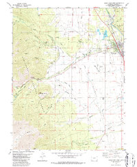
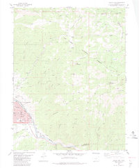
 1983 Salida West1983 Print · USGSChaffee County during the early 1980s reveals a mountain valley anchored by the Arkansas River and the industrial roots of Smeltertown. Researchers can locate family landmarks such as Fairview Cem, the Shavano State Fish Hatchery, and the Denver and Rio Grande Western rail line.3 unique versions available
 - 1983 Map of Mount Antero
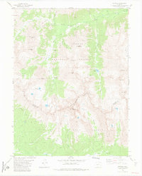
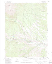
 1983 Mount Antero1983 Print · USGSThe Sawatch Range comes into sharp focus in the early 1980s, revealing a high-country landscape of thermal springs and alpine mining. Hikers and historians can trace the paths of the Merriam Pack Trail, locate the Lucky Mine, or explore the grounds of Mount Princeton Hot Springs.2 unique versions available
 - 1983 Map of Buena Vista East
 1983 Buena Vista East1983 Print · USGSUpper Arkansas Valley life in the early eighties is centered around the river and rail lines between Buena Vista and Nathrop. Researchers can trace industrial and civic history at the State Reformatory, the Nellie Bly Mine, and the Old Railroad Grade.2 unique versions available
 - 1983 Map of Cameron Mountain
 1983 Cameron Mountain1983 Print · USGSHigh-country mining and timber lands at the border of Chaffee, Park, and Fremont counties are documented here in the early 1980s. Local researchers can trace old mining sites like the Marble Quarry or locate landmarks such as Bassam Guard Station and Manoa Springs.
 - 1983 Map of Nathrop
 1983 Nathrop1983 Print · USGSUpper Arkansas River valley life in the early eighties is captured here as the railroad still tracks the river's edge. Researchers can trace the layout of Nathrop, find the Centerville Cem, and explore the canyon terrain near Hecla Junction.
 - 1983 Map of Pikes Peak
 1983 Pikes Peak1983 Print · USGSIn the early eighties, the high-altitude mining districts of Teller County remained deeply etched into the mountain landscape. Researchers can trace the legacy of the Gold Belt through sites like the Stratton Mine and vanished rail stops near Cripple Creek or Altman.
 - 1983 Map of Salida East
 1983 Salida East1983 Print · USGSIn the early eighties, the Arkansas River corridor around Salida reveals a landscape defined by mountain mining and historic rail routes. Researchers can trace local genealogy at Woodlawn Cem or locate the old Federal Quarry and the settlement at Cleora.3 unique versions available
 - 1983 Map of Maysville
 1983 Maysville1983 Print · USGSMaysville and the southern Sawatch Range are captured in the early 1980s as a landscape of high peaks and alpine water management. Researchers can trace the routes of the Hoosier Ditch, locate several Mine sites, and find landmarks like Mount Shavano.
 - 1983 Map of Leadville
 1983 Leadville1983 Print · USGSThe Colorado high country in the early eighties shows a landscape of world-class peaks and deep-rooted mining industry. Trace the historic tracks of the Denver and Rio Grande Western RR and locate high-altitude operations like the Climax Mine or London Mine.2 unique versions available
Showing maps 1-25 of 28
Top cities of Chaffee County
- Salida historical maps
- Buena Vista historical maps
- Poncha Springs historical maps
- Nathrop historical maps
- Alpine historical maps
- Smeltertown historical maps
Frequently asked questions
- What are the different types of historical maps available for Chaffee County?
- What is the oldest map of Chaffee County?
- Where can I purchase historical maps of Chaffee County for my home or office?
- Where can I download high-res historical maps of Chaffee County?
- Are there historical topographic maps available for Chaffee County?
- Is there historical aerial imagery available for Chaffee County?
- Where are historical maps of Chaffee County sourced from?