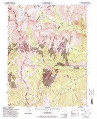
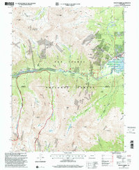
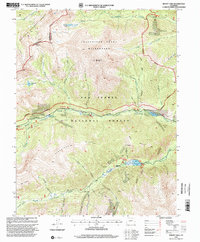
1990s Maps of Chaffee County, Colorado
Explore 28 historic maps of Chaffee County from the 1990s. These maps offer a rare glimpse into what life looked like during the 1990s — showing old roads, neighborhoods, homes, and landmarks that have changed or disappeared over time.
Whether you're researching your family's past, planning a metal detecting trip, or studying how Chaffee County's landscape evolved across the 1990s, these high-resolution maps are a powerful tool for exploring the history of this region.
- Focus on a specific era: All maps on this page are from the 1990s, giving you a focused view of this time period.
- See what’s changed: Compare century-old streets, trails, and buildings to today's modern landscape using overlays and satellite layers.
- Research with precision: Use these maps for genealogy, historical research, land use analysis, or educational projects.
- View, download, or print: Maps are fully viewable online in high resolution, and can be downloaded or printed for your own records.
Start exploring Chaffee County's history through authentic maps from the 1990s. This is your window into the past.
Chaffee County, CO maps
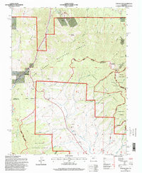
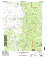
(28)- 1994 Map of Antero Reservoir, 1997 Print
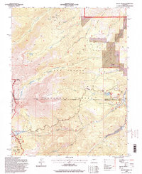
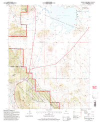 1994 Antero Reservoir1997 Print · USGSHigh-mountain ranching and water engineering define this South Park landscape during the mid-nineties. Researchers can trace the Old Railroad Grade and locate old homesteads like the Salt Works Ranch or the Haver (Aband) settlement site.3 unique versions available
 - 1994 Map of South Peak, 1998 Print
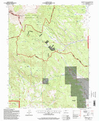
 1994 South Peak1998 Print · USGSPark County high country is shown in detail during the mid-1990s, where three counties meet among protected wilderness and national forest lands. Researchers can trace historic alpine routes like Weston Pass and locate high-altitude prospects near Black Mountain.2 unique versions available
 - 1994 Map of Mount Antero, 1998 Print
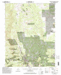
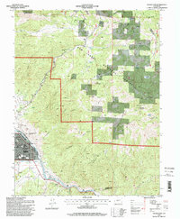
 1994 Mount Antero1998 Print · USGSThe Sawatch Range peaks and thermal waters of Chaffee County are captured here in the mid-nineties. Researchers can locate the Lucky Mine, trace the Colorado Trail, and find local landmarks like Mount Princeton Hot Springs.
 - 1994 Map of Saint Elmo, 1998 Print
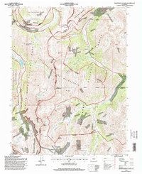
 1994 Saint Elmo1998 Print · USGSThe mining camps of the Sawatch Range are documented here in the mid-nineties, showing the high-country landscape of the San Isabel National Forest. Genealogists and historians can trace the foundations of Saint Elmo, Romley, and Hancock alongside numerous mountain mines.
 - 1994 Map of Buena Vista East, 1998 Print
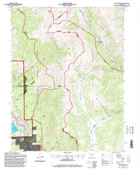
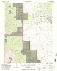
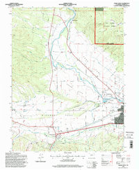
 1994 Buena Vista East1998 Print · USGSThe Arkansas River valley during the late twentieth century reveals a landscape defined by irrigation and high-altitude mining. Researchers can trace historic water routes like the Helena Ditch and find industrial landmarks from Johnson Village to the Triad Mine.
 - 1994 Map of Poncha Pass, 1998 Print
 1994 Poncha Pass1998 Print · USGSSaguache County and the high country of the Sangre De Cristo range are captured here in the mid-1990s. Researchers can trace the junction of three counties and locate old resource sites like Mears Junction, Poncha Hot Springs, and the Rainbow Trail.
 - 1994 Map of Marmot Peak, 1998 Print
 1994 Marmot Peak1998 Print · USGSThe high Divide country of Chaffee and Park counties is shown here in the 1990s as a landscape of wilderness and resource exploration. Trace early mining efforts through scattered Mines and Prospect sites near the Lenhardy Cutoff and Marmot Peak.
 - 1994 Map of Cumberland Pass, 1998 Print
 1994 Cumberland Pass1998 Print · USGSHigh-country mining and railroad history dominate the Continental Divide during the 1990s. Researchers can locate the Old Alpine Tunnel and Alpine Station, or trace early mining claims like the Gold Cup Mine and Bon Ton Mine near Boothill Cemetery.
 - 1994 Map of Cameron Mountain, 1998 Print
 1994 Cameron Mountain1998 Print · USGSThe high country of Chaffee and Park counties is mapped here during the mid-nineties, showing a landscape shaped by mining and forest management. Researchers can locate the Gold Bug Mine, the settlement of Whitehorn, and the remote Bassam Guard Station.
 - 1994 Map of Independence Pass, 1998 Print
 1994 Independence Pass1998 Print · USGSThe high Sawatch Range is documented in the mid-1990s, where the Continental Divide separates three different national forests. Researchers can locate remote mining sites like the Ruby Mine and historic stopping points such as Independence and Brumley.
 - 1994 Map of Salida East, 1998 Print
 1994 Salida East1998 Print · USGSThe Arkansas River valley in the mid-1990s showcases the expansion of Salida and its mountain surroundings. Local historians can trace the streets around Woodlawn Cemetery, the site of Cleora, and the network of gulches like Cottonwood Gulch and Longs Gulch.
 - 1994 Map of Buena Vista West, 1998 Print
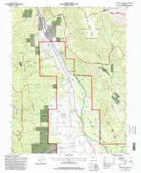
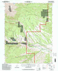
 1994 Buena Vista West1998 Print · USGSBuena Vista and the Chaffee County high country are captured here in the mid-1990s as the town expanded toward the mountains. Researchers can trace historic water rights via the Mary Ditch, locate the Mt Olivet Cem, or explore mining history at the Latchaw Mine.
 - 1994 Map of Wellsville, 1998 Print
 1994 Wellsville1998 Print · USGSThe Arkansas River valley in the 1990s was a hub of high-altitude mining activity centered on the settlement of Wellsville. Modern researchers can trace dozens of mountain Quarries, remote sites like Salamander Lake, and the path of the Rainbow Trail.
 - 1994 Map of Harvard Lakes, 1998 Print
 1994 Harvard Lakes1998 Print · USGSThe Arkansas River valley in the mid-nineties shows a landscape of mountain settlements and wilderness boundaries. Researchers can trace the water infrastructure of Riverside and Americus or locate high-country landmarks like Harvard Lakes and Elephant Rock.
 - 1994 Map of Pieplant, 1998 Print
 1994 Pieplant1998 Print · USGSHigh in the Colorado Rockies during the late twentieth century, this survey tracks the intersection of mining history and wilderness conservation. Researchers can locate the Pieplant Mine, the historic Dinner Station, and the remote Pieplant Mill (Site) near the Continental Divide.
 - 1994 Map of Mount Ouray, 1998 Print
 1994 Mount Ouray1998 Print · USGSHigh in the Sawatch Range during the 1990s, this area showcases the vital mountain crossings of Poncha Pass and Marshall Pass. Researchers can locate the Shirley (Site), the Cinderella South Mine, and remote landmarks like Devils Armchair.
 - 1994 Map of Salida West, 1998 Print
 1994 Salida West1998 Print · USGSThe Upper Arkansas River Valley in the mid-nineties shows a landscape shaped by high-altitude ranching, mining, and river industry. Researchers can trace the irrigation networks of Adobe Park or locate the Shavano State Fish Hatchery and Smeltertown.
 - 1994 Map of Maysville, 1998 Print
 1994 Maysville1998 Print · USGSThe high peaks and valley floors of Chaffee County are captured in the mid-1990s as alpine recreation and water management define the landscape. Researchers can trace the town of Maysville and the South Arkansas River alongside the COLORADO TRAIL and the high mines of Mount Shavano.
 - 1994 Map of Castle Rock Gulch, 1998 Print
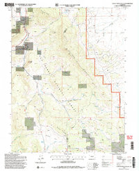 1994 Castle Rock Gulch1998 Print · USGSThe high Chaffee County backcountry is captured here during the mid-nineties, showing a landscape shaped by rugged geology and mining history. Researchers can locate remote sites like the Lucky Jack Mine, the Newett Quarries, and the striking pillars of The Castles.2 unique versions available
 - 1994 Map of Pahlone Peak, 1998 Print
 1994 Pahlone Peak1998 Print · USGSThe high Continental Divide in the mid-1990s serves as a backdrop for active mining and alpine transit. Researchers can trace industrial operations at Pinnacle Mine and Strip Mine, or follow the historic routes over Monarch Pass and the Colorado Trail.
 - 1994 Map of Nathrop, 1998 Print
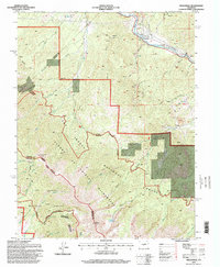
 1994 Nathrop1998 Print · USGSChaffee County in the mid-1990s shows the Arkansas River valley's transition from agricultural hubs to forest land. Researchers can locate the Centerville Cem, trace the Railroad through Browns Canyon, and find old Mines near Hecla Junction.
 - 1994 Map of Garfield, 1998 Print
 1994 Garfield1998 Print · USGSGarfield and the surrounding peaks of the Continental Divide are captured in the mid-nineties during a period of transition between mining and recreation. Trace the footprint of the Monarch Quarry, locate the Tomichi Cem, and follow the South Arkansas River through the heart of the Rockies.
 - 1994 Map of Tincup, 2001 Print
 1994 Tincup2001 Print · USGSHigh in the Rockies during the mid-nineties, this map captures the transition of the Tincup area from a historic mining district to a wilderness destination. Trace old extraction sites through Dredge Tailings and Mines or follow the Timberline Trail across the Continental Divide.
 - 1994 Map of Mount Elbert, 2001 Print
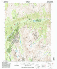
 1994 Mount Elbert2001 Print · USGSThe Sawatch Range reached a balance of historic mining and wilderness preservation in the 1990s as hikers and historians revisited old claims. You can trace the legacy of the Iron Mike Mine and Last Chance Mine or explore the Twin Lakes Historic District.
 - 1994 Map of Mount Yale, 2001 Print
 1994 Mount Yale2001 Print · USGSThe Sawatch Range in the mid-1990s showcases a high-altitude landscape dominated by the fourteen-thousand-foot summit of Mount Yale. Hikers and historians can trace the paths of the Colorado Trail past alpine waters like Cottonwood Lake and historic mining sites such as Holywater Mine.
Showing maps 1-25 of 28
Top cities of Chaffee County
- Salida historical maps
- Buena Vista historical maps
- Poncha Springs historical maps
- Nathrop historical maps
- Alpine historical maps
- Smeltertown historical maps
Frequently asked questions
- What are the different types of historical maps available for Chaffee County?
- What is the oldest map of Chaffee County?
- Where can I purchase historical maps of Chaffee County for my home or office?
- Where can I download high-res historical maps of Chaffee County?
- Are there historical topographic maps available for Chaffee County?
- Is there historical aerial imagery available for Chaffee County?
- Where are historical maps of Chaffee County sourced from?