2020s Maps of Poncha Springs, Colorado
Explore 3 historic maps of Poncha Springs from the 2020s. These maps offer a rare glimpse into what life looked like during the 2020s — showing old roads, neighborhoods, homes, and landmarks that have changed or disappeared over time.
Whether you're researching your family's past, planning a metal detecting trip, or studying how Poncha Springs's landscape evolved across the 2020s, these high-resolution maps are a powerful tool for exploring the history of this region.
- Focus on a specific era: All maps on this page are from the 2020s, giving you a focused view of this time period.
- See what’s changed: Compare century-old streets, trails, and buildings to today's modern landscape using overlays and satellite layers.
- Research with precision: Use these maps for genealogy, historical research, land use analysis, or educational projects.
- View, download, or print: Maps are fully viewable online in high resolution, and can be downloaded or printed for your own records.
Start exploring Poncha Springs's history through authentic maps from the 2020s. This is your window into the past.
Poncha Springs, CO maps
(3)- 2022 Map of Poncha Pass, 2022 Print
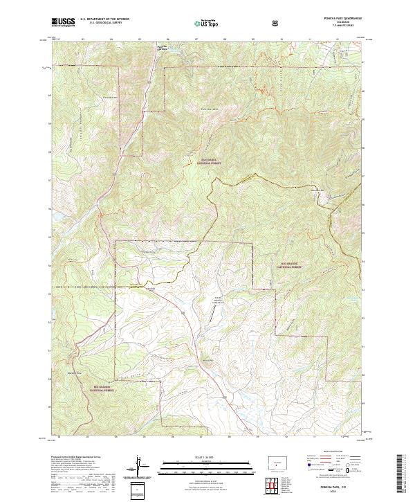 2022 Poncha Pass2022 Print · USGSHigh in the Rockies during the early 2020s, this area centers on the vital crossing at Poncha Pass. Researchers can trace old timber and recreation routes like Rainbow Trl or locate the thermal waters of Poncha Hot Springs.
 - 2023 Map of Salida West, 2023 Print
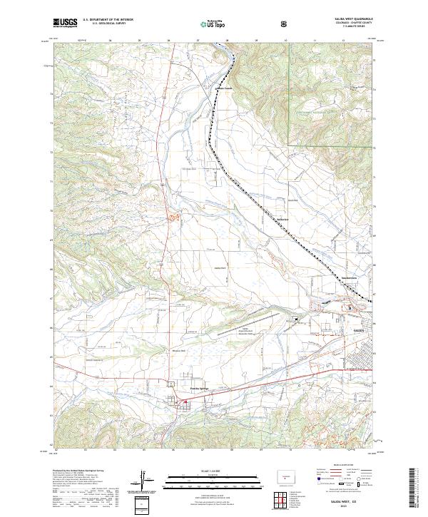 2023 Salida West2023 Print · USGSUpper Arkansas River valley life is documented in this recent survey, showing the intricate irrigation systems surrounding Poncha Springs. Trace historical cemetery sites like Fairview Cem and Woodlawn Cem or follow the paths of the Sunnyside Park Ditch and Kraft Ditch.
 - 2023 Map of Maysville, 2023 Print
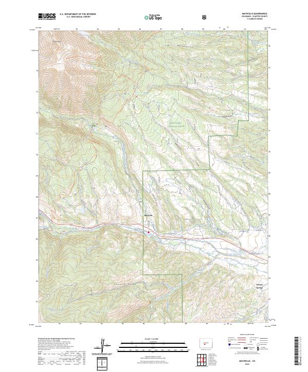 2023 Maysville2023 Print · USGSMaysville and the towering Sawatch Range are captured here in the early twenty-first century. Outdoor enthusiasts and local historians can trace the Colorado Trl or locate water rights along the North Fork Ditch and South Arkansas River.
End of results
Showing maps 1-3 of 3
Top cities near Poncha Springs
Frequently asked questions
- What are the different types of historical maps available for Poncha Springs?
- What is the oldest map of Poncha Springs?
- Where can I purchase historical maps of Poncha Springs for my home or office?
- Where can I download high-res historical maps of Poncha Springs?
- Are there historical topographic maps available for Poncha Springs?
- Is there historical aerial imagery available for Poncha Springs?
- Where are historical maps of Poncha Springs sourced from?