Old Maps of Downieville, Colorado for Genealogy
Trace your family roots with 16 historic maps of Downieville. These high-res maps reveal old neighborhoods, homesites, landmarks, and streets — helping you uncover where your ancestors lived and how the area evolved over time.
- Explore historic neighborhoods: Identify where your relatives may have lived in the 1800s or 1900s.
- Compare maps over time: Trace the changes in streets, buildings, and landmarks for multi-generational research.
- Perfect for genealogy & ancestry research: Used by family historians and researchers to map out lineage and migration.
These maps are an incredible resource for exploring your personal connection to Downieville's past.
Downieville, CO maps
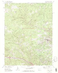
(16)- 1905 Map of Central City
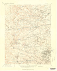
 1905 Central City1905 Print · USGSThe Colorado Front Range is captured here at the peak of its early mining era, showing the dense network of gulches and camps. Trace historic mining operations at Central City, follow the high-mountain route of the Denver Northwestern and Pacific RR, or locate vanished settlements like Baltimore and Perigo.
 - 1910 Map of Central City, 1957 Print
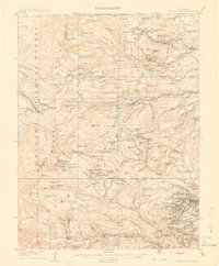
 1910 Central City1957 Print · USGSThe Colorado high country at the start of the century reveals a landscape defined by mining booms and engineering marvels. Trace the intricate rail networks of the Colorado Southern RR or locate family roots in the historic camps of Nevadaville and Central City.2 unique versions available
 - 1912 Map of Central City
 1912 Central City1912 Print · USGSThe Colorado Front Range mining districts were in full operation during this era of deep-shaft extraction and mountain railroading. Researchers can trace the industrial footprint of Central City, locate the Boulder County Mine, and follow the path of the Colorado and Southern RR through the gulches.4 unique versions available
 - 1942 Map of Central City, 1955 Print
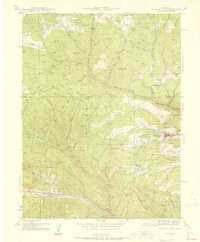 1942 Central City1955 Print · USGSGilpin County’s gold mining heartland is captured here during the early Forties, centered on the intense industrial activity around Central City. Researchers can trace the era's mining infrastructure through features like The Glory Hole, Pittsburg Mine, and the Bald Mtn Cem.5 unique versions available
 - 1944 Map of Central City
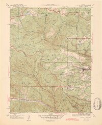 1944 Central City1944 Print · USGSMid-century Colorado mining country is documented here, centering on the historic Gilpin County district during the 1940s. Genealogists and historians can trace the foundations of Central City, locate the massive Glory Hole, and find smaller settlements like Nevadaville and Apex.2 unique versions available
 - 1953 Map of Denver, 1964 Print
 1953 Denver1964 Print · USGSDenver and the Colorado Front Range are captured here during a decade of post-war growth and military expansion. Researchers can trace the sprawling rail lines of the Union Pacific, locate the State Capitol, and explore historic mountain mining hubs like Central City.6 unique versions available
 - 1957 Map of Denver
 1957 Denver1957 Print · USGSDenver and the Colorado Front Range are seen here during a mid-century period of intense military and urban expansion. Trace the footprints of the Rocky Mountain Arsenal, the early United States Air Force Academy, and the Lowry AF Base.
 - 1958 Map of Denver
 1958 Denver1958 Print · USGSDenver and the Colorado Front Range are captured here during the mid-century suburban boom. Trace the footprints of military installations like Buckley Air Force Base alongside the established rail networks of the Colorado & Southern Ry.
 - 1960 Map of Denver
 1960 Denver1960 Print · USGSDenver and the Colorado Front Range are seen here at a pivotal moment of postwar expansion into the plains and foothills. Researchers can trace the mid-century rail network of the Denver & Rio Grande Western RR and locate historic institutional landmarks like Buckley Field and the Colorado School of Mines.
 - 1972 Map of Central City, 1975 Print
 1972 Central City1975 Print · USGSThe Colorado mining districts of the early seventies are captured in high detail across the Gilpin and Clear Creek county lines. Researchers can trace the legacy of the gold rush through the Russell Gulch Cemetery, the streets of Nevadaville, and the dense mine workings on Seaton Mtn.2 unique versions available
 - 1983 Map of Denver West
 1983 Denver West1983 Print · USGSThe Front Range and Denver's western suburbs meet in the early 1980s, documenting the era's growth from the mountain peaks to the valley floor. Genealogists and historians can trace the foundations of Lakewood and Golden, or locate high-altitude landmarks like the Moffat Tunnel and Mount Olivet Cem.2 unique versions available
 - 2011 Map of Central City, 2011 Print
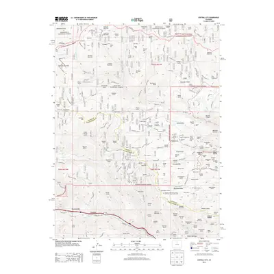
 2011 Central City2011 Print · USGSCovers Downieville, including Idaho Springs, Black Hawk, and other nearby areas
 - 2013 Map of Central City, 2013 Print
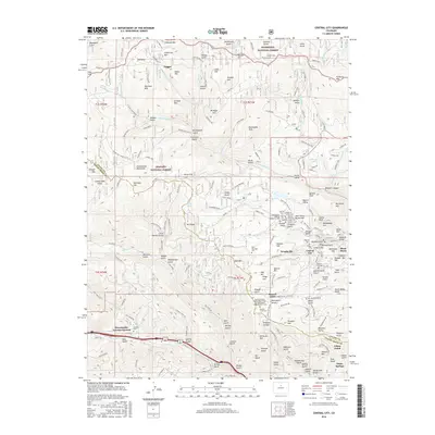
 2013 Central City2013 Print · USGSCovers Downieville, including Idaho Springs, Black Hawk, and other nearby areas
 - 2016 Map of Central City, 2016 Print
 2016 Central City2016 Print · USGSCovers Downieville, including Idaho Springs, Black Hawk, and other nearby areas
 - 2019 Map of Central City, 2019 Print
 2019 Central City2019 Print · USGSCovers Downieville, including Idaho Springs, Black Hawk, and other nearby areas
 - 2022 Map of Central City, 2022 Print
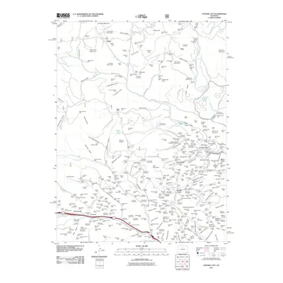
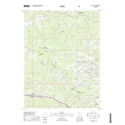
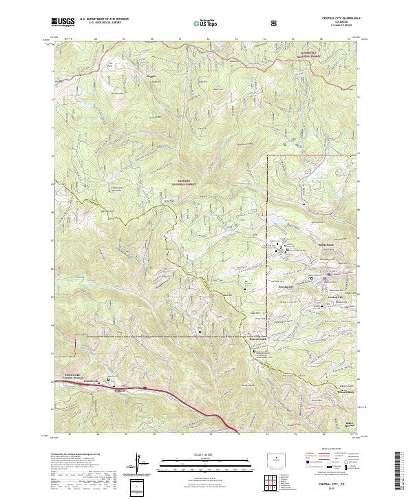 2022 Central City2022 Print · USGSGilpin County's gold-mining heart is preserved here in the mountains above Clear Creek during the early 21st century. Genealogists can locate a significant concentration of historic burial sites such as the Missouri City Cem and Rocky Mountain Independent Order of Oddfellows Lodge Number 2 Cem.
End of results
Showing maps 1-16 of 16
Top cities near Downieville
- Idaho Springs historical maps
- Nederland historical maps
- Georgetown historical maps
- Fraser historical maps
- Empire historical maps
- Silver Plume historical maps
See more
Frequently asked questions
- What are the different types of historical maps available for Downieville?
- What is the oldest map of Downieville?
- Where can I purchase historical maps of Downieville for my home or office?
- Where can I download high-res historical maps of Downieville?
- Are there historical topographic maps available for Downieville?
- Is there historical aerial imagery available for Downieville?
- Where are historical maps of Downieville sourced from?