1970s Maps of Crowley County, Colorado
Explore 13 historic maps of Crowley County from the 1970s. These maps offer a rare glimpse into what life looked like during the 1970s — showing old roads, neighborhoods, homes, and landmarks that have changed or disappeared over time.
Whether you're researching your family's past, planning a metal detecting trip, or studying how Crowley County's landscape evolved across the 1970s, these high-resolution maps are a powerful tool for exploring the history of this region.
- Focus on a specific era: All maps on this page are from the 1970s, giving you a focused view of this time period.
- See what’s changed: Compare century-old streets, trails, and buildings to today's modern landscape using overlays and satellite layers.
- Research with precision: Use these maps for genealogy, historical research, land use analysis, or educational projects.
- View, download, or print: Maps are fully viewable online in high resolution, and can be downloaded or printed for your own records.
Start exploring Crowley County's history through authentic maps from the 1970s. This is your window into the past.
Crowley County, CO maps
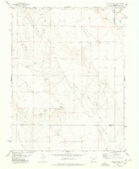
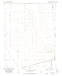
(13)- 1973 Map of Truckton SE, 1975 Print
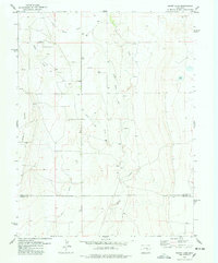
 1973 Truckton SE1975 Print · USGSThe high plains of eastern Colorado meet at a four-county junction in the early 1970s. Researchers can trace rural family routes like Whittemore Road and Rasner Road past several isolated Water Tanks and fence lines.2 unique versions available
 - 1977 Map of Walker Point, 1978 Print
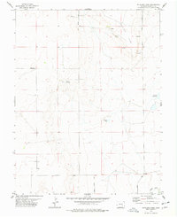
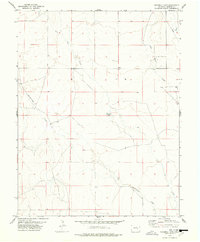
 1977 Walker Point1978 Print · USGSHigh Plains ranching country along the boundary of Lincoln and Crowley counties is captured here in the mid-1970s. Researchers can trace vital water sources across Ninemile Flats, including Dead Horse Creek, Lone Tree Creek, and the prominent Walker Point.
 - 1977 Map of Antelope Mesa, 1978 Print
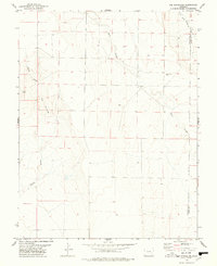
 1977 Antelope Mesa1978 Print · USGSCrowley County's high plains terrain is captured in the late seventies, showing the vital water and road networks of the era. Genealogists and researchers can trace local landmarks like the Boney settlement, Cudahy Reservoir, and the route of Olney Springs Road.
 - 1977 Map of The Pinnacles, 1978 Print
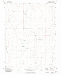
 1977 The Pinnacles1978 Print · USGSThe High Plains of the Colorado borderlands are captured here in the late seventies, showing the sparse ranching landscape of the Crowley and Kiowa county line. Genealogists and researchers can locate Sand Arroyo Cem and trace the terrain around Cow Butte and The Pinnacles.
 - 1977 Map of Box Springs, 1978 Print
 1977 Box Springs1978 Print · USGSCrowley County in the 1970s reveals a landscape defined by water management and high plains ranching. Researchers can trace the development of the Box Springs Reservoir No 1 system and find landmarks like North McCabe Lake or the old Pumping Sta.
 - 1977 Map of Todd Point, 1978 Print
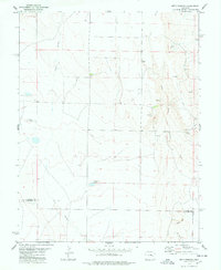
 1977 Todd Point1978 Print · USGSCrowley County in the mid-1970s reveals a landscape of high plains ranching and vital water management. Genealogists and historians can trace the Missouri Pacific railroad corridor and the layout of local landmarks like Lolita Reservoir and Todd Point Spring.
 - 1978 Map of Cockleburr Springs
 1978 Cockleburr Springs1978 Print · USGSLincoln and Crowley Counties are captured here in the late 1970s, showcasing a landscape defined by ranching and intermittent water. Local history researchers can trace the drainage of Cramer Creek and locate vital water sources like Cockleburr Springs and a remote Well.
 - 1978 Map of Metz Springs
 1978 Metz Springs1978 Print · USGSThe high plains of eastern Colorado at the end of the seventies show a landscape defined by ranching and vital water sources. Researchers can trace the drainages of Sand Arroyo and North Fork Mustang Creek or locate landmarks like Metz Springs and Wild Horse Point.
 - 1978 Map of Ninemile Spring
 1978 Ninemile Spring1978 Print · USGSCrowley County, Colorado, is captured here in the late 1970s, showcasing a rural landscape defined by prairie drainages and vital water sources. Researchers can trace the path of Cudahy Road and locate distinctive landmarks like Ninemile Spring and Cramer Creek.
 - 1978 Map of Nero Hill
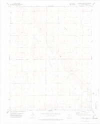
 1978 Nero Hill1978 Print · USGSCrowley County's agricultural landscape is seen here in the late seventies, dominated by the vital irrigation systems of the high plains. Researchers can trace the complex network of the Colorado Canal and identify local water sources like the Ordway Town Reservoir and Cudahy Reservoir.
 - 1978 Map of Sharp Lake
 1978 Sharp Lake1978 Print · USGSThe Lincoln and Crowley county line in the late 1970s shows a landscape of open range and vital water sources. Genealogists and historians can trace old fence lines and property improvements near Ninemile Flats, Sharp Lake, and Steels Fork.
 - 1978 Map of Windmill Lake
 1978 Windmill Lake1978 Print · USGSCrowley County ranching country is captured here in the late seventies, showing a landscape defined by seasonal drainages and water management. Researchers can trace the path of Lone Tree Creek, locate the central Windmill Lake, and identify the routes of Cudahy Road.
 - 1978 Map of Lake Henry
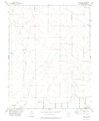
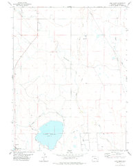 1978 Lake Henry1978 Print · USGSCrowley County irrigation and ranching systems are highlighted in the late seventies. Researchers can trace the flow of the Colorado Canal into Lake Henry and locate rural landmarks like Faw Wells and the Sugar City Lateral.
End of results
Showing maps 1-13 of 13
Top cities of Crowley County
- Ordway historical maps
- Olney Springs historical maps
- Sugar City historical maps
- Crowley historical maps
Frequently asked questions
- What are the different types of historical maps available for Crowley County?
- What is the oldest map of Crowley County?
- Where can I purchase historical maps of Crowley County for my home or office?
- Where can I download high-res historical maps of Crowley County?
- Are there historical topographic maps available for Crowley County?
- Is there historical aerial imagery available for Crowley County?
- Where are historical maps of Crowley County sourced from?