Old Maps of Crowley County, Colorado for Genealogy
Trace your family roots with 165 historic maps of Crowley County. These high-res maps reveal old neighborhoods, homesites, landmarks, and streets — helping you uncover where your ancestors lived and how the area evolved over time.
- Explore historic neighborhoods: Identify where your relatives may have lived in the 1800s or 1900s.
- Compare maps over time: Trace the changes in streets, buildings, and landmarks for multi-generational research.
- Perfect for genealogy & ancestry research: Used by family historians and researchers to map out lineage and migration.
These maps are an incredible resource for exploring your personal connection to Crowley County's past.
Crowley County, CO maps
(165)- 1889 Map of Sanborn, 1962 Print
 1889 Sanborn1962 Print · USGSEastern Colorado ranching country is captured here during the late 1880s as the open range gave way to established holdings. Researchers can locate early livestock operations like the Maryland Cattle Co. Ranch, Orcutt Ranch, and the Sanborn settlement.
 - 1891 Map of Sanborn
 1891 Sanborn1891 Print · USGSEastern Colorado ranching life at the end of the century centers on isolated outposts and seasonal watercourses. Genealogists can trace family holdings like the Fody Ranch and Orcutt Ranch or the small settlement at Sanborn.
 - 1891 Map of Catlin
 1891 Catlin1891 Print · USGSSoutheast Colorado's high plains were a landscape of competing rail lines and isolated ranching camps in the late nineteenth century. Genealogists and historians can trace the early development of Rocky Ford and Catlin along the Arkansas River or locate remote outposts like Lone Tree Ranch and Sheep Camp.
 - 1891 Map of Nepesta
 1891 Nepesta1891 Print · USGSSoutheast Colorado at the close of the 1880s reveals a landscape defined by the arrival of the rails along the Arkansas River. Researchers can trace early ranching sites like Skinner & Tabor Ranch and follow the competing paths of the Atchison Topeka and Santa Fe Railroad and the Missouri Pacific Railroad.
 - 1893 Map of Nepesta
 1893 Nepesta1893 Print · USGSSoutheast Colorado at the close of the nineteenth century is defined here by the arrival of the rails along the Arkansas River. Researchers can trace the early cattle and transit economy through the Skinner & Tabor Ranch, Chico Station, and the village of Nepesta.2 unique versions available
 - 1893 Map of Sanborn
 1893 Sanborn1893 Print · USGSEastern Colorado ranching country is documented here during the late frontier era, showing the early cattle operations and water rights of the high plains. Researchers can locate the Maryland Cattle Co. Ranch and trace the paths of Steel Fork and Horse Creek.4 unique versions available
 - 1893 Map of Big Springs
 1893 Big Springs1893 Print · USGSEastern Colorado ranching country is documented here in the late nineteenth century, showing the early homesteads and water sources of the high plains. Researchers can locate the early holdings of Galloway Ranch and Hancock Ranch or trace the drainage of Black Squirrel Creek.5 unique versions available
 - 1893 Map of Catlin
 1893 Catlin1893 Print · USGSSoutheast Colorado at the close of the nineteenth century was a territory defined by the arrival of the rails and the flow of the Arkansas River. Genealogists and historians can trace early ranching and rail stops such as Rocky Ford, Lone Tree Ranch, and the isolated Double Dobe.5 unique versions available
 - 1904 Map of Nepesta
 1904 Nepesta1904 Print · USGSEastern Colorado at the turn of the century shows a landscape transformed by water and rail. Trace the irrigation network of Excelsior Ditch and the lineage of family outposts like Skinner and Tabor Ranch and Tolle Ranch.3 unique versions available
 - 1953 Map of Cheraw, 1954 Print
 1953 Cheraw1954 Print · USGSOtero County at the start of the fifties shows a landscape reshaped by massive irrigation projects and the sugar beet industry. You can trace the railroad-dependent economy through the Sugar Refinery, locate family sites at Holbrook Cemetery, or explore the mid-century layout of Cheraw.4 unique versions available
 - 1954 Map of Meredith Hill, 1956 Print
 1954 Meredith Hill1956 Print · USGSSoutheastern Colorado ranchlands are documented here in the mid-fifties, showing the vital irrigation network along the Crowley and Otero County line. Genealogists and historians can trace family holdings like Herman Ranch and The Old Best Ranch near the Horse Creek drainage.2 unique versions available
 - 1954 Map of Olney Springs, 1956 Print
 1954 Olney Springs1956 Print · USGSIn the mid-1950s, the irrigation and rail networks of the Arkansas River Valley were the lifeblood of this Crowley County landscape. Genealogists and historians can trace the foundations of Olney Springs, locate the Olney Springs Cemetery, and follow the path of the Missouri Pacific railroad.2 unique versions available
 - 1954 Map of Elder, 1956 Print
 1954 Elder1956 Print · USGSIn the mid-1950s, the Otero County landscape was shaped by the vital irrigation networks surrounding the settlement of Elder. Genealogists and researchers can trace the Atchison Topeka and Santa Fe rail line, Number Six Sch, and Mount View Cemetery.3 unique versions available
 - 1954 Map of Sugar City, 1956 Print
 1954 Sugar City1956 Print · USGSCrowley County's irrigation and rail network is captured here in the mid-fifties, centered on the towns of Sugar City and Ordway. Trace local history at the Lakeview Cemetery, the County Fairground, and a large triangular Airfield (Abandoned).2 unique versions available
 - 1954 Map of Ordway, 1956 Print
 1954 Ordway1956 Print · USGSHigh plains agriculture and irrigation define this mid-century survey of Crowley and Otero counties. Genealogists and historians can trace the intricate network of water transport including the Colorado Canal and locate rural landmarks like the Numa Sch and Ordway Airport.2 unique versions available
 - 1954 Map of Manzanola, 1956 Print
 1954 Manzanola1956 Print · USGSThe Arkansas River valley in the mid-fifties reveals an intensive irrigation and rail network near the Otero and Crowley border. Genealogists can locate Manzanola, the District No 8 Sch, and traces of the Atchison Topeka and Santa Fe line.2 unique versions available
 - 1954 Map of Lamar, 1964 Print
 1954 Lamar1964 Print · USGSSoutheastern Colorado and the Kansas borderlands appear here in the mid-fifties, dominated by the vital Arkansas River irrigation network. Researchers can trace the development of river towns like Lamar and La Junta alongside the Amity Cemetery and several major reservoirs.3 unique versions available
 - 1954 Map of Pueblo, 1966 Print
 1954 Pueblo1966 Print · USGSMid-century Colorado comes alive in this survey of the Front Range and the high plains as the region expanded after the war. Genealogists and historians can trace family roots through rural landmarks like Hanover Church, Pioneer Cemetery, and the Grandview School.3 unique versions available
 - 1955 Map of Rocky Ford, 1956 Print
 1955 Rocky Ford1956 Print · USGSThe Arkansas River valley thrived as a sugar beet and rail hub during the mid-fifties. Researchers can trace the industrial landscape of Rocky Ford through the Sugar Refinery, the Valley View Cem, and the Newdale Sch.2 unique versions available
 - 1957 Map of Pueblo
 1957 Pueblo1957 Print · USGSMid-century Colorado comes alive as the Front Range urban centers expand alongside massive Cold War military installations. Genealogists and historians can trace the foundations of Stone City, rural sites like Hanover School, and the industrial Canon Imperial Mine.
 - 1958 Map of Pueblo
 1958 Pueblo1958 Print · USGSColorado's Front Range and Arkansas River Valley come alive in the late fifties, showing the transition from historic mining districts to major military and rail hubs. Genealogists and historians can trace family roots in ranching communities and find landmarks like Cripple Creek, Manitou, and the Hanover School.
 - 1958 Map of Lamar
 1958 Lamar1958 Print · USGSThe High Plains of Eastern Colorado and Western Kansas in the late fifties reveal a landscape tied to the Arkansas River and the rails. Trace the heritage of the river valley through Fort Lyon, the Atchison Topeka and Santa Fe RR, and rural landmarks like Kendrick Church.2 unique versions available
 - 1959 Map of Grandview School, 1961 Print
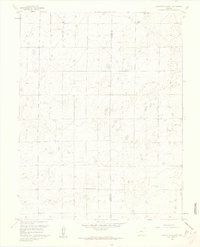 1959 Grandview School1961 Print · USGSThe high plains on the border of Pueblo and Crowley counties are captured here in the late fifties. Genealogists and local historians can locate the rural Grandview School and the nearby Schubert Ranch amid the open prairie landscape.3 unique versions available
 - 1960 Map of Fowler, 1961 Print
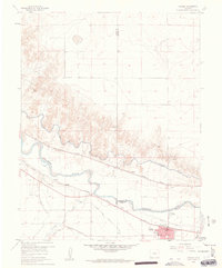 1960 Fowler1961 Print · USGSIn the Arkansas River valley during the early sixties, the local economy relied heavily on a sophisticated network of canals and competing rail lines. Researchers can trace the layout of Fowler and the settlement at Hamlet, or locate industrial sites like the Gravel Pits and the Rocky Ford Highline Canal.3 unique versions available
 - 1960 Map of Grandview School SE, 1962 Print
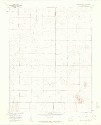 1960 Grandview School SE1962 Print · USGSThe Colorado high plains of the early sixties are defined by open range and the straight boundary line between Pueblo and Crowley counties. Researchers can trace the original section-line road network and locate distinctive natural features like Big Sand Hole.2 unique versions available
Showing maps 1-25 of 165
Top cities of Crowley County
- Ordway historical maps
- Olney Springs historical maps
- Sugar City historical maps
- Crowley historical maps
Frequently asked questions
- What are the different types of historical maps available for Crowley County?
- What is the oldest map of Crowley County?
- Where can I purchase historical maps of Crowley County for my home or office?
- Where can I download high-res historical maps of Crowley County?
- Are there historical topographic maps available for Crowley County?
- Is there historical aerial imagery available for Crowley County?
- Where are historical maps of Crowley County sourced from?