Old Maps of Tanglewood Acres, Colorado for Genealogy
Trace your family roots with 15 historic maps of Tanglewood Acres. These high-res maps reveal old neighborhoods, homesites, landmarks, and streets — helping you uncover where your ancestors lived and how the area evolved over time.
- Explore historic neighborhoods: Identify where your relatives may have lived in the 1800s or 1900s.
- Compare maps over time: Trace the changes in streets, buildings, and landmarks for multi-generational research.
- Perfect for genealogy & ancestry research: Used by family historians and researchers to map out lineage and migration.
These maps are an incredible resource for exploring your personal connection to Tanglewood Acres's past.
Tanglewood Acres, CO maps
(15)- 1954 Map of Pueblo, 1966 Print
 1954 Pueblo1966 Print · USGSMid-century Colorado comes alive in this survey of the Front Range and the high plains as the region expanded after the war. Genealogists and historians can trace family roots through rural landmarks like Hanover Church, Pioneer Cemetery, and the Grandview School.3 unique versions available
 - 1957 Map of Pueblo
 1957 Pueblo1957 Print · USGSMid-century Colorado comes alive as the Front Range urban centers expand alongside massive Cold War military installations. Genealogists and historians can trace the foundations of Stone City, rural sites like Hanover School, and the industrial Canon Imperial Mine.
 - 1958 Map of Pueblo
 1958 Pueblo1958 Print · USGSColorado's Front Range and Arkansas River Valley come alive in the late fifties, showing the transition from historic mining districts to major military and rail hubs. Genealogists and historians can trace family roots in ranching communities and find landmarks like Cripple Creek, Manitou, and the Hanover School.
 - 1959 Map of Electric Peak, 1961 Print
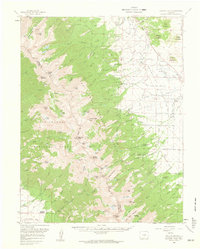 1959 Electric Peak1961 Print · USGSCuster and Saguache counties meet along the high peaks of the Sangre de Cristos during the late fifties. Genealogists can trace family footprints at the King Homestead and Hutchinson Homestead or locate the historic Ula Cem.6 unique versions available
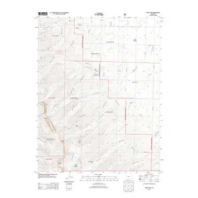
 - 1959 Map of Horn Peak, 1961 Print
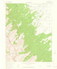 1959 Horn Peak1961 Print · USGSThe Sangre de Cristo Range meets the Wet Mountain Valley in the late fifties, showcasing a landscape of high alpine peaks and emerging settlements. Hikers and historians can trace the Rainbow Trail and locate sites like Horn Creek Ranch and Abbots Lodge.4 unique versions available
 - 1962 Map of Pueblo
 1962 Pueblo1962 Print · USGSThe Front Range and high plains meet in the early sixties as military installations and industrial mining shape the corridor from Colorado Springs to Pueblo. Genealogists can trace family names through rural landmarks like the Columbine School, Hanover Church, and Fairview Cem.
 - 1966 Map of Pueblo
 1966 Pueblo1966 Print · USGSThe Front Range and Arkansas River Valley are captured here in the mid-1960s, showing a landscape shaped by mining, military expansion, and rail. Researchers can locate numerous country schools and mines, such as the Lytle School, Pioneer Cem, and Empire Zinc Mine.
 - 1982 Map of Canon City, 1983 Print
 1982 Canon City1983 Print · USGSCentral Colorado in the early eighties shows a landscape shaped by high peaks and river-valley industry. Genealogists can locate family sites near Silver Cliff, Union Highland Cem, or the State Prison Farm.
 - 1989 Map of Pueblo
 1989 Pueblo1989 Print · USGSIn the late eighties, the Colorado Front Range balanced its deep mining history with massive military expansion and water development. Researchers can trace the rail lines of the AT & SF RR or locate remote high-altitude settlements like Rosita and Querida.
 - 2001 Map of Horn Peak, 2005 Print
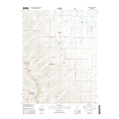
 2001 Horn Peak2005 Print · USGSThe Sangre de Cristo Mountains at the turn of the millennium are captured here in high detail. Hikers and historians can trace the paths of the Rainbow Trail and Venable Trail past landmarks like Horn Peak and Macey Lake.
 - 2011 Map of Horn Peak, 2011 Print
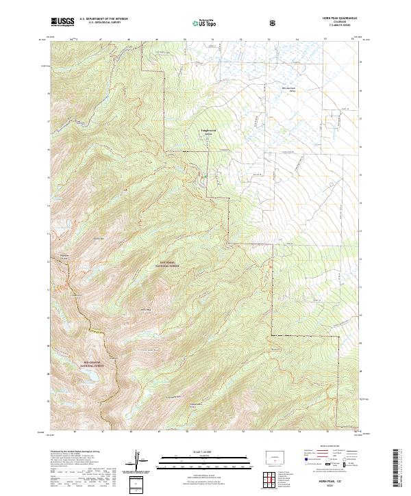
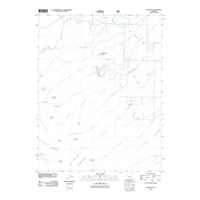 2011 Horn Peak2011 Print · USGSCovers Tanglewood Acres, including Saguache County, Custer County, and other nearby areas
 - 2013 Map of Horn Peak, 2013 Print
 2013 Horn Peak2013 Print · USGSCovers Tanglewood Acres, including Saguache County, Custer County, and other nearby areas
 - 2016 Map of Horn Peak, 2016 Print
 2016 Horn Peak2016 Print · USGSCovers Tanglewood Acres, including Saguache County, Custer County, and other nearby areas
 - 2019 Map of Horn Peak, 2019 Print
 2019 Horn Peak2019 Print · USGSCovers Tanglewood Acres, including Saguache County, Custer County, and other nearby areas
 - 2022 Map of Horn Peak, 2022 Print
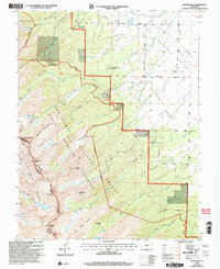
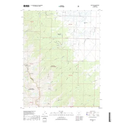
 2022 Horn Peak2022 Print · USGSThe Sangre de Cristo high country meets the Wet Mountain Valley in the 2020s, highlighting the transition from alpine peaks to valley settlements. Researchers can trace the paths of the Rainbow Trl past landmarks like Horn Peak and Tanglewood Acres.
End of results
Showing maps 1-15 of 15
Top cities near Tanglewood Acres
Frequently asked questions
- What are the different types of historical maps available for Tanglewood Acres?
- What is the oldest map of Tanglewood Acres?
- Where can I purchase historical maps of Tanglewood Acres for my home or office?
- Where can I download high-res historical maps of Tanglewood Acres?
- Are there historical topographic maps available for Tanglewood Acres?
- Is there historical aerial imagery available for Tanglewood Acres?
- Where are historical maps of Tanglewood Acres sourced from?