Old Maps of Douglas County, Colorado for Hiking & Exploration
Hike through history with 164 historic maps of Douglas County. Explore old trails, ghost towns, and forgotten backroads — perfect for outdoor adventurers and local explorers.
- Rediscover forgotten places: Map out old mining camps, roads, and footpaths that no longer exist on modern maps.
- Layer with modern tools: Combine with LiDAR or satellite views to plan hikes through historical terrain.
- Made for exploration: Popular among hikers, overlanders, and local history lovers.
Use these maps to find adventure and explore the hidden past of Douglas County.
Douglas County, CO maps
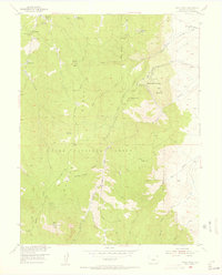
(164)- 1890 Map of East Denver
 1890 East Denver1890 Print · USGSDenver and the surrounding plains are captured in the late frontier era as a complex web of irrigation canals and iron rails. Researchers can trace early water systems like the High Line Ditch or locate early settlements such as Parker's and Scranton.
 - 1893 Map of Platte Canyon
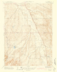
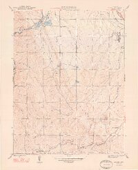
 1893 Platte Canyon1893 Print · USGSThe Front Range highlands come to life in the 1890s as the narrow-gauge Denver South Park and Pacific RR snakes through the mountains. Trace early mountain settlements like Pine Grove and Estabrook along the steep turns of South Platte Canyon.8 unique versions available
 - 1894 Map of Castle Rock
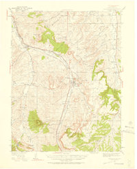
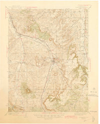
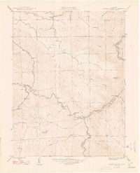
 1894 Castle Rock1894 Print · USGSThe Front Range high country in the 1890s reveals a landscape of ranching hubs and competing rail lines. Trace early transit routes like the Denver and Rio Grande Railroad through Castle Rock, Larkspur, and Monument.2 unique versions available
 - 1899 Map of West Denver
 1899 West Denver1899 Print · USGSThe Denver metropolitan area and its western foothills appear in the late Victorian era as a burgeoning rail and irrigation hub. Researchers can trace the early footprints of Denver, Golden, and Littleton, alongside industrial sites like the Louisville Coal Mine and the grounds of Fort Logan.
 - 1913 Map of Castle Rock
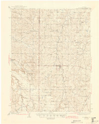
 1913 Castle Rock1913 Print · USGSThe Colorado front range at the start of the twentieth century was a landscape of high-plains ranching and vital rail junctions. Genealogists can locate family homesteads near dozens of early schools like Rock Ridge School and churches such as Bethel Church.5 unique versions available
 - 1935 Map of East Denver Nos. 3 and 4
 1935 East Denver Nos. 3 and 41935 Print · USGSSoutheast Denver and the surrounding High Plains are captured here in the mid-1930s as residential growth began to push into Douglas County. Researchers can locate early landmarks like Fairmount Cemetery, the settlement of Sullivan, and the Melvin Sch.
 - 1939 Map of Elizabeth, 1958 Print
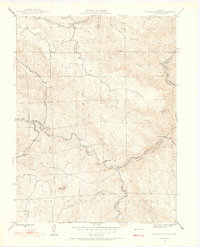
 1939 Elizabeth1958 Print · USGSRanching and early mining history converge on the Elbert County plains in the 1930s. Genealogists and historians can trace the Site of Gold Discovery by Russell and numerous rural schoolhouses like Hilltop Sch and Locust Grove Sch.4 unique versions available
 - 1940 Map of Piney Creek
 1940 Piney Creek1940 Print · USGSThe High Plains of the late Depression era come to life here as the tri-county borders of Arapahoe, Douglas, and Elbert converge. Researchers can trace the rugged drainage patterns of Piney Creek, Sulphur Gulch, and Coal Creek before the landscape was altered by modern development.
 - 1940 Map of Elbert, 1956 Print
 1940 Elbert1956 Print · USGSThe high plains of Elbert and El Paso counties are captured here in the years leading up to the mid-century, where the edge of the Black Forest meets a network of family ranches. Researchers can trace dozens of country landmarks, from the Chicago Rock Island & Pacific railroad to schoolhouses like James Sch and Sidney Sch.2 unique versions available
 - 1940 Map of Castle Rock, 1958 Print
 1940 Castle Rock1958 Print · USGSDouglas County ranching and rail life are captured here just before the mid-century, centered on the growing crossroads of Castle Rock. Genealogists can locate family-named landmarks and rural schools like Fonder Sch or trace the Bear Canyon Cem near Sedalia.3 unique versions available
 - 1942 Map of Highland Ranch
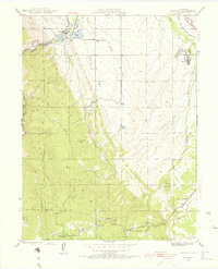
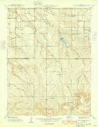
 1942 Highland Ranch1942 Print · USGSThe northern Douglas County ranchlands appear here in the early 1940s as a quiet expanse of large family estates and critical water canals. Researchers can trace the early boundaries of Highland Ranch, locate the Cheese Ranch, and find rural landmarks like Curtis Sch and the Englewood Dam.
 - 1942 Map of Parker
 1942 Parker1942 Print · USGSSoutheast of Denver in the late thirties and early forties, this landscape shows the rural agricultural roots and water management systems of Douglas County. Genealogists can locate family-named landmarks and community centers like Parker, Melvin, and the Happy Canyon Sch.
 - 1942 Map of Littleton
 1942 Littleton1942 Print · USGSLittleton and the South Platte River valley appear here just before the mid-century boom, shaped by a vital network of railroads and reservoirs. Researchers can trace early rural life at Deer Creek Sch, the riverside siding at Struby, and the waters of Marston Lake.2 unique versions available
 - 1942 Map of Piney Creek
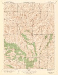 1942 Piney Creek1942 Print · USGSThe Colorado high plains southeast of Denver appear as a quiet rural landscape in the early 1940s, just as modern infrastructure began to take shape. Genealogists and historians can trace the early drainage and road networks along Piney Creek, Sulphur Gulch, and Coal Creek.2 unique versions available
 - 1944 Map of Elbert
 1944 Elbert1944 Print · USGSRanching and rural education define this Elbert County landscape in the mid-1940s. Genealogists can trace family landmarks like the Ten-Sleep Ranch or locate vanished school sites like James Sch and Sidney Sch.2 unique versions available
 - 1945 Map of Castle Rock
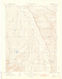
 1945 Castle Rock1945 Print · USGSDouglas County's railway and ranching corridors come to life in the mid-1940s as two major railroads compete for space along the Plum Creek valley. Researchers can trace old family sites and rural institutions like the Pikes Peak Grange Hall, Bear Canyon Cem, and the Clay Mine.2 unique versions available
 - 1945 Map of Elizabeth
 1945 Elizabeth1945 Print · USGSThe ranching and mining country along the Douglas and Elbert county line comes to life in this mid-century survey. Genealogists can trace family landmarks like the Idelweiss Ranch, Miller Cem, and the notable Site of Gold Discovery by Russell.2 unique versions available
 - 1945 Map of Platte Canyon, 1955 Print
 1945 Platte Canyon1955 Print · USGSJefferson and Douglas counties appear here during the mid-1940s, centered on the strategic water gaps of the Front Range. Researchers can trace rural school locations like Lamb Sch and explore small settlements such as Foxton and Longview.2 unique versions available
 - 1945 Map of Kassler, 1956 Print
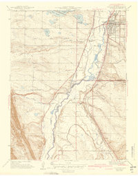
 1945 Kassler1956 Print · USGSDouglas County and Jefferson County were shaped by water and rail at the end of the Second World War. Researchers can trace the Highline Canal and old rural schoolhouses like Jarre Canyon Sch or visit the once-active settlement of Kassler near the river.2 unique versions available
 - 1948 Map of Kassler
 1948 Kassler1948 Print · USGSThe foothills of Douglas County appear here in the late 1940s, highlighting the vital water and rail corridors south of Denver. Genealogists and local historians can locate small rural schoolhouses like Jarre Canyon Sch and the rail station at Louviers.2 unique versions available
 - 1948 Map of Platte Canyon
 1948 Platte Canyon1948 Print · USGSThe South Platte canyon region in the late 1940s reveals a network of mountain settlements and water infrastructure. Genealogists can locate family sites near South Platte, Foxton, and the Lamb Sch, or trace the winding course of the South Platte River.2 unique versions available
 - 1949 Map of Highland Ranch
 1949 Highland Ranch1949 Print · USGSArapahoe and Douglas counties were still defined by sprawling cattle operations and critical water infrastructure during the late 1940s. Genealogists and local historians can locate early landmarks like Cheese Ranch, Curtis Sch, and the original Highland Ranch headquarters.2 unique versions available
 - 1949 Map of Parker
 1949 Parker1949 Print · USGSThe high plains south of Denver are captured here in the late 1940s, a period of rural agriculture before the region's rapid suburban growth. Genealogists and historians can trace old homestead routes and irrigation works like the Arapaho Canal or find the sites of Cherry Creek Sch and Melvin.
 - 1953 Map of Denver, 1964 Print
 1953 Denver1964 Print · USGSDenver and the Colorado Front Range are captured here during a decade of post-war growth and military expansion. Researchers can trace the sprawling rail lines of the Union Pacific, locate the State Capitol, and explore historic mountain mining hubs like Central City.6 unique versions available
 - 1954 Map of Devils Head, 1955 Print
 1954 Devils Head1955 Print · USGSThe Rampart Range comes to life in the mid-1950s, showing a mix of rugged ranching and spiritual seclusion. Trace the locations of Shamballah-Ashrama, the Devils Head Lookout Tower, and the Hy-Way Hereford Ranch.9 unique versions available
Showing maps 1-25 of 164
Top cities of Douglas County
- Highlands Ranch historical maps
- Castle Rock historical maps
- Parker historical maps
- Lone Tree historical maps
- Sedaila historical maps
- Larkspur historical maps
Frequently asked questions
- What are the different types of historical maps available for Douglas County?
- What is the oldest map of Douglas County?
- Where can I purchase historical maps of Douglas County for my home or office?
- Where can I download high-res historical maps of Douglas County?
- Are there historical topographic maps available for Douglas County?
- Is there historical aerial imagery available for Douglas County?
- Where are historical maps of Douglas County sourced from?