
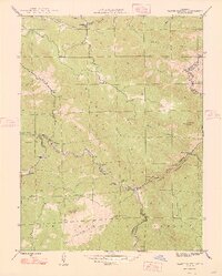
1948 Map of Platte Canyon
USGS Topo · Published 1948About this map
The South Platte River carves a deep path through the canyon in this 1945 survey, where the Jefferson and Douglas county lines meet at the water’s edge. The small settlement of South Platte serves as a central hub in the river valley, supported by the South Platte Sch and connected to outlying mountain communities like Foxton and Buffalo Park. Steep drainage systems including Deer Creek and Kennedy Gulch define the vertical relief, culminating in landmarks like Turkshead Peak and Raleigh Peak. A critical piece of infrastructure, the Intake, is positioned on the river near Strontia Springs, reflecting the area's importance to the Denver water system. Researchers will find a landscape where isolated homesteads and small mountain schools like Lamb Sch were still the primary markers of human presence in the front range backcountry before modern development moved in.
Find a feature on this map
37 named features on this map. Tap any name to fly to it.
Don’t see what you’re looking for? This feature index may not catch every label — zoom into the map to look around manually.
Map Details
Editions of this 1948 Platte Canyon Map
2 editions found
Other maps of this area

1893 · Platte Canyon
USGS Topo · 1:125,000

1899 · West Denver
USGS Topo · 1:125,000

1942 · Littleton
USGS Topo · 1:31,680

1945 · Indian Hills
USGS Topo · 1:31,680

1945 · Platte Canyon
USGS Topo · 1:24,000

1945 · Pine
USGS Topo · 1:24,000

1945 · Kassler
USGS Topo · 1:24,000

1948 · Kassler
USGS Topo · 1:24,000

1948 · Pine
USGS Topo · 1:24,000

1953 · Denver
USGS Topo · 1:250,000