Old Maps of Almont, Colorado for Hiking & Exploration
Hike through history with 12 historic maps of Almont. Explore old trails, ghost towns, and forgotten backroads — perfect for outdoor adventurers and local explorers.
- Rediscover forgotten places: Map out old mining camps, roads, and footpaths that no longer exist on modern maps.
- Layer with modern tools: Combine with LiDAR or satellite views to plan hikes through historical terrain.
- Made for exploration: Popular among hikers, overlanders, and local history lovers.
Use these maps to find adventure and explore the hidden past of Almont.
Almont, CO maps
(12)- 1956 Map of Montrose, 1963 Print
 1956 Montrose1963 Print · USGSThe Colorado western slope in the late fifties and early sixties shows a landscape defined by the Denver & Rio Grande Western RR and the Gunnison River. Trace the development of Blue Mesa Reservoir or locate high-country sites like the Bachelor Mine.3 unique versions available
 - 1959 Map of Montrose
 1959 Montrose1959 Print · USGSWestern Colorado in the late fifties is defined by the high peaks and river valleys of the Southern Rockies. Genealogists and historians can trace the paths of the Denver & Rio Grande Western RR or locate mountain settlements like Crawford, Lazear, and Doyleville.
 - 1960 Map of Montrose
 1960 Montrose1960 Print · USGSThe Colorado high country in the mid-fifties is captured here during a period of steady ranching and persistent mining. Researchers can trace the path of the Denver & Rio Grande Western RR or locate small settlements like Somerset, Maher, and Sargent.2 unique versions available
 - 1964 Map of Almont, 1967 Print
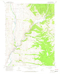 1964 Almont1967 Print · USGSGunnison County is documented in the mid-1960s at the junction of two major mountain rivers. Trace the valley's development and transport history through the Old Railroad Grade, the Roaring Judy Fish Hatchery, and the settlement at Almont.5 unique versions available
 - 1968 Map of Montrose
 1968 Montrose1968 Print · USGSThe Western Slope and Continental Divide meet in the late sixties, showing the vital river valleys and high-mountain mining districts. Trace the historic route of the Denver and Rio Grande Western RR or locate small settlements like Sargents and Powderhorn.
 - 1984 Map of Gunnison
 1984 Gunnison1984 Print · USGSHigh mountain passes and historic mining districts define this mid-eighties record of the central Colorado Rockies. Genealogists and historians can trace the foundations of Gunnison and Crested Butte or locate remote sites like St Elmo, Tincup, and Hancock.2 unique versions available
 - 2001 Map of Almont, 2004 Print
 2001 Almont2004 Print · USGSAlmont sits at the birth of the Gunnison River at the turn of the twenty-first century, where mountain waters meet forest management. Genealogists and researchers can locate the small settlement of Jacks Cabin, the local Cem, and the Rippers Work Center within the Gunnison National Forest.
 - 2011 Map of Almont, 2011 Print
 2011 Almont2011 Print · USGSCovers Almont, including Gunnison County, United States, and other nearby areas
 - 2013 Map of Almont, 2013 Print
 2013 Almont2013 Print · USGSCovers Almont, including Gunnison County, United States, and other nearby areas
 - 2016 Map of Almont, 2016 Print
 2016 Almont2016 Print · USGSCovers Almont, including Gunnison County, United States, and other nearby areas
 - 2019 Map of Almont, 2019 Print
 2019 Almont2019 Print · USGSCovers Almont, including Gunnison County, United States, and other nearby areas
 - 2022 Map of Almont, 2022 Print
 2022 Almont2022 Print · USGSThe confluence of the Taylor and East rivers takes center stage in this Gunnison County study, showing the high-country landscape at the start of the 2020s. Genealogists and local historians can locate Jacks Cabin Cem and trace the irrigation networks of the Gunnison Highline Canal and E River Number 2 Ditch.
End of results
Showing maps 1-12 of 12
Top cities near Almont
Frequently asked questions
- What are the different types of historical maps available for Almont?
- What is the oldest map of Almont?
- Where can I purchase historical maps of Almont for my home or office?
- Where can I download high-res historical maps of Almont?
- Are there historical topographic maps available for Almont?
- Is there historical aerial imagery available for Almont?
- Where are historical maps of Almont sourced from?