Old Maps of Sapinero, Colorado for Genealogy
Trace your family roots with 14 historic maps of Sapinero. These high-res maps reveal old neighborhoods, homesites, landmarks, and streets — helping you uncover where your ancestors lived and how the area evolved over time.
- Explore historic neighborhoods: Identify where your relatives may have lived in the 1800s or 1900s.
- Compare maps over time: Trace the changes in streets, buildings, and landmarks for multi-generational research.
- Perfect for genealogy & ancestry research: Used by family historians and researchers to map out lineage and migration.
These maps are an incredible resource for exploring your personal connection to Sapinero's past.
Sapinero, CO maps
(14)- 1908 Map of Uncompahgre, 1954 Print
 1908 Uncompahgre1954 Print · USGSThe Gunnison River canyon and high mesas defined life in this corner of Colorado during the early twentieth century. Genealogists and historians can trace the Denver and Rio Grande Railroad line through mountain outposts like Sapinero, Cebolla, and the Gunnison Mine.2 unique versions available
 - 1911 Map of Uncompahgre
 1911 Uncompahgre1911 Print · USGSThe Colorado high country at the start of the twentieth century reveals a landscape of isolated mining camps and vital mountain railways. Genealogists and historians can trace the Denver and Rio Grande RR through Sapinero to remote operations like the Gunnison Mine and Capitol City.2 unique versions available
 - 1954 Map of Sapinero, 1956 Print
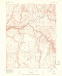 1954 Sapinero1956 Print · USGSSapinero and the Gunnison River valley are captured in the mid-fifties, shortly before the valley floor was transformed. Genealogists and researchers can trace the original location of Sapinero, the Sapinero Cemetery, and landmarks like Elizonde Ranch or the Sapinero Ranger Sta.10 unique versions available
 - 1956 Map of Montrose, 1963 Print
 1956 Montrose1963 Print · USGSThe Colorado western slope in the late fifties and early sixties shows a landscape defined by the Denver & Rio Grande Western RR and the Gunnison River. Trace the development of Blue Mesa Reservoir or locate high-country sites like the Bachelor Mine.3 unique versions available
 - 1959 Map of Montrose
 1959 Montrose1959 Print · USGSWestern Colorado in the late fifties is defined by the high peaks and river valleys of the Southern Rockies. Genealogists and historians can trace the paths of the Denver & Rio Grande Western RR or locate mountain settlements like Crawford, Lazear, and Doyleville.
 - 1960 Map of Montrose
 1960 Montrose1960 Print · USGSThe Colorado high country in the mid-fifties is captured here during a period of steady ranching and persistent mining. Researchers can trace the path of the Denver & Rio Grande Western RR or locate small settlements like Somerset, Maher, and Sargent.2 unique versions available
 - 1968 Map of Montrose
 1968 Montrose1968 Print · USGSThe Western Slope and Continental Divide meet in the late sixties, showing the vital river valleys and high-mountain mining districts. Trace the historic route of the Denver and Rio Grande Western RR or locate small settlements like Sargents and Powderhorn.
 - 1983 Map of Montrose
 1983 Montrose1983 Print · USGSThe Uncompahgre Valley and high San Juan peaks come together in the early eighties, showing a landscape defined by deep canyons and mountain mining towns. Genealogists and hikers can trace old routes near Ouray, Lake City, and the Pelican Mine.2 unique versions available
 - 2001 Map of Sapinero, 2004 Print
 2001 Sapinero2004 Print · USGSGunnison County is defined by its deep canyons and rising mesas at the turn of the millennium. Genealogists and historians can locate the Sapinero settlement, the Elizondo Ranch, and the dramatic topography of the Gunnison Black Canyon of the River.
 - 2011 Map of Sapinero, 2011 Print
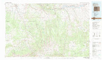
 2011 Sapinero2011 Print · USGSCovers Sapinero, including Gunnison County, United States, and other nearby areas
 - 2013 Map of Sapinero, 2013 Print
 2013 Sapinero2013 Print · USGSCovers Sapinero, including Gunnison County, United States, and other nearby areas
 - 2016 Map of Sapinero, 2016 Print
 2016 Sapinero2016 Print · USGSCovers Sapinero, including Gunnison County, United States, and other nearby areas
 - 2019 Map of Sapinero, 2019 Print
 2019 Sapinero2019 Print · USGSCovers Sapinero, including Gunnison County, United States, and other nearby areas
 - 2022 Map of Sapinero, 2022 Print
 2022 Sapinero2022 Print · USGSGunnison County's high mesa country and the flooded canyon of the Gunnison River are documented in this contemporary survey. Researchers can trace the shoreline of Blue Mesa Reservoir and locate local landmarks like Sapinero and the Dillon Pinnacles Trail.
End of results
Showing maps 1-14 of 14
Frequently asked questions
- What are the different types of historical maps available for Sapinero?
- What is the oldest map of Sapinero?
- Where can I purchase historical maps of Sapinero for my home or office?
- Where can I download high-res historical maps of Sapinero?
- Are there historical topographic maps available for Sapinero?
- Is there historical aerial imagery available for Sapinero?
- Where are historical maps of Sapinero sourced from?