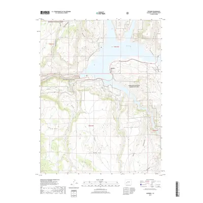
2019 Map of Sapinero
USGS Topo · Published 2019About this map
Blue Mesa Reservoir dominates the landscape near the community of Sapinero, where the waters of the Gunnison River are held within the Curecanti National Recreation Area. This high-country terrain is defined by a series of distinct flat-topped landforms, including Soap Mesa, Sapinero Mesa, Blue Mesa, and Pine Creek Mesa, which rise above deep drainages like Dillon Gulch and Cottonwood Gulch. To the west, the map details the rugged eastern reach of the Black Canyon of the Gunnison. The area serves as a significant intersection of public lands, bordering the Gunnison National Forest to the north. Transportation routes such as CO Highway 92 and the Lake City Cut-Off trace the ridges and shorelines, providing access to the recreational corridors and the Dillon Pinnacles Trail overlooking the water.
Find a feature on this map
79 named features on this map. Tap any name to fly to it.
Don’t see what you’re looking for? This feature index may not catch every label — zoom into the map to look around manually.
Map Details
Editions of this 2019 Sapinero Map
This is the sole edition of this map. No revisions or reprints were ever made.
Other maps of this area

1908 · Uncompahgre
USGS Topo · 1:125,000

1911 · Uncompahgre
USGS Topo · 1:125,000

1954 · West Elk Peak SW
USGS Topo · 1:24,000

1954 · Little Soap Park
USGS Topo · 1:24,000

1954 · Cebolla
USGS Topo · 1:24,000

1954 · Sapinero
USGS Topo · 1:24,000

1954 · Gateview
USGS Topo · 1:24,000

1956 · Curecanti Needle
USGS Topo · 1:24,000

1956 · Montrose
USGS Topo · 1:250,000

1957 · X Lazy F Ranch
USGS Topo · 1:24,000