
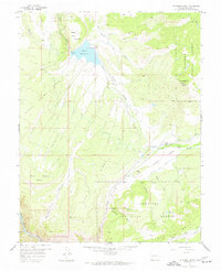
1956 Map of Curecanti Needle
USGS Topo · Published 1957About this map
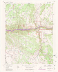
The Curecanti Needle rises sharply above the Gunnison River in this mid-1950s survey of the western Colorado highlands. The map details the transition between high mesas and the steep walls of the Black Canyon, where water sources like Mesa Creek and Myers Gulch cut through the terrain. Human presence is marked by isolated outposts such as Knott Ranch and McLeod Ranch, along with the Halfway House to the southeast. A glimpse into the region's changing settlement patterns is seen at the Rimrock Sch (Aband), while a Gaging Sta and Gravel Pit indicate the technical and industrial needs of the era. Much of the land falls within the Gunnison National Forest, punctuated by high-altitude features like Fitzpatrick Mesa and the aptly named Dry Lake.
Find a feature on this map
30 named features on this map. Tap any name to fly to it.
Don’t see what you’re looking for? This feature index may not catch every label — zoom into the map to look around manually.
Map Details
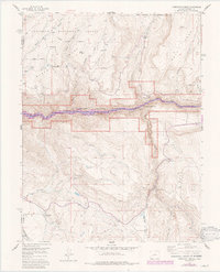
Editions of this 1956 Curecanti Needle Map
5 editions found


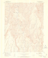
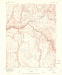
Other maps of this area

1908 · Uncompahgre
USGS Topo · 1:125,000

1909 · Montrose
USGS Topo · 1:125,000

1911 · Uncompahgre
USGS Topo · 1:125,000

1911 · Montrose
USGS Topo · 1:125,000
1954 · Little Soap Park
USGS Topo · 1:24,000
1954 · Sapinero
USGS Topo · 1:24,000

1956 · Cimarron
USGS Topo · 1:24,000

1956 · Montrose
USGS Topo · 1:250,000
1957 · Cathedral Peak
USGS Topo · 1:24,000
1957 · X Lazy F Ranch
USGS Topo · 1:24,000