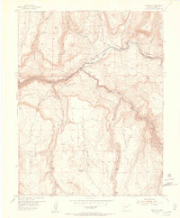
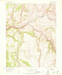
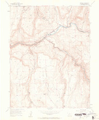
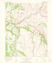
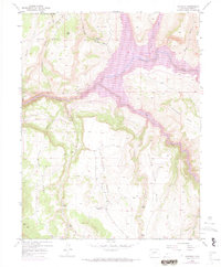
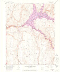
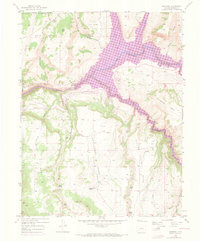
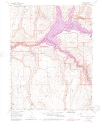
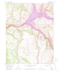
1954 Map of Sapinero
USGS Topo · Published 1956About this map
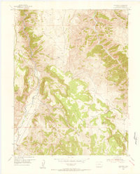
Sapinero and its surrounding river valleys define this 1954 topographic survey, conducted just years before the landscape was fundamentally altered by reservoir construction. The settlement serves as a focal point near the confluence of the Gunnison River and Lake Fork, with the Sapinero Cemetery and Sapinero Ranger Sta situated on the north bank. This era is characterized by established ranching and forest service presence, evidenced by the Elizonde Ranch and numerous Beaver Ponds tucked into the high drainage basins.
Find a feature on this map
32 named features on this map. Tap any name to fly to it.
Don’t see what you’re looking for? This feature index may not catch every label — zoom into the map to look around manually.
Map Details
Editions of this 1954 Sapinero Map
10 editions found

Other maps of this area

1908 · Uncompahgre
USGS Topo · 1:125,000

1911 · Uncompahgre
USGS Topo · 1:125,000
1954 · West Elk Peak SW
USGS Topo · 1:24,000
1954 · Little Soap Park
USGS Topo · 1:24,000
1954 · Cebolla
USGS Topo · 1:24,000
1954 · Gateview
USGS Topo · 1:24,000

1956 · Curecanti Needle
USGS Topo · 1:24,000

1956 · Montrose
USGS Topo · 1:250,000
1957 · X Lazy F Ranch
USGS Topo · 1:24,000

1959 · Montrose
USGS Topo · 1:250,000