1900-1909 Maps of Larimer County, Colorado
Explore 10 historic maps of Larimer County from 1900-1909. These maps offer a rare glimpse into what life looked like during the 1900s — showing old roads, neighborhoods, homes, and landmarks that have changed or disappeared over time.
Whether you're researching your family's past, planning a metal detecting trip, or studying how Larimer County's landscape evolved across the 1900s, these high-resolution maps are a powerful tool for exploring the history of this region.
- Focus on a specific era: All maps on this page are from the 1900s, giving you a focused view of this time period.
- See what’s changed: Compare century-old streets, trails, and buildings to today's modern landscape using overlays and satellite layers.
- Research with precision: Use these maps for genealogy, historical research, land use analysis, or educational projects.
- View, download, or print: Maps are fully viewable online in high resolution, and can be downloaded or printed for your own records.
Start exploring Larimer County's history through authentic maps from the 1900s. This is your window into the past.
Larimer County, CO maps
(10)- 1902 Map of Greeley
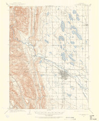
 1902 Greeley1902 Print · USGSThe northern Colorado plains come alive in this survey of the South Platte and Cache la Poudre river valleys. Researchers can trace early railroad expansion and irrigation networks while locating specific homesteads like Klugs Ranch and old coal operations such as the Black Prince Coal Mine.4 unique versions available
 - 1905 Map of Mount Olympus, 1955 Print
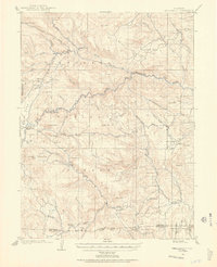 1905 Mount Olympus1955 Print · USGSLarimer County mountain life is captured here at the turn of the century as early ranching and tourism began to define the canyons. Genealogists and historians can trace family-held lands such as Pflums Ranch, stay at the Rustic Hotel, or locate the now-submerged site of Pinewood.2 unique versions available
 - 1906 Map of Loveland, 1954 Print
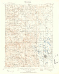
 1906 Loveland1954 Print · USGSThe Colorado plains meet the Front Range in the early 1900s, showing a landscape transformed by early irrigation and rail. Genealogists can trace family names across Loveland and Berthoud or locate rural sites like Masonville and Benson Lake.5 unique versions available
 - 1906 Map of Fort Collins, 1955 Print
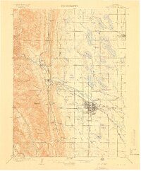
 1906 Fort Collins1955 Print · USGSFort Collins and its surrounding ranchlands are shown at the start of the century as irrigation systems began to reshape the Larimer County plains. Researchers can trace early rail spurs like the Wellington Branch and find old landmarks like the Empire Mine and Colorado State Agricultural College.4 unique versions available
 - 1907 Map of Mount Olympus
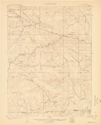 1907 Mount Olympus1907 Print · USGSLarimer County at the turn of the century shows a landscape of early cattle ranches and mountain retreats along the Thompson River. Genealogists can trace family holdings at the Plum's Ranch and Miners Ranch or locate the historic Rustic Hotel and Noland rail stop.4 unique versions available
 - 1907 Map of Livermore, 1954 Print
 1907 Livermore1954 Print · USGSLarimer County at the turn of the century shows a frontier landscape transitioning into a settled ranching and rail corridor. Genealogists and historians can trace family-named sites like Maxwell Ranch alongside early landmarks like the Forks Hotel and Campbell Grove School.2 unique versions available
 - 1908 Map of Loveland
 1908 Loveland1908 Print · USGSThe Front Range foothills of Larimer County come alive in this early 1900s survey, showing a landscape transformed by water engineering and rail. Trace the original irrigation lines like Louden Ditch and find early industrial sites like the Plaster Mill.7 unique versions available
 - 1908 Map of Fort Collins
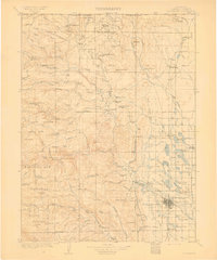
 1908 Fort Collins1908 Print · USGSNorthern Colorado at the turn of the century reveals a landscape transformed by water engineering and rail. Genealogists and historians can trace the early footprints of Fort Collins, the Colorado State Agricultural College, and local industry at the Empire Mine.4 unique versions available
 - 1908 Map of Eaton, 1957 Print
 1908 Eaton1957 Print · USGSWeld and Larimer counties are seen here in the early twentieth century as irrigation and rail lines transformed the high plains. Researchers can trace the development of agricultural hubs like Pierce and Severance alongside rural landmarks like Albert School and the Indian Springs Coal Mine.
 - 1909 Map of Livermore
 1909 Livermore1909 Print · USGSNorthern Colorado at the turn of the century shows a landscape of developing irrigation and early mountain industry. Trace the early streets of Fort Collins or find the remote Forks Hotel and Empire Mine among the foothills.4 unique versions available
End of results
Showing maps 1-10 of 10
Top cities of Larimer County
- Fort Collins historical maps
- Loveland historical maps
- Estes Park historical maps
- Wellington historical maps
- Red Feather Lakes historical maps
- Timnath historical maps
Frequently asked questions
- What are the different types of historical maps available for Larimer County?
- What is the oldest map of Larimer County?
- Where can I purchase historical maps of Larimer County for my home or office?
- Where can I download high-res historical maps of Larimer County?
- Are there historical topographic maps available for Larimer County?
- Is there historical aerial imagery available for Larimer County?
- Where are historical maps of Larimer County sourced from?