1950s Maps of Larimer County, Colorado
Explore 23 historic maps of Larimer County from the 1950s. These maps offer a rare glimpse into what life looked like during the 1950s — showing old roads, neighborhoods, homes, and landmarks that have changed or disappeared over time.
Whether you're researching your family's past, planning a metal detecting trip, or studying how Larimer County's landscape evolved across the 1950s, these high-resolution maps are a powerful tool for exploring the history of this region.
- Focus on a specific era: All maps on this page are from the 1950s, giving you a focused view of this time period.
- See what’s changed: Compare century-old streets, trails, and buildings to today's modern landscape using overlays and satellite layers.
- Research with precision: Use these maps for genealogy, historical research, land use analysis, or educational projects.
- View, download, or print: Maps are fully viewable online in high resolution, and can be downloaded or printed for your own records.
Start exploring Larimer County's history through authentic maps from the 1950s. This is your window into the past.
Larimer County, CO maps
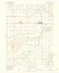
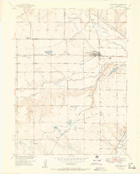
(23)- 1950 Map of Windsor
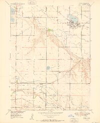 1950 Windsor1950 Print · USGSWindsor and the surrounding plains of Weld and Larimer Counties appear here in the mid-twentieth century as a thriving agricultural and rail corridor. Researchers can trace the layout of small rail stops like Kelim and Officer or locate rural landmarks like Oklahoma School and Jeffers Sch.8 unique versions available
 - 1950 Map of Kings Canyon, 1959 Print
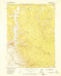
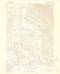
 1950 Kings Canyon1959 Print · USGSThe Colorado-Wyoming border region in the 1950s was a hub for high-country mining and specialized irrigation. Researchers can trace historic industrial sites like the Kings Canyon Mine and water infrastructure such as the Hardwork Ditch and Government Ditch.4 unique versions available
 - 1950 Map of Johnstown, 1960 Print
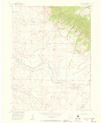
 1950 Johnstown1960 Print · USGSMid-century Larimer and Weld Counties are defined by the vital waters of the Big Thompson River and an extensive irrigation network. Genealogists and local historians can locate early landmarks like Twin Mounds School, the Elwell Cem, and the Walker Elevator.5 unique versions available
 - 1951 Map of Johnstown
 1951 Johnstown1951 Print · USGSAgriculture and industry meet at the confluence of the Thompson rivers in the early 1950s. Trace the rail-and-river economy through the Walker Elevator and local schoolhouses like Twin Mounds School or the rural Elwell settlement.2 unique versions available
 - 1952 Map of Kings Canyon
 1952 Kings Canyon1952 Print · USGSThe Colorado-Wyoming borderlands appear here in the early fifties as a rugged high-altitude frontier shaped by mining and rail. Genealogists and historians can trace the sites of Roach and Camp Nelson along the Union Pacific line.2 unique versions available
 - 1954 Map of Greeley, 1966 Print
 1954 Greeley1966 Print · USGSNorthern Colorado transitions from high-alpine peaks to the irrigated South Platte valley during this mid-century period of growth. Genealogists and historians can trace rail-connected hubs like Greeley and Longmont alongside landmarks like Horsetooth Reservoir and Estes Park.3 unique versions available
 - 1954 Map of Craig, 1973 Print
 1954 Craig1973 Print · USGSNorthwest Colorado and the high mountain parks are captured in the mid-fifties, showing the region's ranching, mining, and timber centers. Genealogists and historians can trace rail corridors like the Denver and Rio Grande Western and old towns such as Axial, Milner, and Coalmont.3 unique versions available
 - 1955 Map of Old Roach, 1957 Print
 1955 Old Roach1957 Print · USGSHigh in the mountains along the Colorado-Wyoming border in the mid-1950s, this area shows a landscape of timber and irrigation. Researchers can trace the abandoned site of Old Roach or the water systems of the Laramie River and Hohnholz Lake.5 unique versions available
 - 1955 Map of Eagle Hill, 1957 Print
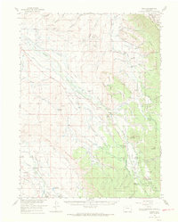
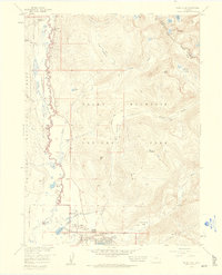
 1955 Eagle Hill1957 Print · USGSJackson County ranching and energy production intersect in the mid-1950s along the winding Canadian River. Genealogists and local historians can locate early family sites like the Dowell Homestead, Blevins Ranch, and the infrastructure of the North McCallum Oil Field.4 unique versions available
 - 1955 Map of Shipman Mountain, 1957 Print
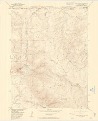
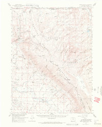
 1955 Shipman Mountain1957 Print · USGSThe high peaks and forest boundaries of Larimer and Jackson counties meet here in the mid-1950s. Trace old backcountry routes like the Paghe Trail and Medicine Bow Trail, and locate water-rights history through the Ute Ditch and Kerr Ditch.6 unique versions available
 - 1955 Map of Kings Canyon, 1969 Print
 1955 Kings Canyon1969 Print · USGSThe Colorado-Wyoming border highlands are captured in the mid-1950s, showing a remote landscape of mining claims and rugged mountain ranches. Local historians can locate the Village Belle Mine, the Old Roach (Site), and the family-named Dowell Homestead near the North Sand Hills.2 unique versions available
 - 1956 Map of Johnny Moore Mountain, 1958 Print
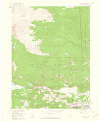
 1956 Johnny Moore Mountain1958 Print · USGSJackson County ranching and water rights take center stage in the 1950s as a complex network of ditches crosses the foothills of the Medicine Bow Mountains. Genealogists and historians can locate established family sites like Dodge Ranch and Mace Ranch alongside the high-altitude Marr Mine.7 unique versions available
 - 1956 Map of Gould, 1969 Print
 1956 Gould1969 Print · USGSJackson County ranching and mining hubs are captured here in the late fifties, showing the area as a hard-working mountain basin. Genealogists and researchers can locate family sites like Gould Ranch or the Marr Mine and the rural Haworth Sch.2 unique versions available
 - 1957 Map of Craig
 1957 Craig1957 Print · USGSNorthwest Colorado in the mid-fifties is a landscape of mountain ranching and rail-dependent river towns. Researchers can trace historic coal mining at the Sudduth Mine, follow the Denver and Rio Grande Western tracks, and locate vanished settlements like Pearl.
 - 1957 Map of Greeley
 1957 Greeley1957 Print · USGSNorthern Colorado in the mid-fifties is captured here as the agricultural plains of Weld County meet the high peaks of the Front Range. Genealogists and historians can trace rail-linked towns like Keenesburg and Roggen or locate early water features such as Boyd Lake and Fossil Creek Reservoir.
 - 1957 Map of Mc Henrys Peak, 1959 Print
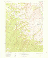
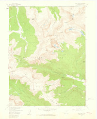
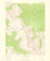 1957 Mc Henrys Peak1959 Print · USGSRocky Mountain National Park in the late 1950s reveals a high-alpine landscape defined by the Continental Divide and its massive glaciers. Trace historic climbing routes and trail networks near Mc Henrys Peak, Andrews Glacier, and Bear Lake.8 unique versions available
 - 1957 Map of Trail Ridge, 1959 Print
 1957 Trail Ridge1959 Print · USGSRocky Mountain high country in the late fifties reveals a landscape of nascent alpine tourism and rugged wilderness. Trace the winding route of Trail Ridge Road past the Ski Lodge or locate the remote Patrol Cabin near Lawn Lake.8 unique versions available
 - 1957 Map of Longs Peak, 1959 Print
 1957 Longs Peak1959 Print · USGSThe eastern gateway to the high Rockies was maturing in the late fifties, blending traditional camp life with increasing park infrastructure. Researchers can trace early hiking routes like the Storm Pass Trail and locate recreation sites such as the Cheley Camp and Marys Lake.2 unique versions available
 - 1957 Map of Estes Park, 1959 Print
 1957 Estes Park1959 Print · USGSEstes Park was already established as a primary mountain gateway in the late fifties, balancing ranching roots with growing tourism. Genealogists and researchers can trace the early layout of Estes Park, the McGraw Ranch, and landmarks like the State Fish Hatchery.
 - 1958 Map of Greeley
 1958 Greeley1958 Print · USGSNorthern Colorado and the high peaks of the Front Range appear here in the mid-fifties as the region's agricultural and rail networks were fully established. Genealogists can locate family homes near Virginia Dale, Waverly, or Kuner, and trace the path of the Union Pacific Railroad through Greeley.
 - 1958 Map of Craig
 1958 Craig1958 Print · USGSNorthwest Colorado and the High Rockies are captured here in the mid-fifties, showing a landscape of burgeoning water projects and mountain ranching. Genealogists and historians can trace old homesteads and mountain outposts from Grand Lake to Meeker, alongside industrial landmarks like Uranium Mines and the Denver and Rio Grande Western railroad.
 - 1958 Map of Fall River Pass, 1959 Print
 1958 Fall River Pass1959 Print · USGSThe high alpine pass and Continental Divide are documented here in the late fifties as tourism and water diversion shaped the landscape. Researchers can locate the Lulu City mining site and trace the engineering of the Grand Ditch and Trail Ridge Road.6 unique versions available
 - 1958 Map of Grand Lake, 1960 Print
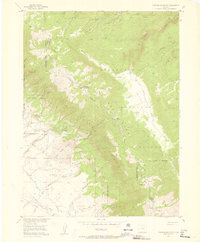
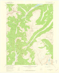
 1958 Grand Lake1960 Print · USGSThe western gateway to the high Rockies is captured here in the late fifties, showcasing a landscape of guest ranches and massive water engineering. Researchers can trace the legacy of early tourism and ranching at the Holzwarth Ranch, the Gaskil (Site), and Grand Lake Lodge.8 unique versions available
End of results
Showing maps 1-23 of 23
Top cities of Larimer County
- Fort Collins historical maps
- Loveland historical maps
- Estes Park historical maps
- Wellington historical maps
- Red Feather Lakes historical maps
- Timnath historical maps
Frequently asked questions
- What are the different types of historical maps available for Larimer County?
- What is the oldest map of Larimer County?
- Where can I purchase historical maps of Larimer County for my home or office?
- Where can I download high-res historical maps of Larimer County?
- Are there historical topographic maps available for Larimer County?
- Is there historical aerial imagery available for Larimer County?
- Where are historical maps of Larimer County sourced from?