Old Maps of Larimer County, Colorado for Metal Detecting
Plan your next treasure hunt with 386 historic maps of Larimer County. Find old homesites, ghost towns, trails, and gathering spots that may be lost to time — perfect for identifying promising metal detecting locations.
- Locate forgotten sites: Uncover places like long-lost settlements, abandoned rail lines, or gathering spots.
- Plan better hunts: Use map overlays combined with LiDAR or satellite views to narrow in on historically rich areas.
- Made for detectorists: Thousands of hobbyists use these maps to discover relics, coins, and hidden history.
Use these historic maps to boost your research and find new opportunities beneath the surface of Larimer County.
Larimer County, CO maps
(386)- 1902 Map of Greeley
 1902 Greeley1902 Print · USGSThe northern Colorado plains come alive in this survey of the South Platte and Cache la Poudre river valleys. Researchers can trace early railroad expansion and irrigation networks while locating specific homesteads like Klugs Ranch and old coal operations such as the Black Prince Coal Mine.4 unique versions available
 - 1905 Map of Mount Olympus, 1955 Print
 1905 Mount Olympus1955 Print · USGSLarimer County mountain life is captured here at the turn of the century as early ranching and tourism began to define the canyons. Genealogists and historians can trace family-held lands such as Pflums Ranch, stay at the Rustic Hotel, or locate the now-submerged site of Pinewood.2 unique versions available
 - 1906 Map of Loveland, 1954 Print
 1906 Loveland1954 Print · USGSThe Colorado plains meet the Front Range in the early 1900s, showing a landscape transformed by early irrigation and rail. Genealogists can trace family names across Loveland and Berthoud or locate rural sites like Masonville and Benson Lake.5 unique versions available
 - 1906 Map of Fort Collins, 1955 Print
 1906 Fort Collins1955 Print · USGSFort Collins and its surrounding ranchlands are shown at the start of the century as irrigation systems began to reshape the Larimer County plains. Researchers can trace early rail spurs like the Wellington Branch and find old landmarks like the Empire Mine and Colorado State Agricultural College.4 unique versions available
 - 1907 Map of Mount Olympus
 1907 Mount Olympus1907 Print · USGSLarimer County at the turn of the century shows a landscape of early cattle ranches and mountain retreats along the Thompson River. Genealogists can trace family holdings at the Plum's Ranch and Miners Ranch or locate the historic Rustic Hotel and Noland rail stop.4 unique versions available
 - 1907 Map of Livermore, 1954 Print
 1907 Livermore1954 Print · USGSLarimer County at the turn of the century shows a frontier landscape transitioning into a settled ranching and rail corridor. Genealogists and historians can trace family-named sites like Maxwell Ranch alongside early landmarks like the Forks Hotel and Campbell Grove School.2 unique versions available
 - 1908 Map of Loveland
 1908 Loveland1908 Print · USGSThe Front Range foothills of Larimer County come alive in this early 1900s survey, showing a landscape transformed by water engineering and rail. Trace the original irrigation lines like Louden Ditch and find early industrial sites like the Plaster Mill.7 unique versions available
 - 1908 Map of Fort Collins
 1908 Fort Collins1908 Print · USGSNorthern Colorado at the turn of the century reveals a landscape transformed by water engineering and rail. Genealogists and historians can trace the early footprints of Fort Collins, the Colorado State Agricultural College, and local industry at the Empire Mine.4 unique versions available
 - 1908 Map of Eaton, 1957 Print
 1908 Eaton1957 Print · USGSWeld and Larimer counties are seen here in the early twentieth century as irrigation and rail lines transformed the high plains. Researchers can trace the development of agricultural hubs like Pierce and Severance alongside rural landmarks like Albert School and the Indian Springs Coal Mine.
 - 1909 Map of Livermore
 1909 Livermore1909 Print · USGSNorthern Colorado at the turn of the century shows a landscape of developing irrigation and early mountain industry. Trace the early streets of Fort Collins or find the remote Forks Hotel and Empire Mine among the foothills.4 unique versions available
 - 1910 Map of Eaton
 1910 Eaton1910 Print · USGSNorthern Colorado at the turn of the century shows a landscape transformed by railroads and early irrigation projects. Genealogists can locate many family-named landmarks like Slaxton Ranch and rural schoolhouses including Abbot School and Birch School.3 unique versions available
 - 1915 Map of Longs Peak
 1915 Longs Peak1915 Print · USGSHigh mountain passes and early alpine settlements define this region just as the National Park system was taking root. Genealogists and hikers can trace the Ute Trail, locate the Sleepy Hollow School, or find the old Monarch PO near Grand Lake.3 unique versions available
 - 1916 Map of Home, 1954 Print
 1916 Home1954 Print · USGSHigh mountain ranching and early forestry are captured in this 1916 survey of northern Colorado as the modern park system took root. Researchers can trace historic homesteads like Williams Ranch, find the Black Mtn School, and locate the mining-era settlement of Manhattan.2 unique versions available
 - 1919 Map of Rocky Mountain National Park
 1919 Rocky Mountain National Park1919 Print · USGSThe high alpine basins of Northern Colorado are captured here in the years following the park's creation. Researchers can locate early schools and post offices like Sleepy Hollow School and Monarch PO, or trace the rail lines of the Denver and Salt Lake RR.7 unique versions available
 - 1920 Map of Home
 1920 Home1920 Print · USGSLarimer County at the end of the Great War was a landscape of high-country ranches and forest outposts. Genealogists and historians can locate family homesteads like Derby Ranch and Bennett Ranch or trace the early operations of the Black Mtn School and Manhattan.4 unique versions available
 - 1950 Map of Windsor
 1950 Windsor1950 Print · USGSWindsor and the surrounding plains of Weld and Larimer Counties appear here in the mid-twentieth century as a thriving agricultural and rail corridor. Researchers can trace the layout of small rail stops like Kelim and Officer or locate rural landmarks like Oklahoma School and Jeffers Sch.8 unique versions available
 - 1950 Map of Kings Canyon, 1959 Print
 1950 Kings Canyon1959 Print · USGSThe Colorado-Wyoming border region in the 1950s was a hub for high-country mining and specialized irrigation. Researchers can trace historic industrial sites like the Kings Canyon Mine and water infrastructure such as the Hardwork Ditch and Government Ditch.4 unique versions available
 - 1950 Map of Johnstown, 1960 Print
 1950 Johnstown1960 Print · USGSMid-century Larimer and Weld Counties are defined by the vital waters of the Big Thompson River and an extensive irrigation network. Genealogists and local historians can locate early landmarks like Twin Mounds School, the Elwell Cem, and the Walker Elevator.5 unique versions available
 - 1951 Map of Johnstown
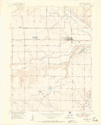 1951 Johnstown1951 Print · USGSAgriculture and industry meet at the confluence of the Thompson rivers in the early 1950s. Trace the rail-and-river economy through the Walker Elevator and local schoolhouses like Twin Mounds School or the rural Elwell settlement.2 unique versions available
 - 1952 Map of Kings Canyon
 1952 Kings Canyon1952 Print · USGSThe Colorado-Wyoming borderlands appear here in the early fifties as a rugged high-altitude frontier shaped by mining and rail. Genealogists and historians can trace the sites of Roach and Camp Nelson along the Union Pacific line.2 unique versions available
 - 1954 Map of Greeley, 1966 Print
 1954 Greeley1966 Print · USGSNorthern Colorado transitions from high-alpine peaks to the irrigated South Platte valley during this mid-century period of growth. Genealogists and historians can trace rail-connected hubs like Greeley and Longmont alongside landmarks like Horsetooth Reservoir and Estes Park.3 unique versions available
 - 1954 Map of Craig, 1973 Print
 1954 Craig1973 Print · USGSNorthwest Colorado and the high mountain parks are captured in the mid-fifties, showing the region's ranching, mining, and timber centers. Genealogists and historians can trace rail corridors like the Denver and Rio Grande Western and old towns such as Axial, Milner, and Coalmont.3 unique versions available
 - 1955 Map of Old Roach, 1957 Print
 1955 Old Roach1957 Print · USGSHigh in the mountains along the Colorado-Wyoming border in the mid-1950s, this area shows a landscape of timber and irrigation. Researchers can trace the abandoned site of Old Roach or the water systems of the Laramie River and Hohnholz Lake.5 unique versions available
 - 1955 Map of Eagle Hill, 1957 Print
 1955 Eagle Hill1957 Print · USGSJackson County ranching and energy production intersect in the mid-1950s along the winding Canadian River. Genealogists and local historians can locate early family sites like the Dowell Homestead, Blevins Ranch, and the infrastructure of the North McCallum Oil Field.4 unique versions available
 - 1955 Map of Shipman Mountain, 1957 Print
 1955 Shipman Mountain1957 Print · USGSThe high peaks and forest boundaries of Larimer and Jackson counties meet here in the mid-1950s. Trace old backcountry routes like the Paghe Trail and Medicine Bow Trail, and locate water-rights history through the Ute Ditch and Kerr Ditch.6 unique versions available
Showing maps 1-25 of 386
Top cities of Larimer County
- Fort Collins historical maps
- Loveland historical maps
- Estes Park historical maps
- Wellington historical maps
- Red Feather Lakes historical maps
- Timnath historical maps
Frequently asked questions
- What are the different types of historical maps available for Larimer County?
- What is the oldest map of Larimer County?
- Where can I purchase historical maps of Larimer County for my home or office?
- Where can I download high-res historical maps of Larimer County?
- Are there historical topographic maps available for Larimer County?
- Is there historical aerial imagery available for Larimer County?
- Where are historical maps of Larimer County sourced from?