1960s Maps of Larimer County, Colorado
Explore 53 historic maps of Larimer County from the 1960s. These maps offer a rare glimpse into what life looked like during the 1960s — showing old roads, neighborhoods, homes, and landmarks that have changed or disappeared over time.
Whether you're researching your family's past, planning a metal detecting trip, or studying how Larimer County's landscape evolved across the 1960s, these high-resolution maps are a powerful tool for exploring the history of this region.
- Focus on a specific era: All maps on this page are from the 1960s, giving you a focused view of this time period.
- See what’s changed: Compare century-old streets, trails, and buildings to today's modern landscape using overlays and satellite layers.
- Research with precision: Use these maps for genealogy, historical research, land use analysis, or educational projects.
- View, download, or print: Maps are fully viewable online in high resolution, and can be downloaded or printed for your own records.
Start exploring Larimer County's history through authentic maps from the 1960s. This is your window into the past.
Larimer County, CO maps
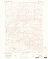
(53)- 1960 Map of Craig
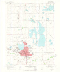
 1960 Craig1960 Print · USGSNorthwest Colorado in the 1950s is a landscape of mountain summits and industrial growth at the headwaters of the West. Genealogists and historians can trace rail-town development along the Denver and Salt Lake line, while locating Uranium Mines and settlements like Craig, Meeker, and Steamboat Springs.
 - 1960 Map of Livermore, 1962 Print
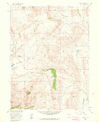 1960 Livermore1962 Print · USGSLarimer County ranching and quarrying operations are captured here during the early sixties. Researchers can trace historic water rights and early inhabitants through features like Park Creek Reservoir, the Folsom Point Discovery, and Spring Hill Ranch.4 unique versions available
 - 1960 Map of Fort Collins, 1962 Print
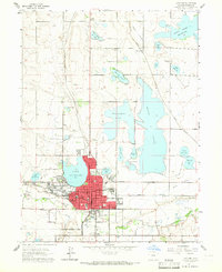
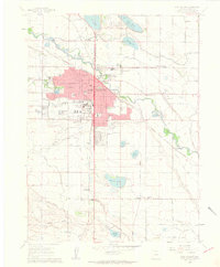 1960 Fort Collins1962 Print · USGSFort Collins during the early sixties shows a university town transitioning into a regional hub while maintaining its irrigation-fed agricultural roots. Researchers can trace historic neighborhoods near Buckingham, old burial sites at Harmony Cem, and the rail-side industry of the Sugar Refinery.6 unique versions available
 - 1960 Map of Cobb Lake, 1962 Print
 1960 Cobb Lake1962 Print · USGSWellington and the surrounding High Plains of Colorado are captured here in the early sixties, showing a landscape defined by vital water systems. Researchers can trace the Windsor Ditch, locate the Highland Cem, and explore the contours of Cactus Hill.5 unique versions available
 - 1960 Map of Buckeye, 1962 Print
 1960 Buckeye1962 Print · USGSLarimer County at the dawn of the 1960s reveals a landscape defined by ranching, water engineering, and shifting transportation. Researchers can trace the Old Railroad Grade near Ripple and explore the irrigation systems surrounding the settlement of Buckeye.5 unique versions available
 - 1960 Map of Haystack Gulch, 1962 Print
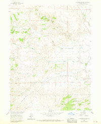
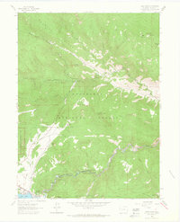
 1960 Haystack Gulch1962 Print · USGSLarimer County high country in the early sixties centers on the rugged drainage of the Rabbit Creek forks. Trace old family sites and rural landmarks like Log Cabin, the Lone Pine Sch, and Stuart Hole along the Red Feather Lakes Road.4 unique versions available
 - 1960 Map of Timnath, 1962 Print
 1960 Timnath1962 Print · USGSTimnath and the surrounding Colorado farm country are captured here at the dawn of the 1960s, defined by a complex network of irrigation canals and reservoirs. Genealogists and local historians can locate the Timnath Cem, Boxelder Sch, and rail-side settlements like Kluver and Kerns.4 unique versions available
 - 1960 Map of Berthoud, 1963 Print
 1960 Berthoud1963 Print · USGSNorthern Colorado's agricultural heartland comes into focus in the early sixties, showing the vital irrigation networks surrounding Berthoud. Trace family roots at Greenlawn Cem or locate early landmarks like Campion Academy and the Old Berthoud Sch.9 unique versions available
 - 1960 Map of Wellington, 1963 Print
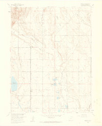
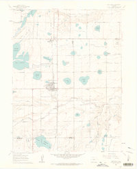
 1960 Wellington1963 Print · USGSNorth of Fort Collins in the early sixties, this region reveals a complex system of high-plains water management and rail commerce. Trace the local history of Wellington and Waverly, and locate rural landmarks like Rocky Ridge Sch and Meyers Corner.6 unique versions available
 - 1960 Map of Loveland, 1965 Print
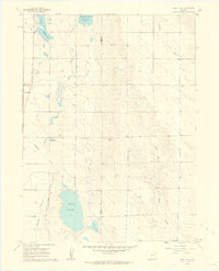
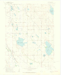
 1960 Loveland1965 Print · USGSMid-century Larimer County comes to life in this detailed map of the Loveland area and its extensive reservoir system. Researchers can trace the industrial footprint of the Sugar Refinery or locate family sites near Lakeside Cem and Trilby Corner.
 - 1960 Map of Livermore Mountain, 1968 Print
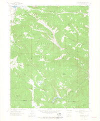
 1960 Livermore Mountain1968 Print · USGSThe Livermore area in the early 1960s was a landscape of high-country ranching and emerging mountain access. Researchers can locate the Livermore (Old Site), the Livermore Cem, and the winding North Fork Cache la Poudre River.3 unique versions available
 - 1961 Map of Estes Park
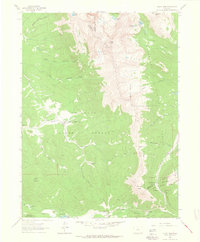
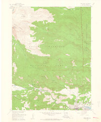 1961 Estes Park1961 Print · USGSThe Larimer County highlands appear in the early sixties as a center for mountain tourism and ranching. Genealogists and researchers can trace local landmarks like St Bartholomew, McGraw Ranch, and the State Fish Hatchery alongside the town of Estes Park.8 unique versions available
 - 1961 Map of Greeley
 1961 Greeley1961 Print · USGSNorthern Colorado's transition from high mountain peaks to irrigated plains is captured here just as the post-war population boom reached the Front Range. Researchers can trace early water infrastructure and rail lines like the Great Western RR connecting sugar beet hubs from Fort Collins to Greeley.
 - 1961 Map of Longs Peak
 1961 Longs Peak1961 Print · USGSRocky Mountain National Park and the outskirts of Estes Park are captured here in the early sixties. Researchers can trace historic climbing routes near The Keyhole or locate sites like the Eugenia Mine and the YMCA Conference Camp.8 unique versions available
 - 1961 Map of Masonville, 1973 Print
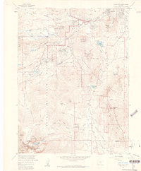
 1961 Masonville1973 Print · USGSIn the foothills of Larimer County during the early sixties and seventies, this area shows a landscape defined by water engineering and stone quarrying. Genealogists and local historians can trace family-named landmarks like Buckhorn Community Ch, the Big Thompson Sch, and the original Masonville Post Office.
 - 1962 Map of Craig
 1962 Craig1962 Print · USGSNorthwest Colorado in the early sixties is a land of high-elevation ranching and remote river valleys. Genealogists and historians can trace the Denver and Rio Grande Western rail lines and locate early settlements like Hahns Peak, Meeker, and Juniper Springs.
 - 1962 Map of Loveland, 1963 Print
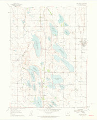
 1962 Loveland1963 Print · USGSLoveland and the surrounding Larimer County lakes are captured here in the early sixties, showing a landscape defined by water and rail. Researchers can trace the lines of the Great Western railroad, locate the Sugar Refinery, or find rural landmarks like Trilby Corner and Mt Hope Sch.4 unique versions available
 - 1962 Map of Clark Peak, 1964 Print
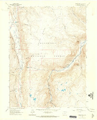
 1962 Clark Peak1964 Print · USGSThe rugged divide of the Front Range and the Medicine Bow Mountains comes into focus in the early sixties. Trace historical timber operations at Bockman Lumber Camp or explore alpine features like Clark Peak and the Michigan Ditch.6 unique versions available
 - 1962 Map of Pingree Park, 1964 Print
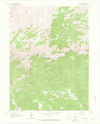
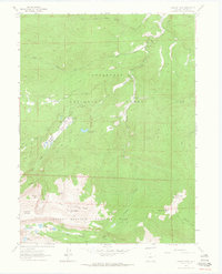 1962 Pingree Park1964 Print · USGSLarimer County high country in the early sixties shows the interface of the national forest and Rocky Mountain National Park. Researchers can trace historic ranch boundaries like Koenig Ranch or locate backcountry landmarks such as Twin Lake Reservoir and Sky Ranch.4 unique versions available
 - 1962 Map of Boston Peak, 1964 Print
 1962 Boston Peak1964 Print · USGSLarimer County high country in the early 1960s is defined by the intersection of mountain water projects and remote forest outposts. Trace the path of the Laramie-Poudre Tunnel or locate historic stops like Sportsman Lodge and Reds Place.4 unique versions available
 - 1962 Map of Glen Haven, 1964 Print
 1962 Glen Haven1964 Print · USGSLarimer County mountain life is captured here in the early sixties, showing the rugged canyon settlements before modern expansion. Genealogists and historians can trace family locations and old recreation sites from Glen Haven to the H Bar G Ranch and Loveland Heights.6 unique versions available
 - 1962 Map of Panorama Peak, 1964 Print
 1962 Panorama Peak1964 Print · USGSThe foothills of the Front Range come alive in the early sixties, showing the mountain community of Estes Park and the early development of Stanley Park. Researchers can trace the boundaries of legacy properties like Crocker Ranch, follow the winding path of Muggins Gulch, or locate remote landmarks like Pierson Park and Big Elk Meadows.7 unique versions available
 - 1962 Map of Poudre Park, 1964 Print
 1962 Poudre Park1964 Print · USGSThe Cache La Poudre River corridor in Larimer County comes alive in this early 1960s survey. Historians and outdoor enthusiasts can trace the development of riverside Mishawaka, the grounds of Stratton Park Sch, and mining history at Brinkhoff Mine.2 unique versions available
 - 1962 Map of Buckhorn Mountain, 1964 Print
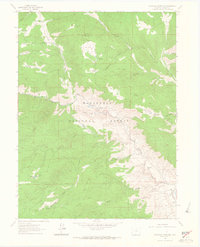 1962 Buckhorn Mountain1964 Print · USGSThe Larimer County high country in the early sixties was a landscape of forest service trails and remote camps. You can trace the primitive routes to Buckhorn Lodge or locate the settlement at Stringtown and landmarks like Mica Mine Ridge.4 unique versions available
 - 1962 Map of Comanche Peak, 1964 Print
 1962 Comanche Peak1964 Print · USGSThe high alpine country of the Front Range is captured here in the early sixties, showing the intersection of national forest and park lands. Hikers and historians can trace old routes like the Zimmerman Trail to remote landmarks including Browns Lake and Comanche Peak.4 unique versions available
Showing maps 1-25 of 53
Top cities of Larimer County
- Fort Collins historical maps
- Loveland historical maps
- Estes Park historical maps
- Wellington historical maps
- Red Feather Lakes historical maps
- Timnath historical maps
Frequently asked questions
- What are the different types of historical maps available for Larimer County?
- What is the oldest map of Larimer County?
- Where can I purchase historical maps of Larimer County for my home or office?
- Where can I download high-res historical maps of Larimer County?
- Are there historical topographic maps available for Larimer County?
- Is there historical aerial imagery available for Larimer County?
- Where are historical maps of Larimer County sourced from?