Old Maps of Ouray County, Colorado for Hiking & Exploration
Hike through history with 141 historic maps of Ouray County. Explore old trails, ghost towns, and forgotten backroads — perfect for outdoor adventurers and local explorers.
- Rediscover forgotten places: Map out old mining camps, roads, and footpaths that no longer exist on modern maps.
- Layer with modern tools: Combine with LiDAR or satellite views to plan hikes through historical terrain.
- Made for exploration: Popular among hikers, overlanders, and local history lovers.
Use these maps to find adventure and explore the hidden past of Ouray County.
Ouray County, CO maps
(141)- 1897 Map of Telluride
 1897 Telluride1897 Print · USGSMining and railroading define the San Miguel Mountains during the 1890s silver boom. Genealogists and historians can trace the foundations of Telluride and its surrounding camps, including Pandora, Ames (P.O.), and the Nellie Mine.
 - 1897 Map of Silverton
 1897 Silverton1897 Print · USGSSilverton and its surrounding mining camps are captured at their industrial peak in the mid-1890s. Trace the intricate rail networks like the Silverton and Red Mountain R.R. and locate family-named operations like the Yankee Girl Mine or Stoiber Smelter.2 unique versions available
 - 1901 Map of Silverton, 1957 Print
 1901 Silverton1957 Print · USGSSilverton was the bustling center of the San Juan silver boom when these mountain railroads were at their peak. Genealogists and historians can trace the high-altitude rail lines to remote camps like Animas Forks, Guston, and Red Mountain.
 - 1902 Map of Silverton
 1902 Silverton1902 Print · USGSSilverton and its surrounding high-country mining camps are captured here during the peak of the San Juan mountain silver boom. Genealogists and industrial historians can trace the paths of the Silverton Northern R.R. to remote outposts like Animas Forks, Eureka, and the Sunnyside Mill.4 unique versions available
 - 1902 Map of Ouray, 1963 Print
 1902 Ouray1963 Print · USGSThe mountain town of Ouray and its surrounding peaks were surveyed at the start of the twentieth century. Genealogists and historians can trace the path of the Denver and Rio Grande R. R. through Bachelor Switch, Portland, and past the waters of Lake Lenore.
 - 1904 Map of Ouray
 1904 Ouray1904 Print · USGSIn the early 1900s, the mining hub of Ouray was already a critical terminal for the Denver and Rio Grande RR. Historians can trace the industrial corridor from Portland down to Ouray, finding sites like the New York Tunnel and the Hot Springs as they appeared over a century ago.3 unique versions available
 - 1904 Map of Telluride
 1904 Telluride1904 Print · USGSThe San Juan Mountains were at the height of their mining boom when this survey was conducted at the turn of the century. Genealogists and historians can trace the intricate rail network of the Rio Grande Southern R.R. and locate storied operations like the Smuggler Mine and the community at Ophir.2 unique versions available
 - 1909 Map of Montrose, 1960 Print
 1909 Montrose1960 Print · USGSThe Uncompahgre Valley and surrounding peaks come into focus during the first decade of the twentieth century. Researchers can trace the Denver and Rio Grande Western RR through Ridgway to Bachelor Switch and the Blaine Mine.
 - 1911 Map of Montrose
 1911 Montrose1911 Print · USGSThe Uncompahgre River valley and the Denver and Rio Grande RR define the landscape of this region before the First World War. Researchers can trace the early layout of Montrose, the mining influence at Blaine Mine, and the route through Ridgway.3 unique versions available
 - 1945 Map of Durango
 1945 Durango1945 Print · USGSSouthwest Colorado and Northern New Mexico at mid-century are defined by the high peaks of the San Juan Range and the tribal lands of the Southern Ute. Genealogists and historians can trace the paths of the D & R G W RR and locate local landmarks like Animas City and the Blanco Basin School.3 unique versions available
 - 1953 Map of Durango, 1963 Print
 1953 Durango1963 Print · USGSThe high peaks of the San Juan Mountains and the Colorado mining country are shown here as they appeared in the early fifties. Genealogists and local historians can trace the rail lines of the D & R G W RR and locate historic mining camps like Silverton, Ouray, and Old Ophir.
 - 1954 Map of Durango
 1954 Durango1954 Print · USGSSouthern Colorado in the mid-1950s was defined by high-altitude mining towns and the expansion of water storage in the San Luis Valley. Trace the narrow-gauge Denver & Rio Grande Western RR as it connects Durango to mountain outposts like Silverton and Creede.2 unique versions available
 - 1955 Map of Ironton, 1957 Print
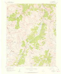 1955 Ironton1957 Print · USGSThe San Juan mining districts are captured here in the mid-fifties, showing the deep industrial roots of the Ouray and San Juan county lines. Genealogists and historians can trace the sites of Ironton, Guston, and the Revenue Mine, or locate the abandoned aerial tramway near Ingram Lake.5 unique versions available
 - 1955 Map of Ouray, 1957 Print
 1955 Ouray1957 Print · USGSOuray in the mid-fifties is captured here as a bustling mountain center defined by its deep mining heritage and rugged canyon geography. Researchers can trace the legacy of local industry through sites like the American Nettie Mine, the Silvershield Mill, and the winding Old Railroad Grade.9 unique versions available
 - 1955 Map of Telluride, 1957 Print
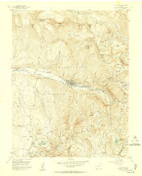 1955 Telluride1957 Print · USGSTelluride and its high-altitude mining basins are captured here during the mid-fifties, showing the town before its modern transformation. Researchers can trace historic operations like the Smuggler Mine, find the Tomboy (Ruins) townsite, and locate Lone Tree Cem.8 unique versions available
 - 1955 Map of Handies Peak, 1957 Print
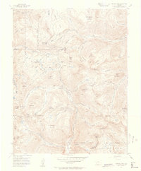 1955 Handies Peak1957 Print · USGSHigh-altitude mining camps and mountain passes characterize the San Juan Mountains during the mid-fifties. Genealogists and historians can trace the foundations of Animas Forks, the Sunnyside Mine, and the Old Lout Mine.7 unique versions available
 - 1955 Map of Telluride, 1959 Print
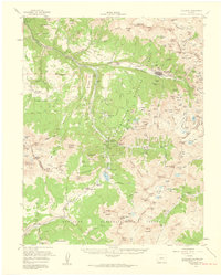 1955 Telluride1959 Print · USGSHigh in the San Miguel Mountains during the 1950s, this area shows the peak of Colorado's mining infrastructure. Genealogists and historians can trace the Rio Grande Southern Railroad past Tomboy and the Ophir Loop Sch.5 unique versions available
 - 1955 Map of Silverton, 1960 Print
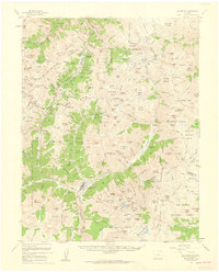 1955 Silverton1960 Print · USGSSilverton and the high San Juans are shown at a peak of mid-century mining activity, linked by rail and the mountain-hugging Million Dollar Highway. Researchers can trace historic claims and infrastructure from the Mayflower Mill to the remote Eureka and Howardsville town sites.3 unique versions available
 - 1956 Map of Montrose, 1963 Print
 1956 Montrose1963 Print · USGSThe Colorado western slope in the late fifties and early sixties shows a landscape defined by the Denver & Rio Grande Western RR and the Gunnison River. Trace the development of Blue Mesa Reservoir or locate high-country sites like the Bachelor Mine.3 unique versions available
 - 1956 Map of Moab, 1972 Print
 1956 Moab1972 Print · USGSThe Colorado Plateau and La Sal Mountains appear here in the mid-fifties, just as the uranium boom and energy exploration were reshaping the Four Corners. Researchers can trace the Denver and Rio Grande Western through Cisco or locate the remote outpost of Uravan and Looking Glass Rock.3 unique versions available
 - 1959 Map of Moab
 1959 Moab1959 Print · USGSSoutheast Utah and Western Colorado are mapped here in the late fifties, just as the uranium boom was transforming the remote canyon lands. Genealogists and historians can trace the foundations of Moab and Nucla, or locate mining sites and landmarks like Uravan and Dead Horse Point.
 - 1959 Map of Montrose
 1959 Montrose1959 Print · USGSWestern Colorado in the late fifties is defined by the high peaks and river valleys of the Southern Rockies. Genealogists and historians can trace the paths of the Denver & Rio Grande Western RR or locate mountain settlements like Crawford, Lazear, and Doyleville.
 - 1960 Map of Montrose
 1960 Montrose1960 Print · USGSThe Colorado high country in the mid-fifties is captured here during a period of steady ranching and persistent mining. Researchers can trace the path of the Denver & Rio Grande Western RR or locate small settlements like Somerset, Maher, and Sargent.2 unique versions available
 - 1960 Map of Moab
 1960 Moab1960 Print · USGSThe canyonlands and high plateaus of the Utah-Colorado border are shown here during the mid-century uranium boom. Researchers can trace the river-and-rail corridors of the Colorado River and the Denver and Rio Grande Western near Moab and Uravan.3 unique versions available
 - 1961 Map of Durango
 1961 Durango1961 Print · USGSThe high San Juan country in the early sixties is shown here as a network of historic mining towns and early reservoir projects. Genealogists and researchers can trace the Denver & Rio Grande Western RR as it connects Durango, Silverton, and Arboles.
Showing maps 1-25 of 141
Top cities of Ouray County
Frequently asked questions
- What are the different types of historical maps available for Ouray County?
- What is the oldest map of Ouray County?
- Where can I purchase historical maps of Ouray County for my home or office?
- Where can I download high-res historical maps of Ouray County?
- Are there historical topographic maps available for Ouray County?
- Is there historical aerial imagery available for Ouray County?
- Where are historical maps of Ouray County sourced from?