1980s Maps of Summit County, Colorado
Explore 10 historic maps of Summit County from the 1980s. These maps offer a rare glimpse into what life looked like during the 1980s — showing old roads, neighborhoods, homes, and landmarks that have changed or disappeared over time.
Whether you're researching your family's past, planning a metal detecting trip, or studying how Summit County's landscape evolved across the 1980s, these high-resolution maps are a powerful tool for exploring the history of this region.
- Focus on a specific era: All maps on this page are from the 1980s, giving you a focused view of this time period.
- See what’s changed: Compare century-old streets, trails, and buildings to today's modern landscape using overlays and satellite layers.
- Research with precision: Use these maps for genealogy, historical research, land use analysis, or educational projects.
- View, download, or print: Maps are fully viewable online in high resolution, and can be downloaded or printed for your own records.
Start exploring Summit County's history through authentic maps from the 1980s. This is your window into the past.
Summit County, CO maps
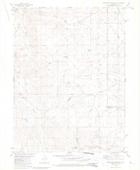
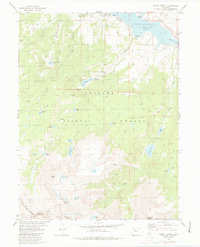
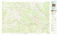
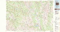
(10)- 1980 Map of Ute Peak
 1980 Ute Peak1980 Print · USGSHigh in the Colorado Rockies during the late seventies, this survey illustrates a landscape of heavy industry meeting mountain wilderness. You can trace the complex water systems serving the Henderson Mill alongside family-named landmarks like Trails End Ranch and the rugged Ute Pass.2 unique versions available
 - 1980 Map of Sheephorn Mountain
 1980 Sheephorn Mountain1980 Print · USGSThe high country of the Rockies in the late seventies is documented here as Grand, Eagle, and Summit counties meet among the peaks. You can trace early burial sites at Sheephorn Cem or follow water routes like Noonan Ditch and Gutzler Lakes.3 unique versions available
 - 1980 Map of Squaw Creek
 1980 Squaw Creek1980 Print · USGSSummit and Grand Counties in 1980 show a landscape shaped by the Blue River and the development of the Arapaho National Forest. Trace recreational history and early trails at Green Mountain Reservoir, Graveyards Campground Cem, and the Slate Creek Trail.2 unique versions available
 - 1980 Map of King Creek
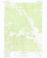
 1980 King Creek1980 Print · USGSThe High Rockies near the Grand and Summit County line come into focus during the early 1980s, centered on the Green Mountain Reservoir. Researchers can locate the settlement of Heeney, the Big Four Mine, and numerous high-altitude springs and prospects.3 unique versions available
 - 1980 Map of Piney Peak
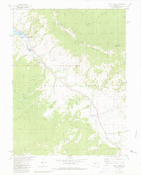
 1980 Piney Peak1980 Print · USGSThe Eagle and Summit County line follows high ridges during the late 1970s, showing a landscape shaped by water and wilderness trails. You can trace remote backcountry routes through the National Forests to landmarks like Chimney Rock, Blue Lake, and Piney Peak.3 unique versions available
 - 1980 Map of Mount Powell
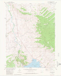
 1980 Mount Powell1980 Print · USGSThe Gore Range and Green Mountain Reservoir area come into focus in the 1980s, revealing a landscape defined by water and high-altitude wilderness. Hikers and historians can trace the paths of the Guthrie Trail and locate remote landmarks like Eagles Nest or the settlement of Heeney.3 unique versions available
 - 1980 Map of Vail, 1982 Print
 1980 Vail1982 Print · USGSThe Eagle River valley and the Gore Range are shown here in the early eighties as mountain towns evolved from mining hubs to world-class destinations. Trace the Denver and Rio Grande Western railroad or locate the Lady Belle Mine and Johnson Mine.
 - 1983 Map of Denver West
 1983 Denver West1983 Print · USGSThe Front Range and Denver's western suburbs meet in the early 1980s, documenting the era's growth from the mountain peaks to the valley floor. Genealogists and historians can trace the foundations of Lakewood and Golden, or locate high-altitude landmarks like the Moffat Tunnel and Mount Olivet Cem.2 unique versions available
 - 1983 Map of Leadville
 1983 Leadville1983 Print · USGSThe Colorado high country in the early eighties shows a landscape of world-class peaks and deep-rooted mining industry. Trace the historic tracks of the Denver and Rio Grande Western RR and locate high-altitude operations like the Climax Mine or London Mine.2 unique versions available
 - 1983 Map of Bailey
 1983 Bailey1983 Print · USGSPark County and the high Front Range are captured here during the early 1980s as traditional mountain settlements met new development patterns. Genealogists and researchers can trace the Denver and Rio Grande Western Railroad and old mountain hamlets like Bailey, Webster, and Garo.2 unique versions available
End of results
Showing maps 1-10 of 10
Top cities of Summit County
- Breckenridge historical maps
- Silverthorne historical maps
- Frisco historical maps
- Dillon historical maps
- Blue River historical maps
- Montezuma historical maps
See more
Frequently asked questions
- What are the different types of historical maps available for Summit County?
- What is the oldest map of Summit County?
- Where can I purchase historical maps of Summit County for my home or office?
- Where can I download high-res historical maps of Summit County?
- Are there historical topographic maps available for Summit County?
- Is there historical aerial imagery available for Summit County?
- Where are historical maps of Summit County sourced from?