Old Maps of Summit County, Colorado for Hiking & Exploration
Hike through history with 178 historic maps of Summit County. Explore old trails, ghost towns, and forgotten backroads — perfect for outdoor adventurers and local explorers.
- Rediscover forgotten places: Map out old mining camps, roads, and footpaths that no longer exist on modern maps.
- Layer with modern tools: Combine with LiDAR or satellite views to plan hikes through historical terrain.
- Made for exploration: Popular among hikers, overlanders, and local history lovers.
Use these maps to find adventure and explore the hidden past of Summit County.
Summit County, CO maps
(178)- 1889 Map of Leadville, 1955 Print
 1889 Leadville1955 Print · USGSThe Colorado high country at the peak of its mining era reveals a landscape of high-altitude rail lines and booming silver camps. Genealogists and historians can trace the early rail routes of the Colorado Midland Railway, find the origins of Leadville, and locate mountain settlements like Alma and Kokomo.
 - 1891 Map of Leadville
 1891 Leadville1891 Print · USGSThe Silver City and its surrounding mining camps are caught at their industrial height in the 1880s and 90s. Trace the competing rail lines and high-altitude settlements from Holy Cross City to the busy streets of Leadville and London Park City.7 unique versions available
 - 1924 Map of Montezuma
 1924 Montezuma1924 Print · USGSHigh Colorado peaks and mining camps define the landscape during the 1920s and 1930s. Genealogists and historians can trace the foundations of Montezuma and Keystone, and locate historic operations like the Hamill Mine and Waldorf Mine.2 unique versions available
 - 1926 Map of Montezuma
 1926 Montezuma1926 Print · USGSThe Continental Divide during the 1920s reveals a high-country landscape defined by its mining heritage and high mountain passes. Researchers can trace the rugged operations at the Waldorf Mine and Stevens Mine or locate the early mountain settlements of Montezuma and Swandyke.3 unique versions available
 - 1929 Map of Dillon, 1955 Print
 1929 Dillon1955 Print · USGSIn the late 1920s, the Blue River valley was a high-country network of rail stops and mining camps before the landscape was changed by major dam projects. Genealogists and historians can trace the early footprints of Dillon, Frisco, and the Colorado and Southern railroad line.2 unique versions available
 - 1933 Map of Mt. Powell
 1933 Mt. Powell1933 Print · USGSThe Colorado high country in the early thirties reveals a landscape of isolated mountain homesteads and remote federal forest lands. Genealogists and local historians can trace family locations like the Noonen Ranch or locate early rural schools including Upper Sheephorn Sch and Lakeside Sch.5 unique versions available
 - 1933 Map of Montezuma, 1956 Print
 1933 Montezuma1956 Print · USGSThe mining districts of the high Rockies are caught in a period of transition in the 1930s. Researchers can locate remote industrial sites like the Waldorf Mine and follow early mountain routes over Loveland Pass and Argentine Pass.3 unique versions available
 - 1933 Map of Ute Peak, 1959 Print
 1933 Ute Peak1959 Print · USGSThe high mountain country of Grand and Summit Counties is captured here in the early 1930s before modern development altered these drainages. Genealogists and historians can trace the locations of the Ute Park School and Hermosa School or find the remote Leal post office and Horseshoe Ranger Station.3 unique versions available
 - 1934 Map of Climax
 1934 Climax1934 Print · USGSThe Colorado high country in the mid-1930s reveals a landscape of industrial mining and high-altitude transport. Trace the routes of the Colorado and Southern RR or locate the historic mining district of Quartzville and the London Mine.
 - 1934 Map of Minturn
 1934 Minturn1934 Print · USGSThe mountain corridors of Eagle County were defined by mining and the railroad during the early nineteen-thirties. You can trace the industrial landscape of the Eagle River through settlements like Gilman, the remote Bells Camp, and the high-altitude Liberty Mine.5 unique versions available
 - 1934 Map of Dillon
 1934 Dillon1934 Print · USGSDillon and the surrounding Blue River Valley are shown here in the mid-1930s before the valley was flooded for reservoir construction. Genealogists and historians can trace the original locations of Dillon, the Dickey Ranger Sta, and mining sites like the Boss Mine.3 unique versions available
 - 1937 Map of Ute Peak
 1937 Ute Peak1937 Print · USGSGrand and Summit counties are captured here in the 1930s, when remote ranger stations and schoolhouses anchored the high timber. Trace the early road and trail networks connecting Ute Park, Leal, and the Slate Creek Ranger Sta.3 unique versions available
 - 1937 Map of Como
 1937 Como1937 Print · USGSPark County at the height of the mining era is captured here, centered on the high mountain passes and rail corridors. Genealogists and historians can trace the early footprints of Como, Jefferson, and the high-altitude Ute Mine or the remote Bakers Tank.3 unique versions available
 - 1938 Map of Mt. Lincoln
 1938 Mt. Lincoln1938 Print · USGSSummit and Park counties are captured here in the late 1930s, documenting the high-altitude mining landscape of the Tenmile Range. Researchers can trace the early footprints of Alma, the mining sites at Kokomo and London, and historic routes over Mosquito Pass.7 unique versions available
 - 1940 Map of Mount Powell
 1940 Mount Powell1940 Print · USGSThe high peaks of the Gore Range and the Blue River valley are shown here during the late 1930s. Researchers can locate remote homesteads and schools such as Abbet Place, Smith Ranch, and the Hillcrest Sch among the alpine lakes.3 unique versions available
 - 1942 Map of Leadville, 1943 Print
 1942 Leadville1943 Print · USGSHigh in the Rockies during the early war years, this area served as a critical hub for military training and mining operations. Trace the rail lines of the Denver and Rio Grande Western RR and find local landmarks like the U. S. Fish Hatchery or the Adelaide mine.
 - 1945 Map of Mount Lincoln
 1945 Mount Lincoln1945 Print · USGSBreckenridge and the surrounding mining districts were still active industrial hubs when this survey was updated in the mid-1940s. Researchers can trace historic claims and mineral landmarks such as USLM No 16 and the remote high-altitude site of Climax.2 unique versions available
 - 1949 Map of Holy Cross, 1955 Print
 1949 Holy Cross1955 Print · USGSThe Eagle River valley and the high-altitude terrain of the Sawatch Range are captured here just after the war. You can trace the military history of Camp Hale and find old mining claims like the Matchless Mine or the remote Holy Cross City.7 unique versions available
 - 1950 Map of Minturn, 1966 Print
 1950 Minturn1966 Print · USGSMid-century Eagle County was defined by deep canyons and high-altitude industry. Genealogists and historians can trace the railroad corridors of the Denver and Rio Grande Western, the mining operations at Gilman, and the footprint of Camp Hale Military Reservation.3 unique versions available
 - 1951 Map of Holy Cross
 1951 Holy Cross1951 Print · USGSHigh in the Sawatch Mountains during the post-war era, this region shows a landscape shaped by military training and alpine mining. Researchers can trace the layout of Camp Hale, locate the Homestake Mine, or find the high-altitude Evergreen Cem.2 unique versions available
 - 1953 Map of Denver, 1964 Print
 1953 Denver1964 Print · USGSDenver and the Colorado Front Range are captured here during a decade of post-war growth and military expansion. Researchers can trace the sprawling rail lines of the Union Pacific, locate the State Capitol, and explore historic mountain mining hubs like Central City.6 unique versions available
 - 1957 Map of Denver
 1957 Denver1957 Print · USGSDenver and the Colorado Front Range are seen here during a mid-century period of intense military and urban expansion. Trace the footprints of the Rocky Mountain Arsenal, the early United States Air Force Academy, and the Lowry AF Base.
 - 1957 Map of Boreas Pass, 1959 Print
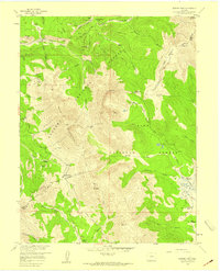 1957 Boreas Pass1959 Print · USGSThe high Divide during the late fifties reveals a landscape of transitioning industry and vanished mining camps. You can trace the remnants of high-altitude life at Parkville, the Sally Barber Mine, and the Schattinger Homestead.4 unique versions available
 - 1957 Map of Leadville, 1978 Print
 1957 Leadville1978 Print · USGSHigh-country mining and rail transport define the central Colorado Rockies during the mid-to-late twentieth century. Researchers can trace the industrial footprints of Gilman and Climax, find small rail stops like Malta, and follow the Denver and Rio Grande Western RR.2 unique versions available
 - 1958 Map of Denver
 1958 Denver1958 Print · USGSDenver and the Colorado Front Range are captured here during the mid-century suburban boom. Trace the footprints of military installations like Buckley Air Force Base alongside the established rail networks of the Colorado & Southern Ry.
Showing maps 1-25 of 178
Top cities of Summit County
- Breckenridge historical maps
- Silverthorne historical maps
- Frisco historical maps
- Dillon historical maps
- Blue River historical maps
- Montezuma historical maps
See more
Frequently asked questions
- What are the different types of historical maps available for Summit County?
- What is the oldest map of Summit County?
- Where can I purchase historical maps of Summit County for my home or office?
- Where can I download high-res historical maps of Summit County?
- Are there historical topographic maps available for Summit County?
- Is there historical aerial imagery available for Summit County?
- Where are historical maps of Summit County sourced from?