
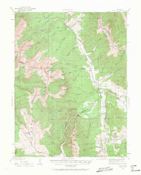
1929 Map of Dillon
USGS Topo · Published 1955About this map
The Blue River valley serves as the central corridor for this 1929 survey, documenting the region before the creation of modern reservoirs altered the landscape. Dillon stands as a primary mountain settlement, situated at the confluence of the Blue River and the Snake River, while the Colorado and Southern railroad tracks follow the river's path, connecting smaller stops like Dickey and Braddocks. This era represents a period when narrow-gauge rail lines still served the high-altitude mining and ranching economy, tracing through the terrain below the Gore Range.
Find a feature on this map
74 named features on this map. Tap any name to fly to it.
Don’t see what you’re looking for? This feature index may not catch every label — zoom into the map to look around manually.
Map Details
Editions of this 1929 Dillon Map
2 editions found
Other maps of this area

1889 · Leadville
USGS Topo · 1:125,000

1891 · Leadville
USGS Topo · 1:125,000

1924 · Montezuma
USGS Topo · 1:62,500

1924 · Fraser
USGS Topo · 1:62,500

1926 · Fraser
USGS Topo · 1:62,500

1926 · Montezuma
USGS Topo · 1:62,500

1933 · Mt. Powell
USGS Topo · 1:48,000

1933 · Montezuma
USGS Topo · 1:62,500

1933 · Ute Peak
USGS Topo · 1:62,500

1934 · Climax
USGS Topo · 1:48,000