1970s Maps of Yuma County, Colorado
Explore 33 historic maps of Yuma County from the 1970s. These maps offer a rare glimpse into what life looked like during the 1970s — showing old roads, neighborhoods, homes, and landmarks that have changed or disappeared over time.
Whether you're researching your family's past, planning a metal detecting trip, or studying how Yuma County's landscape evolved across the 1970s, these high-resolution maps are a powerful tool for exploring the history of this region.
- Focus on a specific era: All maps on this page are from the 1970s, giving you a focused view of this time period.
- See what’s changed: Compare century-old streets, trails, and buildings to today's modern landscape using overlays and satellite layers.
- Research with precision: Use these maps for genealogy, historical research, land use analysis, or educational projects.
- View, download, or print: Maps are fully viewable online in high resolution, and can be downloaded or printed for your own records.
Start exploring Yuma County's history through authentic maps from the 1970s. This is your window into the past.
Yuma County, CO maps
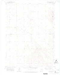
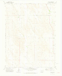
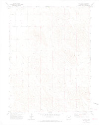
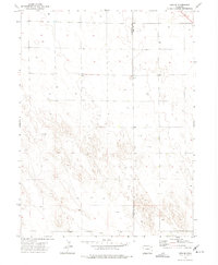
(33)- 1971 Map of Hale Ponds, 1973 Print
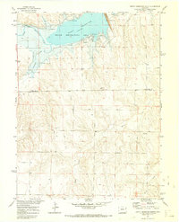
 1971 Hale Ponds1973 Print · USGSThe high plains on the Colorado and Kansas border are documented here in the early seventies, showcasing a rural landscape defined by the South Fork Republican River. Genealogists can locate family landmarks such as Gilstrap Cem, Zion Cem, and the church at Armel.
 - 1971 Map of Bonny Reservoir South, 1973 Print
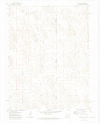
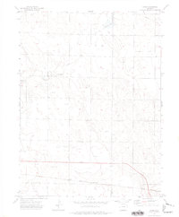
 1971 Bonny Reservoir South1973 Print · USGSThe eastern Colorado plains meet the waters of the Republican River in the early seventies, just as the regional reservoir system was fully established. Researchers can trace the shoreline of Bonny Reservoir, locate the small settlement of Knapp, and identify early leisure sites like the Campground.3 unique versions available
 - 1971 Map of Bonny Reservoir SE, 1973 Print
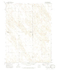
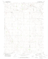
 1971 Bonny Reservoir SE1973 Print · USGSThe Colorado-Kansas borderlands are captured here in the early seventies, showing a remote landscape of high plains ranching and intricate drainage systems. Genealogists and land historians can trace property boundaries and water rights along Beaver Creek, Battle Creek, and Jaqua Creek.2 unique versions available
 - 1971 Map of Alvin NW, 1974 Print
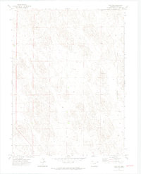
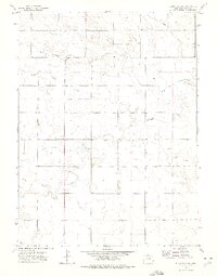
 1971 Alvin NW1974 Print · USGSThe Colorado plains at the border of Phillips and Yuma counties are captured in the early seventies, showcasing a landscape defined by cattle ranching and energy. Researchers can trace the subterranean water network through numerous Wells and the prominent diagonal path of the Pipeline near Vogus.3 unique versions available
 - 1971 Map of Alvin SW, 1974 Print
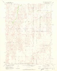
 1971 Alvin SW1974 Print · USGSYuma County during the early 1970s shows a landscape of deep-water irrigation and sparse prairie landmarks. Local historians can trace individual resources like the PIPELINE and find secluded sites such as Ceres or the lone Grave in section sixteen.3 unique versions available
 - 1971 Map of Fiddler Peak, 1974 Print
 1971 Fiddler Peak1974 Print · USGSThe Phillips and Yuma County line in the early 1970s shows a landscape of cattle ranching and scattered prairie outposts. Researchers can locate the community around Wages, the Wages Ch, and natural landmarks like Patent Creek and Fiddler Peak.
 - 1971 Map of Wauneta NE, 1974 Print
 1971 Wauneta NE1974 Print · USGSEastern Colorado land use comes into focus during the early 1970s along the Phillips and Yuma county line. Researchers can trace local names and infrastructure such as Sheridan, Hargreaves, and numerous Well sites across this section of the plains.
 - 1971 Map of Alvin, 1974 Print
 1971 Alvin1974 Print · USGSThe Colorado-Nebraska borderlands in the early seventies reveal a sparse ranching and energy landscape. Genealogists and researchers can trace the small settlement of Alvin, find family roots at Hughes Cem, and locate early utility infrastructure like the Pumping Sta.3 unique versions available
 - 1971 Map of Clarkville NE, 1974 Print
 1971 Clarkville NE1974 Print · USGSThe high plains of eastern Colorado are captured here in the early seventies, showing the sparse but organized settlement of the borderlands. Genealogists and researchers can trace rural landmarks like Ford Ch, a remote Landing Strip, and the winding path of Patent Creek.2 unique versions available
 - 1971 Map of Yuma NE, 1974 Print
 1971 Yuma NE1974 Print · USGSYuma County during the early 1970s shows a landscape transitioning with modern infrastructure and groundwater development. Researchers can trace the path of the Pipeline and locate specific sites like the local Substa or various Well placements.
 - 1971 Map of Wauneta, 1974 Print
 1971 Wauneta1974 Print · USGSThe high plains of Yuma County are captured here in the early seventies, showing a landscape defined by industrial agriculture. Researchers can locate the small settlement of Wauneta and trace the network of rural Well sites and the local Substation.3 unique versions available
 - 1971 Map of Wray NE, 1974 Print
 1971 Wray NE1974 Print · USGSThe high plains on the Colorado-Nebraska border are documented here in the early 1970s, showing a landscape shaped by ranching and resource extraction. Researchers can locate the Ceres Ranch, trace the Yuma and Dundy county line, and find a localized Gravel Pit.3 unique versions available
 - 1971 Map of Eckley NE, 1974 Print
 1971 Eckley NE1974 Print · USGSThe high plains of eastern Colorado are captured here in the early seventies, showing a landscape defined by cattle ranching and agriculture. Researchers can locate the Mullison settlement and trace vital water sources through numerous labeled wells and a local Gravel Pit.2 unique versions available
 - 1971 Map of Alvin NE, 1974 Print
 1971 Alvin NE1974 Print · USGSThe tri-state borderland between Colorado and Nebraska comes alive in this early 1970s survey of the High Plains. Genealogists and land researchers can trace property boundaries across Colorado and Nebraska near a Gravel Pit and numerous wells.3 unique versions available
 - 1971 Map of Wray NW, 1974 Print
 1971 Wray NW1974 Print · USGSYuma County during the early 1970s reveals a quiet landscape of agricultural expansion and rural utility. Researchers can trace land use through specific markers like the Bushong landmark, several Well locations, and a local Gravel Pit.3 unique versions available
 - 1971 Map of Clarkville SE, 1974 Print
 1971 Clarkville SE1974 Print · USGSYuma County in the early 1970s reveals a quiet landscape of agricultural expansion and rural community hubs. Researchers can locate remote family landmarks like Vonder or trace local history through the Pleasant Valley Ch and Buffalo Grass Ch.2 unique versions available
 - 1971 Map of Old Baldy, 1974 Print
 1971 Old Baldy1974 Print · USGSYuma County during the early 1970s shows a landscape of dispersed agricultural development and essential water infrastructure. Researchers can trace land use patterns near Old Baldy and locate numerous resource sites like Brophy and several mapped Well locations.3 unique versions available
 - 1971 Map of Eckley NW, 1974 Print
 1971 Eckley NW1974 Print · USGSYuma County’s high plains are captured in the early 1970s, showing a landscape shaped by agricultural townships and utility lines. Genealogists and historians can trace the exact placement of a Radio Tower, an underground PIPELINE, and numerous scattered Well sites.2 unique versions available
 - 1972 Map of Clarkville, 1975 Print
 1972 Clarkville1975 Print · USGSEastern Colorado ranching country is documented here in the early 1970s, at the junction of three counties. Local historians and genealogists can trace family landmarks like Rockland Cem and Bryant Cem, or locate the site of Almhof.2 unique versions available
 - 1972 Map of New Haven, 1975 Print
 1972 New Haven1975 Print · USGSThe high plains of Northeast Colorado are captured here in the early seventies, showing a quiet rural landscape at the meeting point of three counties. Genealogists and local historians can trace the early layout of New Haven and the paths of Coyote Creek and Red Willow Creek.
 - 1972 Map of Hyde, 1975 Print
 1972 Hyde1975 Print · USGSEastern Colorado's High Plains are captured here in the early seventies, showing a landscape defined by rail transport and energy extraction. Genealogists and historians can locate the Hyde Cem and trace the Burlington Northern line through Suiter and Yuma Siding.
 - 1972 Map of Lone Star, 1975 Print
 1972 Lone Star1975 Print · USGSThe high plains of the Colorado panhandle are captured in the early seventies, centered on the rural settlement of Lone Star. Genealogists and local historians can trace the paths of Rock Creek and Red Willow Creek or locate landmarks like the Meridian and isolated Well sites.
 - 1972 Map of Clarkville SW, 1975 Print
 1972 Clarkville SW1975 Print · USGSYuma County during the 1970s shows a high plains landscape defined by its vital water sources and remote community hubs. Genealogists and local historians can trace the network of agricultural sections surrounding the Red Willow Community Center and the winding paths of Surveyor Creek and Rock Creek.2 unique versions available
 - 1972 Map of Otis SE, 1975 Print
 1972 Otis SE1975 Print · USGSEastern Colorado high-plains terrain is documented in the early seventies along the Washington Co and Yuma Co line. Local historians and researchers can trace a landscape defined by industrial water access via numerous Well sites and a central Gravel Pit.
 - 1972 Map of Yuma South, 1975 Print
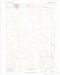 1972 Yuma South1975 Print · USGSThe town of Yuma enters the 1970s as a thriving agricultural and transportation hub on the Colorado plains. Genealogists and historians can trace the town's development through landmarks like Lake Yuma, the High Sch, and the Burlington Northern rail line.4 unique versions available
Showing maps 1-25 of 33
Top cities of Yuma County
Frequently asked questions
- What are the different types of historical maps available for Yuma County?
- What is the oldest map of Yuma County?
- Where can I purchase historical maps of Yuma County for my home or office?
- Where can I download high-res historical maps of Yuma County?
- Are there historical topographic maps available for Yuma County?
- Is there historical aerial imagery available for Yuma County?
- Where are historical maps of Yuma County sourced from?