Old Maps of Yuma County, Colorado for Academic Research
Study the evolution of Yuma County with 344 high-resolution historic maps. Whether you're teaching, researching, or modeling changes in land use, these maps provide essential visual documentation of urban, environmental, and geographic change.
- Analyze long-term change: Track patterns in development, transportation, and natural features.
- Ideal for environmental or urban studies: Support academic projects with primary historical map data.
- Use in the classroom or lab: Educators and researchers rely on these maps to bring historical context to life.
These maps are a powerful tool for teaching, research, and visualizing how Yuma County has changed over the decades.
Yuma County, CO maps
(344)- 1950 Map of Bonny Reservoir, 1952 Print
 1950 Bonny Reservoir1952 Print · USGSThe high plains of the Colorado-Kansas border were undergoing a massive transformation in the early fifties with the completion of the Bonny Dam. Genealogists and local historians can locate several family-named landmarks including Burr Ranch and the Jacobs Cem, alongside long-gone schoolhouses like Happy Hollow Sch.3 unique versions available
 - 1954 Map of Limon
 1954 Limon1954 Print · USGSThe Eastern Colorado plains and the Kansas borderlands come alive in the mid-fifties, showing the vital rail-and-road corridor through Limon. Genealogists and historians can trace the Chicago Rock Island & Pacific line through Burlington and find remote outposts like Arickaree and Anton.4 unique versions available
 - 1954 Map of Sterling
 1954 Sterling1954 Print · USGSNortheastern Colorado and the Nebraska borderlands are defined by the river-and-rail corridors of the mid-twentieth century. Researchers can trace the development of agricultural hubs from Sterling and Fort Morgan to smaller rail stops along the Union Pacific and Burlington Northern lines.3 unique versions available
 - 1957 Map of Limon
 1957 Limon1957 Print · USGSThe High Plains of Eastern Colorado and Western Kansas come alive in the mid-1950s, showing the vital rail-and-road connections of the era. You can trace the path of the Chicago Rock Island and Pacific through towns like Limon, Stratton, and Burlington or find the early footprint of Bonny Reservoir.
 - 1958 Map of Limon
 1958 Limon1958 Print · USGSEastern Colorado and the Kansas border meet in this late-fifties study of High Plains rail and river systems. Researchers can trace the path of the Chicago Rock Island and Pacific through Limon and Burlington, or locate the Bonny Dam and Bonny Reservoir.
 - 1958 Map of Sterling
 1958 Sterling1958 Print · USGSNortheastern Colorado thrived along the river and rail corridors during the late fifties. Genealogists and historians can trace family-named irrigation works like Davis Brothers Ditch and agricultural hubs from Peetz to Fort Morgan.
 - 1961 Map of Eckley, 1963 Print
 1961 Eckley1963 Print · USGSEckley and the surrounding high plains of Yuma County are documented here in the early sixties, as the region's agricultural layout was firmly established. Researchers can trace land boundaries through detailed fence lines and locate sites like the Eckley Cems, Bethel Community Hall, and the Chicago Burlington and Quincy rail line.3 unique versions available
 - 1961 Map of Robb, 1963 Print
 1961 Robb1963 Print · USGSEastern Colorado prairie life in the early sixties centers on the rail siding at Robb and the waters of the Republican River. Trace the local rail economy along the Chicago Burlington and Quincy and the conservation history at the State Fish Hatchery.2 unique versions available
 - 1961 Map of Laird, 1963 Print
 1961 Laird1963 Print · USGSThe high plains borderland at the Colorado-Nebraska-Kansas corner comes to life in the early sixties, centered on the river-and-rail corridor. Researchers can trace the path of the Chicago Burlington and Quincy railroad or locate local landmarks like Laird, Hanshaw Cem, and Sanborn.4 unique versions available
 - 1961 Map of Wray, 1963 Print
 1961 Wray1963 Print · USGSYuma County during the early sixties centers on the railroad and river systems that supported this High Plains community. Genealogists and local historians can trace the town of Wray along the North Fork Republican River, locating the Wray Cem and the Chicago Burlington and Quincy line.4 unique versions available
 - 1963 Map of Vernon, 1965 Print
 1963 Vernon1965 Print · USGSYuma County ranching country appears here in the early sixties, as the high plains transition into the canyons of the Republican River system. Genealogists and local historians can locate the Glendale Cem, the township of Vernon, and the winding paths of Black Wolf Creek and the North Fork.
 - 1963 Map of Beecher Island, 1965 Print
 1963 Beecher Island1965 Print · USGSThe Arikaree River breaks through the Yuma County high plains in the early sixties, a landscape defined by ranching and frontier history. Genealogists can trace family footprints near MK Ranch, the Lansing Valley Cem, and the notable Historical Monument at Beecher Island.3 unique versions available
 - 1963 Map of Armel, 1965 Print
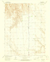 1963 Armel1965 Print · USGSThe Colorado-Kansas borderlands in the early sixties reveal a high-plains landscape of deep valleys and scattered ranching communities. Trace family roots at the Armel Cemetery, the Blue Ridge School, or the Lansing Valley Ranch.3 unique versions available
 - 1963 Map of Beecher Island NW, 1965 Print
 1963 Beecher Island NW1965 Print · USGSEastern Yuma County during the early sixties is shown as a rural landscape shaped by the Arikaree River. Researchers can trace the winding paths of Black Wolf Creek or locate local landmarks like Squaw Hill and a solitary Grave.3 unique versions available
 - 1963 Map of Willow Creek Ranch, 1965 Print
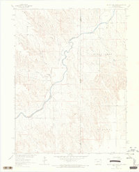 1963 Willow Creek Ranch1965 Print · USGSThe Colorado and Kansas borderlands come into focus in the early sixties as ranching and river drainage patterns define the High Plains. Genealogists and local historians can trace the Willow Creek Ranch and Ecklund settlements or locate family landmarks like Nutty Combe.
 - 1963 Map of Wildcat Canyon, 1965 Print
 1963 Wildcat Canyon1965 Print · USGSYuma County ranching and river geography are documented here during the early sixties. Genealogists and researchers can trace local family landmarks and rural outposts such as McCoy Ranch, Gerberz, and the remote stretches of the Arikaree River.2 unique versions available
 - 1968 Map of Abarr SE, 1971 Print
 1968 Abarr SE1971 Print · USGSYuma County in the late sixties shows a classic High Plains ranching landscape defined by the Arikaree River. Researchers can trace old property boundaries and land use near the Hines Ranch or locate several Gravel Pit sites and remote water wells.
 - 1968 Map of Vernon SW, 1971 Print
 1968 Vernon SW1971 Print · USGSYuma County ranching lands are captured here in the late sixties as the Missouri River Basin development program documented the High Plains. Genealogists can trace the footprint of family operations like Wingfield Ranch, McCoy Ranch, and the Arikaree River valley.
 - 1968 Map of Joes, 1971 Print
 1968 Joes1971 Print · USGSThe eastern Colorado high plains are captured in the late sixties, centered on the ranching community of Joes. Genealogists and researchers can trace the locations of the Mennonite Brethren Ch, the Winger Ranch, and Hillside Ranch.
 - 1968 Map of Bonny Reservoir North, 1971 Print
 1968 Bonny Reservoir North1971 Print · USGSYuma County ranching and water management come into focus in the late 1960s as the Bonny Reservoir fills the valley. Researchers can trace the infrastructure of the Bonny Dam and locate early sites like Moellenberg Ranch and the Hale Ditch Aqueduct.
 - 1968 Map of Spring Canyon, 1971 Print
 1968 Spring Canyon1971 Print · USGSYuma County ranching and river geography are documented here in the late sixties. Researchers can trace land use through local landmarks like Sharp Ranch and follow the paths of the Arikaree R and North Sand Creek.2 unique versions available
 - 1968 Map of Adler Creek, 1971 Print
 1968 Adler Creek1971 Print · USGSHigh plains ranching and small-town life define this Yuma County landscape in the late sixties. Researchers can locate the Liberty Sch and Liberty settlement, alongside family history markers at Olivet Cem and Adler Cem.
 - 1968 Map of Idalia, 1971 Print
 1968 Idalia1971 Print · USGSThe High Plains of Yuma County are documented here in the late sixties, centered on the community of Idalia. Genealogists and local historians can trace family roots at Lucas Memorial Cem and St John Ch or locate the old High Sch.
 - 1969 Map of Idalia SE, 1972 Print
 1969 Idalia SE1972 Print · USGSThe High Plains of eastern Colorado appear in detail during the late sixties, showing the vital irrigation network of the South Fork Republican River. Researchers can trace local history through Ritzius Sch, Belto Cem, and Spring Valley Ranch.
 - 1969 Map of Heartstrong, 1972 Print
 1969 Heartstrong1972 Print · USGSThe high plains of eastern Colorado come into focus in the late 1960s, showing a landscape shaped by groundwater and grit. Researchers can locate the central Heartstrong settlement and trace the rural community infrastructure at the Community Hall.
Showing maps 1-25 of 344
Top cities of Yuma County
Frequently asked questions
- What are the different types of historical maps available for Yuma County?
- What is the oldest map of Yuma County?
- Where can I purchase historical maps of Yuma County for my home or office?
- Where can I download high-res historical maps of Yuma County?
- Are there historical topographic maps available for Yuma County?
- Is there historical aerial imagery available for Yuma County?
- Where are historical maps of Yuma County sourced from?