Old Maps of Yuma, Colorado for Academic Research
Study the evolution of Yuma with 15 high-resolution historic maps. Whether you're teaching, researching, or modeling changes in land use, these maps provide essential visual documentation of urban, environmental, and geographic change.
- Analyze long-term change: Track patterns in development, transportation, and natural features.
- Ideal for environmental or urban studies: Support academic projects with primary historical map data.
- Use in the classroom or lab: Educators and researchers rely on these maps to bring historical context to life.
These maps are a powerful tool for teaching, research, and visualizing how Yuma has changed over the decades.
Yuma, CO maps
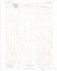
(15)- 1954 Map of Sterling
 1954 Sterling1954 Print · USGSNortheastern Colorado and the Nebraska borderlands are defined by the river-and-rail corridors of the mid-twentieth century. Researchers can trace the development of agricultural hubs from Sterling and Fort Morgan to smaller rail stops along the Union Pacific and Burlington Northern lines.3 unique versions available
 - 1958 Map of Sterling
 1958 Sterling1958 Print · USGSNortheastern Colorado thrived along the river and rail corridors during the late fifties. Genealogists and historians can trace family-named irrigation works like Davis Brothers Ditch and agricultural hubs from Peetz to Fort Morgan.
 - 1972 Map of Yuma South, 1975 Print
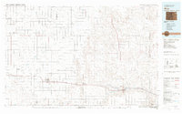
 1972 Yuma South1975 Print · USGSThe town of Yuma enters the 1970s as a thriving agricultural and transportation hub on the Colorado plains. Genealogists and historians can trace the town's development through landmarks like Lake Yuma, the High Sch, and the Burlington Northern rail line.4 unique versions available
 - 1972 Map of Yuma North, 1975 Print
 1972 Yuma North1975 Print · USGSThe northern edge of Yuma, Colorado, appears as a developing agricultural hub in the early seventies, just as the regional infrastructure was modernizing. Researchers can trace the town's expansion around the Fairground and Golf Course, or locate the historic Cem.
 - 1981 Map of Wray, 1982 Print
 1981 Wray1982 Print · USGSThe high plains at the meeting of Colorado, Nebraska, and Kansas are documented here in the early 1980s. Local researchers can trace the Burlington Northern rail corridor and locate rural landmarks like Lone Star, Glocken Hill, and Dearing Lake.
 - 2010 Map of Yuma South, 2010 Print
 2010 Yuma South2010 Print · USGSCovers Yuma, including Yuma County, United States, and other nearby areas
 - 2010 Map of Yuma North, 2010 Print
 2010 Yuma North2010 Print · USGSCovers Yuma, including Yuma County, United States, and other nearby areas
 - 2013 Map of Yuma South, 2013 Print
 2013 Yuma South2013 Print · USGSCovers Yuma, including Yuma County, United States, and other nearby areas
 - 2013 Map of Yuma North, 2013 Print
 2013 Yuma North2013 Print · USGSCovers Yuma, including Yuma County, United States, and other nearby areas
 - 2016 Map of Yuma North, 2016 Print
 2016 Yuma North2016 Print · USGSCovers Yuma, including Yuma County, United States, and other nearby areas
 - 2016 Map of Yuma South, 2016 Print
 2016 Yuma South2016 Print · USGSCovers Yuma, including Yuma County, United States, and other nearby areas
 - 2019 Map of Yuma South, 2019 Print
 2019 Yuma South2019 Print · USGSCovers Yuma, including Yuma County, United States, and other nearby areas
 - 2019 Map of Yuma North, 2019 Print
 2019 Yuma North2019 Print · USGSCovers Yuma, including Yuma County, United States, and other nearby areas
 - 2022 Map of Yuma North, 2022 Print
 2022 Yuma North2022 Print · USGSYuma and its northern prairie reaches are captured in this recent survey, showcasing the orderly growth of this agricultural hub. Genealogists and researchers can trace local family landmarks like the Yuma Municipal Cem and follow the route of Old Post Rd.
 - 2022 Map of Yuma South, 2022 Print
 2022 Yuma South2022 Print · USGSThe southern edge of Yuma and the surrounding high plains come into focus in this recent survey. Local historians can trace the growth of the town's grid south of E 2nd Ave or locate regional aviation landmarks like Koenig Airport and Yuma Municipal Airport.
End of results
Showing maps 1-15 of 15
Top cities near Yuma
Top neighborhoods of Yuma
Frequently asked questions
- What are the different types of historical maps available for Yuma?
- What is the oldest map of Yuma?
- Where can I purchase historical maps of Yuma for my home or office?
- Where can I download high-res historical maps of Yuma?
- Are there historical topographic maps available for Yuma?
- Is there historical aerial imagery available for Yuma?
- Where are historical maps of Yuma sourced from?