1950s Maps of Lower Connecticut River Valley Planning Region, Connecticut
Explore 19 historic maps of Lower Connecticut River Valley Planning Region from the 1950s. These maps offer a rare glimpse into what life looked like during the 1950s — showing old roads, neighborhoods, homes, and landmarks that have changed or disappeared over time.
Whether you're researching your family's past, planning a metal detecting trip, or studying how Lower Connecticut River Valley Planning Region's landscape evolved across the 1950s, these high-resolution maps are a powerful tool for exploring the history of this region.
- Focus on a specific era: All maps on this page are from the 1950s, giving you a focused view of this time period.
- See what’s changed: Compare century-old streets, trails, and buildings to today's modern landscape using overlays and satellite layers.
- Research with precision: Use these maps for genealogy, historical research, land use analysis, or educational projects.
- View, download, or print: Maps are fully viewable online in high resolution, and can be downloaded or printed for your own records.
Start exploring Lower Connecticut River Valley Planning Region's history through authentic maps from the 1950s. This is your window into the past.
Lower Connecticut River Valley Planning Region, CT maps
(19)- 1951 Map of Lyme
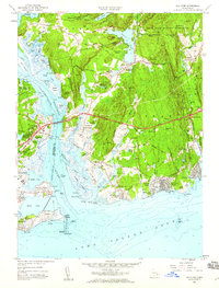
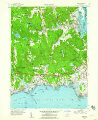
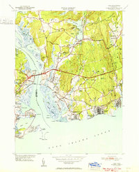 1951 Lyme1951 Print · USGSThe Connecticut shoreline at the start of the fifties shows a transition from quiet rural hills to bustling beach colonies. Trace family roots and local history at the Duck River Cem, Lynde Pt Lighthouse, and the Lyme Sta railroad stop.2 unique versions available
 - 1951 Map of Clinton, 1953 Print
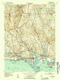 1951 Clinton1953 Print · USGSCoastal Connecticut in the early fifties shows a landscape of growing seaside communities and managed state forests. Researchers can trace the path of the New York New Haven and Hartford railroad or find historic local landmarks like the Cow Hill Red Sch and Evergreen Cem.3 unique versions available
 - 1952 Map of Deep River, 1953 Print
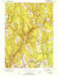
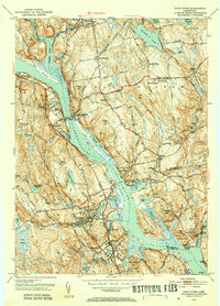 1952 Deep River1953 Print · USGSMiddlesex County life in the early fifties is centered on the river and rail lines between Moodus and Deep River. Genealogists and historians can trace family roots through numerous local landmarks like Hearse Hill Cem, Parker Cem, and Johnson Mill.3 unique versions available
 - 1952 Map of Middle Haddam, 1953 Print
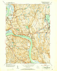 1952 Middle Haddam1953 Print · USGSMiddlesex County's riverfront communities are captured in the early 1950s as they balanced river-based industry with growing recreational areas. Researchers can trace family sites at Swedish Cem, Haddam Neck Ch, and landmarks like Eureka Mill.3 unique versions available
 - 1952 Map of Moodus, 1953 Print
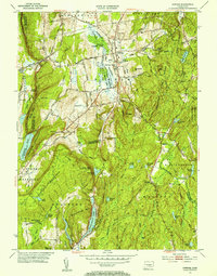
 1952 Moodus1953 Print · USGSThe Moodus area in the early fifties shows a landscape defined by industrial river power and maturing state forests. Genealogists and hikers can trace historic connections between Moodus, Leesville, and the Old Comstock Bridge while locating family plots at Bashan Lake Cem.3 unique versions available
 - 1952 Map of Middletown, 1954 Print
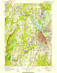 1952 Middletown1954 Print · USGSThe Connecticut River valley thrives in the early fifties as Middletown and Portland expand around their industrial and academic roots. Genealogists and historians can locate Indian Hill Cemetery, the Swedish Orphanage, and the old Brazos Quarry.3 unique versions available
 - 1952 Map of Hamburg, 1954 Print
 1952 Hamburg1954 Print · USGSIn the early 1950s, this pocket of New London County remained a landscape of dense state forests and scattered farmsteads. Researchers can trace numerous family burial sites like Millington Cem or explore the grounds of the Yale Engineering Camp and Devils Hopyard State Park.3 unique versions available
 - 1952 Map of Haddam, 1954 Print
 1952 Haddam1954 Print · USGSMiddlesex County's river-and-rail landscape is captured in the early fifties before modern development reshaped these historic Connecticut valley towns. Genealogists can trace family roots through dozen of neighborhood burial grounds like Stone House Cem and Burr District Cem or locate the Haddam Neck Sch.3 unique versions available
 - 1952 Map of Hartford South, 1954 Print
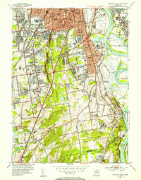 1952 Hartford South1954 Print · USGSGreater Hartford and the Connecticut River valley are shown during a period of rapid suburban growth in the early fifties. Genealogists and historians can locate family landmarks like the Cedar Hill Cemetery, Trinity College, and the State Veterans Home.4 unique versions available
 - 1953 Map of Colchester, 1954 Print
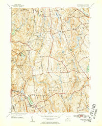
 1953 Colchester1954 Print · USGSColchester and its surrounding hamlets are captured in the early 1950s, revealing a landscape of historic crossroads and family-named corners. Genealogists can trace ancestral locations at St Johns Cem, Exeter Ch, and rural intersections like Avery Corner.7 unique versions available
 - 1953 Map of Marlborough, 1954 Print
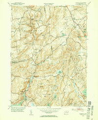
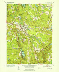
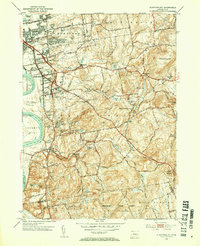
 1953 Marlborough1954 Print · USGSThis eastern Connecticut landscape near the Tolland and Hartford county line shows the region’s rural character in the early fifties. You can locate family history at Townsend Cem, trace the old New York New Haven and Hartford line, and see the early layout of Marlborough.4 unique versions available
 - 1953 Map of Durham, 1954 Print
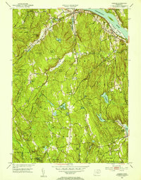
 1953 Durham1954 Print · USGSThe rural heart of Middlesex County is captured in the early fifties, showing a landscape of small crossroads villages and steep ridges. Genealogists and hikers can trace old routes like Stagecoach Road, locate the Bluff Head Cemetery, and explore the rail corridor through Reed Gap.4 unique versions available
 - 1953 Map of Glastonbury, 1954 Print
 1953 Glastonbury1954 Print · USGSGlastonbury and East Hartford are shown during a period of post-war residential growth, as new villages expanded toward the eastern ridges. Researchers can trace the layout of early housing at Welles Village, locate historic burials at Still Hill Cem, or follow the path of the New London Turnpike.3 unique versions available
 - 1954 Map of Plum Island, 1971 Print
 1954 Plum Island1971 Print · USGSCoastal Suffolk County is captured here in the mid-fifties, showing the isolated research facilities and navigation aids that define these waters. Trace the geography of the Plum Island Restricted animal disease lab, the Latham Cem, and Little Gull I.2 unique versions available
 - 1955 Map of Meriden, 1956 Print
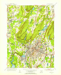 1955 Meriden1956 Print · USGSMid-century Meriden and Southington are shown here during a period of significant post-war development and infrastructure growth. Genealogists can trace family landmarks at Bishops Corner and Stillmans Corner, or locate ancestors at Walnut Grove Cem.3 unique versions available
 - 1956 Map of Orient, 1957 Print
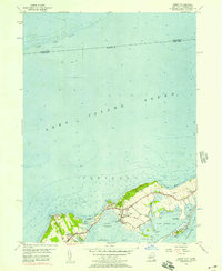 1956 Orient1957 Print · USGSThe tip of Long Island’s North Fork comes into focus in the mid-fifties, showing the maritime village of Orient and the surrounding coastal ponds. Genealogists can locate family names at Village Cem and Terry Cem, while trace the contours of Truman Beach and the Browns Hills.3 unique versions available
 - 1958 Map of Niantic, 1959 Print
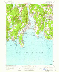 1958 Niantic1959 Print · USGSThe Connecticut coast at the dawn of the interstate era shows a mix of summer colonies and institutional history. Trace the development of Niantic and East Lyme through landmarks like the State Military Camp, Millstone Quarry, and the New London Airport.3 unique versions available
 - 1958 Map of Old Lyme, 1959 Print
 1958 Old Lyme1959 Print · USGSThe Connecticut shoreline transitions into a new era of travel just as the turnpike is being established near Old Lyme. Genealogists and historians can trace family plots at Duck River Cem or locate the old Lyme Station along the rail line.6 unique versions available
 - 1958 Map of Essex, 1960 Print
 1958 Essex1960 Print · USGSThe Connecticut coast at the end of the fifties reveals a landscape of tidal coves and growing shoreline communities. Genealogists and historians can trace family-named sites like Mares Hill, locate the Central Burying Ground, and follow the path of the New York New Haven and Hartford railroad.5 unique versions available
End of results
Showing maps 1-19 of 19
Top cities of Lower Connecticut River Valley Planning Region
- Middletown historical maps
- Clinton historical maps
- Cromwell historical maps
- East Hampton historical maps
- Old Saybrook historical maps
- Portland historical maps
See more
Frequently asked questions
- What are the different types of historical maps available for Lower Connecticut River Valley Planning Region?
- What is the oldest map of Lower Connecticut River Valley Planning Region?
- Where can I purchase historical maps of Lower Connecticut River Valley Planning Region for my home or office?
- Where can I download high-res historical maps of Lower Connecticut River Valley Planning Region?
- Are there historical topographic maps available for Lower Connecticut River Valley Planning Region?
- Is there historical aerial imagery available for Lower Connecticut River Valley Planning Region?
- Where are historical maps of Lower Connecticut River Valley Planning Region sourced from?