Old Maps of Huntington, Shelton for Metal Detecting
Plan your next treasure hunt with 17 historic maps of Huntington. Find old homesites, ghost towns, trails, and gathering spots that may be lost to time — perfect for identifying promising metal detecting locations.
- Locate forgotten sites: Uncover places like long-lost settlements, abandoned rail lines, or gathering spots.
- Plan better hunts: Use map overlays combined with LiDAR or satellite views to narrow in on historically rich areas.
- Made for detectorists: Thousands of hobbyists use these maps to discover relics, coins, and hidden history.
Use these historic maps to boost your research and find new opportunities beneath the surface of Huntington.
Huntington, Shelton maps
(17)- 1889 Map of Derby
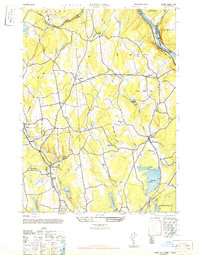
 1889 Derby1889 Print · USGSThe industrial Naugatuck Valley hums with activity in the late Victorian era as railroads and river power drive the growth of Connecticut's mill towns. Genealogists can trace family holdings near John Johnson Hill or explore the early street layouts of BIRMINGHAM, ANSONIA, and SEYMOUR.
 - 1891 Map of Derby
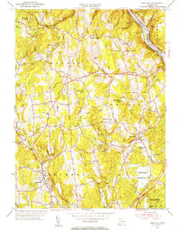
 1891 Derby1891 Print · USGSThe industrial Naugatuck Valley and the rural hills of Oxford come to life in the late nineteenth century. Genealogists and historians can trace the early footprints of Birmingham, Ansonia, and Derby or locate outlying hamlets like Quaker Farms and Red City.
 - 1893 Map of Derby, 1898 Print
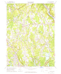
 1893 Derby1898 Print · USGSLower Naugatuck Valley industry and rural hill towns are captured in detail during the 1890s as the rail network reached its peak. Researchers can trace the industrial hearts of Birmingham and Derby or locate old crossings like Zoar Bridge and Pines Bridge.9 unique versions available
 - 1947 Map of Long Hill
 1947 Long Hill1947 Print · USGSFairfield County towns and river valleys are captured here in the years following the war. Genealogists and local historians can trace the rail lines through Long Hill and Stepney or locate landmarks like Monroe and Trap Falls Reservoir.2 unique versions available
 - 1947 Map of Hartford, 1955 Print
 1947 Hartford1955 Print · USGSSouthern New England and the Hudson Valley are shown in detail during the post-war expansion era. Genealogists and researchers can trace local landmarks from the State Capitol and Yale University to the Stratford Lighthouse and Woodlawn Cem.2 unique versions available
 - 1948 Map of Hartford
 1948 Hartford1948 Print · USGSSouthern New England is captured here in the late 1940s, showcasing a landscape of thriving industrial cities and developing parkways. Genealogists and historians can trace the rail networks of the New York New Haven and Hartford RR or locate coastal defense sites like Fort Terry and Camp Shanks.2 unique versions available
 - 1953 Map of Long Hill, 1955 Print
 1953 Long Hill1955 Print · USGSFairfield County's interior settlements and reservoir systems are captured in the early 1950s before significant modern expansion. Researchers can trace ancestral sites like Cutlers Farm Cem, find the old Monroe Sch, and locate the New York New Haven and Hartford RR along the Housatonic River.2 unique versions available
 - 1961 Map of Hartford
 1961 Hartford1961 Print · USGSSouthern New England and the Hudson Valley are shown here in the mid-fifties, capturing a landscape of booming coastal cities and interior hill towns. Researchers can trace the legacy of the New York New Haven and Hartford rail corridor and find strategic sites like Camp Shanks and Fort Michie.
 - 1962 Map of Hartford, 1971 Print
 1962 Hartford1971 Print · USGSSouthern New England and the Hudson Valley are shown in the early sixties, as suburban growth reached into the foothills. Trace the path of the New York New Haven & Hartford RR and find landmarks like Camp Nathan Hale and Gillette Castle State Park.3 unique versions available
 - 1964 Map of Long Hill, 1967 Print
 1964 Long Hill1967 Print · USGSFairfield County towns like Monroe and Huntington are shown here during the mid-1960s, reflecting a mix of rural heritage and suburban growth. Researchers can trace local history through Tungsten Mine Park, the Cutlers Farm Cem, and the Monroe Airport.3 unique versions available
 - 1965 Map of Hartford
 1965 Hartford1965 Print · USGSSouthern New England and the Hudson Valley are shown here during the mid-sixties expansion of the Interstate era. Trace the path of the New York New Haven & Hartford RR or locate historic landmarks like West Point Military Reservation and the Merritt Parkway.2 unique versions available
 - 1986 Map of Bridgeport
 1986 Bridgeport1986 Print · USGSSpanning the New York and Connecticut border in the mid-eighties, this survey shows the dense rail and parkway network connecting the Hudson to the Sound. Researchers can trace the massive New Croton Reservoir system or locate landmarks like the West Point U.S. Military Academy.3 unique versions available
 - 2012 Map of Long Hill, 2012 Print
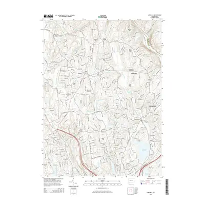
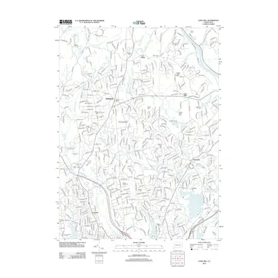 2012 Long Hill2012 Print · USGSCovers Huntington, including Stratford, Shelton, and other nearby areas
 - 2015 Map of Long Hill, 2015 Print
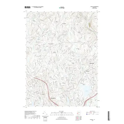
 2015 Long Hill2015 Print · USGSCovers Huntington, including Stratford, Shelton, and other nearby areas
 - 2018 Map of Long Hill, 2018 Print
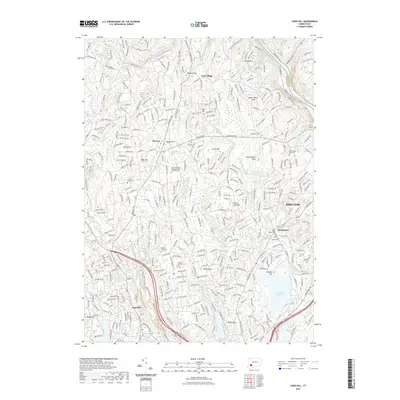
 2018 Long Hill2018 Print · USGSCovers Huntington, including Stratford, Shelton, and other nearby areas
 - 2021 Map of Long Hill, 2021 Print
 2021 Long Hill2021 Print · USGSCovers Huntington, including Stratford, Shelton, and other nearby areas
 - 2024 Map of Long Hill, 2024 Print
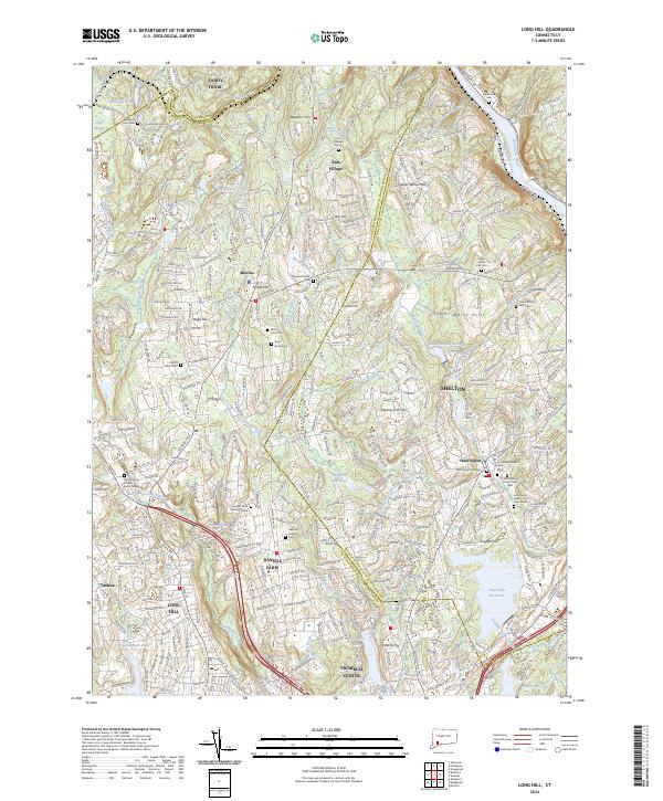 2024 Long Hill2024 Print · USGSFairfield County's upland terrain and the Housatonic River valley are shown here in the contemporary era. Researchers can trace local lineage through numerous historic sites like the Gregory Four Corners Burial Ground and Saint Johns Cem.
End of results
Showing maps 1-17 of 17
Top cities near Huntington
- Brookhaven historical maps
- Bridgeport historical maps
- New Haven historical maps
- Waterbury historical maps
- Hamden historical maps
- Fairfield historical maps
See more
Frequently asked questions
- What are the different types of historical maps available for Huntington?
- What is the oldest map of Huntington?
- Where can I purchase historical maps of Huntington for my home or office?
- Where can I download high-res historical maps of Huntington?
- Are there historical topographic maps available for Huntington?
- Is there historical aerial imagery available for Huntington?
- Where are historical maps of Huntington sourced from?