1900s (20th Century) Maps of Southeastern Connecticut Planning Region, Connecticut
Explore 88 historic maps of Southeastern Connecticut Planning Region from the 1900s (20th Century). These maps offer a rare glimpse into what life looked like during the 1900s — showing old roads, neighborhoods, homes, and landmarks that have changed or disappeared over time.
Whether you're researching your family's past, planning a metal detecting trip, or studying how Southeastern Connecticut Planning Region's landscape evolved across the 1900s, these high-resolution maps are a powerful tool for exploring the history of this region.
- Focus on a specific era: All maps on this page are from the 1900s, giving you a focused view of this time period.
- See what’s changed: Compare century-old streets, trails, and buildings to today's modern landscape using overlays and satellite layers.
- Research with precision: Use these maps for genealogy, historical research, land use analysis, or educational projects.
- View, download, or print: Maps are fully viewable online in high resolution, and can be downloaded or printed for your own records.
Start exploring Southeastern Connecticut Planning Region's history through authentic maps from the 1900s. This is your window into the past.
Southeastern Connecticut Planning Region, CT maps
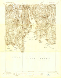
(88)- 1903 Map of Gardiners Island, 1962 Print
 1903 Gardiners Island1962 Print · USGSCovers Southeastern Connecticut Planning Region, including East Hampton, Southold, and other nearby areas
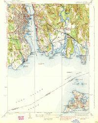
 - 1904 Map of Gardiners Island
 1904 Gardiners Island1904 Print · USGSCovers Southeastern Connecticut Planning Region, including East Hampton, Southold, and other nearby areas6 unique versions available
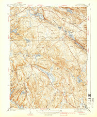
 - 1920 Map of Moosup
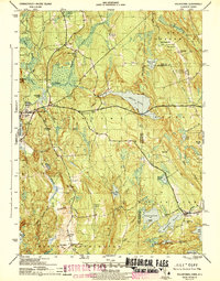
 1920 Moosup1920 Print · USGSCovers Southeastern Connecticut Planning Region, including Coventry, Plainfield, and other nearby areas
 - 1921 Map of Gardiners Island
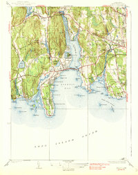
 1921 Gardiners Island1921 Print · USGSCovers Southeastern Connecticut Planning Region, including East Hampton, Southold, and other nearby areas
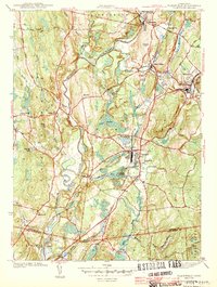
 - 1921 Map of New London
 1921 New London1921 Print · USGSCovers Southeastern Connecticut Planning Region, including Norwich, Groton, and other nearby areas
 - 1921 Map of Woodstock
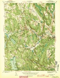
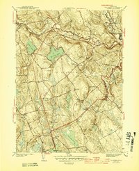
 1921 Woodstock1921 Print · USGSCovers Southeastern Connecticut Planning Region, including Mansfield, Windham, and other nearby areas
 - 1921 Map of Stonington
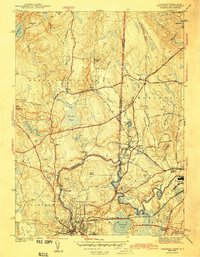
 1921 Stonington1921 Print · USGSCovers Southeastern Connecticut Planning Region, including Groton, Southold, and other nearby areas
 - 1934 Map of Niantic
 1934 Niantic1934 Print · USGSCovers Southeastern Connecticut Planning Region, including New London, Southold, and other nearby areas
 - 1935 Map of Montville
 1935 Montville1935 Print · USGSCovers Southeastern Connecticut Planning Region, including Montville, Waterford, and other nearby areas
 - 1938 Map of New London
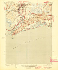
 1938 New London1938 Print · USGSCovers Southeastern Connecticut Planning Region, including Groton, New London, and other nearby areas3 unique versions available
 - 1938 Map of Niantic
 1938 Niantic1938 Print · USGSCovers Southeastern Connecticut Planning Region, including New London, Southold, and other nearby areas3 unique versions available
 - 1939 Map of Montville
 1939 Montville1939 Print · USGSCovers Southeastern Connecticut Planning Region, including Montville, Waterford, and other nearby areas3 unique versions available
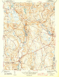
 - 1941 Map of Uncasville
 1941 Uncasville1941 Print · USGSCovers Southeastern Connecticut Planning Region, including Norwich, Groton, and other nearby areas2 unique versions available
 - 1941 Map of Lyme
 1941 Lyme1941 Print · USGSCovers Southeastern Connecticut Planning Region, including East Lyme, Old Saybrook, and other nearby areas2 unique versions available
 - 1942 Map of Block Island, 1943 Print
 1942 Block Island1943 Print · USGSCovers Southeastern Connecticut Planning Region, including Groton, South Kingstown, and other nearby areas2 unique versions available
 - 1943 Map of Voluntown
 1943 Voluntown1943 Print · USGSCovers Southeastern Connecticut Planning Region, including Griswold, Hopkinton, and other nearby areas4 unique versions available
 - 1943 Map of Plainfield
 1943 Plainfield1943 Print · USGSCovers Southeastern Connecticut Planning Region, including Plainfield, Griswold, and other nearby areas3 unique versions available
 - 1943 Map of Fitchville
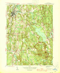
 1943 Fitchville1943 Print · USGSCovers Southeastern Connecticut Planning Region, including Norwich, Montville, and other nearby areas3 unique versions available
 - 1943 Map of Ashaway
 1943 Ashaway1943 Print · USGSCovers Southeastern Connecticut Planning Region, including Westerly, Hopkinton, and other nearby areas2 unique versions available
 - 1943 Map of Old Mystic
 1943 Old Mystic1943 Print · USGSCovers Southeastern Connecticut Planning Region, including Groton, Ledyard, and other nearby areas2 unique versions available
 - 1943 Map of Putnam, 1944 Print
 1943 Putnam1944 Print · USGSCovers Southeastern Connecticut Planning Region, including Warwick, Cranston, and other nearby areas
 - 1944 Map of Mystic
 1944 Mystic1944 Print · USGSCovers Southeastern Connecticut Planning Region, including Groton, Southold, and other nearby areas3 unique versions available
 - 1944 Map of Watch Hill
 1944 Watch Hill1944 Print · USGSCovers Southeastern Connecticut Planning Region, including Southold, Westerly, and other nearby areas2 unique versions available
 - 1944 Map of Jewett City
 1944 Jewett City1944 Print · USGSCovers Southeastern Connecticut Planning Region, including Griswold, North Stonington, and other nearby areas3 unique versions available
 - 1944 Map of Columbia
 1944 Columbia1944 Print · USGSCovers Southeastern Connecticut Planning Region, including Mansfield, Windham, and other nearby areas3 unique versions available
Showing maps 1-25 of 88
Top cities of Southeastern Connecticut Planning Region
- Norwich historical maps
- Groton historical maps
- New London historical maps
- Windham historical maps
- Montville historical maps
- Waterford historical maps
See more
Frequently asked questions
- What are the different types of historical maps available for Southeastern Connecticut Planning Region?
- What is the oldest map of Southeastern Connecticut Planning Region?
- Where can I purchase historical maps of Southeastern Connecticut Planning Region for my home or office?
- Where can I download high-res historical maps of Southeastern Connecticut Planning Region?
- Are there historical topographic maps available for Southeastern Connecticut Planning Region?
- Is there historical aerial imagery available for Southeastern Connecticut Planning Region?
- Where are historical maps of Southeastern Connecticut Planning Region sourced from?